
Old Ghost Road hiking guide: route map, stages & where to stay
The Old Ghost Road: 85 km hut to hut on a revived gold-miners' road through the backcountry of New Zealand's West Coast, from Lyell in the Upper Buller Gorge to Seddonville on the Mōkihinui River. Trampers take 4–5 days and sleep in bookable huts.
Best time to hike the Old Ghost Road →

Photo: Schwede66, CC BY-SA 4.0, cropped
The Old Ghost Road is an 85 km backcountry trail in the Buller District of New Zealand's West Coast, on the South Island. It runs from the old gold-rush town site of Lyell in the Upper Buller Gorge to Seddonville on the Mōkihinui River, near the Tasman Sea. It follows the line of a 19th-century miners' dray road that was never finished, and it was rebuilt as a single track for both trampers and mountain bikers by the Mōkihinui-Lyell Backcountry Trust, a volunteer charity. Most trampers walk south to north in 4 nights and 5 days. You sleep in booked huts, so you carry food and a sleeping bag but no tent.
The route
From Lyell the trail climbs steadily through beech forest on the old benched dray road to Lyell Saddle Hut at 875 m. Day 2 climbs through cloud forest onto the open tops and follows about 6 km of ridge to Ghost Lake Hut, the highest hut at about 1,200 m. Day 3 drops almost 800 m along the Skyline ridge and down the Skyline Steps, about 60 m of stairs, to Stern Valley. Day 4 is the longest: past the twin lakes Grim and Cheerful, through the boulder field called the Boneyard, over Solemn Saddle and down into the Goat Creek catchment, then through tall podocarp forest past Goat Creek and Mōkihinui Forks huts to Specimen Point. The last day follows the Mōkihinui River gorge on a firm, rocky trail to the northern trailhead at Seddonville.
This guide follows the route mapped on OpenStreetMap and splits it into 5 stages, about 15.9 km each, ending at the four huts the trust recommends for trampers. The mapped line is about 80 km, a little shorter than the official 85 km, because the zigzags on the Lyell climb are drawn smoothly. If 25 km is too long for day 4, stay at the free DOC huts at Goat Creek or Mōkihinui Forks and take 6 days.
Highlights
- Lyell: the gold-rush town site and the Croesus stamping battery near the start
- Lyell Saddle to Ghost Lake: the open tops and the view over Ghost Lake from the hut deck
- The Skyline Steps and Stern Valley: a steep, narrow ridge and a quiet valley floor
- Lake Grim, Lake Cheerful and the Boneyard: earthquake country in the Earnest Valley
- The Mōkihinui: podocarp forest, 21 main bridges and the long gorge to the sea
When to go
The trail is open all year, but the best months are October to April: the days are long, the summer sleepouts are open (September to May) and the Rough and Tumble Bush Lodge serves food. About 13 km of the trail is above 1,000 m. Snow can settle on the tops and block the trail, and snow, heavy rain and freezing temperatures are possible in any month. Winter is cheaper but only for experienced, well-equipped parties. Wasps are common in the lower beech forest from January to April, and sandflies are everywhere.
How hard is it?
DOC grades it advanced. The surface is firm and well built, but you need to be fit enough to walk up to 8 hours a day and to have some backcountry experience; the trust says it should not be your first New Zealand tramp. The hardest walking is the climb to Lyell Saddle, the Skyline Steps and the long day 4. You share the trail with mountain bikers, who can come fast round blind corners: listen, keep to one side and step aside where it is safe.
Booking and fees
Book all nights in the trust huts on the Old Ghost Road website before you go: Lyell Saddle (10 bunks), Ghost Lake (18), Stern Valley (10) and Specimen Point (14). Each also has two private summer sleepouts for up to 4 and one tent site for 2. Through-users pay a flat fee for 1 to 4 nights: $160 per person for a hut bunk, $360 per sleepout or $50 per tent site (2026 prices, NZ dollars), with a discount in winter. Trust huts have gas cookers, cookware, mattresses, rainwater and composting toilets. Goat Creek (4 bunks) and Mōkihinui Forks (10) are basic DOC huts: free, first come, first served, with no gas or cookware. Cancellations made less than 72 hours before your start get no refund.
Getting there and away
Westport is the base town: Lyell is 62 km away on SH6, about 50 minutes by car, and Seddonville is 50 km north on SH67. Murchison is 35 km east of Lyell. The two trailheads are about two hours apart by road, so most people use a shuttle or car relocation from an official partner such as HikenBike in Seddonville, Buller Adventures or Go Tracks. InterCity buses between Nelson and Westport pass Lyell, but the trust cannot guarantee them. Lyell Campsite (DOC) must be booked. At the northern end you can stay at the Rough and Tumble Bush Lodge at the trailhead, in Seddonville or at Mōkihinui on the coast.
Money and phone signal
There are no shops, ATMs or card machines on the trail or at Lyell. Buy food and fuel in Westport or Murchison. Seddonville has a small shop at the hotel. Mobile coverage is very limited or absent for almost the whole trail, so you cannot count on your phone to call for help.
What to pack
A warm sleeping bag; food for 5 days plus a spare day; full waterproofs, warm layers, hat and gloves even in summer; sturdy boots and walking poles; a torch; water bottles for at least 2 litres, because there is no water on the tops between huts and none on day 3 until Stern Creek; a stove, fuel and toilet paper if you might use the DOC huts or a tent site; sandfly repellent and antihistamines; an emergency shelter, first aid kit and a personal locator beacon (PLB); and your printed booking confirmation.
Safety
In an emergency call 111 and ask for the Police. The four trust huts have an emergency phone that connects to NZ Police; elsewhere use a PLB. Several creeks are unbridged and can flood after heavy rain, notably Irishman's Creek about 4 km from Lyell and Goat Creek beside its hut: never cross a creek in flood, wait for it to drop. Watch for rockfall and slips after rain or an earthquake, and stay behind the barriers at the Croesus battery, where the old workings held cyanide. Check the trail status and the Ghost Lake forecast before the tops, and be ready to wait a day in a hut.
History
Gold was found in the Lyell area in the early 1860s, and a dray road was built from the town of Lyell towards Lyell Saddle. A second road ran up the Mōkihinui River from Seddonville, and in 1886 a route was surveyed to join them, but it was never built. The 1929 Murchison earthquake and the 1968 Inangahua earthquake destroyed much of what remained. Work on the new trail began at Lyell Saddle in 2009. After Meridian Energy cancelled its plan to dam the Mōkihinui River in 2012, crews could finish the trail through the gorge. The name comes from that forgotten "ghost" road.
Old Ghost Road map
The whole Old Ghost Road with its 5 stages, Lyell to Seddonville. Tap a stage on the map to open it. To follow the route with GPS and offline maps on the trail, open it in the free Outest app.
The 5 stages
The classic four nights and five days hut to hut from Lyell in the Upper Buller Gorge to Seddonville on the Mōkihinui River, via Lyell Saddle, Ghost Lake, Stern Valley and Specimen Point huts, the itinerary the trail trust recommends for trampers. Walking times allow for a full pack and the climbs to Lyell Saddle and Ghost Lake. Each stage page has a map, elevation profile, the huts and the nearest help.
| # | Stage | Distance | Level |
|---|---|---|---|
| 1 | Lyell → Lyell Saddle Hut | 15.9 km | hard |
| 2 | Lyell Saddle Hut → Ghost Lake Hut | 10.6 km | moderate |
| 3 | Ghost Lake Hut → Stern Valley Hut | 12.4 km | moderate |
| 4 | Stern Valley Hut → Specimen Point Hut | 24.1 km | hard |
| 5 | Specimen Point Hut → Seddonville | 16.8 km | hard |
Emergency, hospitals and services
In an emergency call 111 and ask for the Police, who run search and rescue. The four trust huts have an emergency phone that connects to NZ Police, but there is almost no mobile signal on the trail, so carry a personal locator beacon (PLB). 3 hospitals and clinics are within reach by road; the nearest full emergency departments are in Greymouth and Nelson, and Westport has 24/7 acute care. Every stage page lists the nearest help.
Where to stay on the Old Ghost Road
Backcountry huts, summer sleepouts, tent sites and the lodges and campgrounds at each end, grouped by stage from Lyell to Seddonville. Listings were checked online in October 2026. Places marked "not confirmed by the operator" are listed on OpenStreetMap or in tourism listings but could not be checked on an official page. Book the trust huts, the Lyell campsite and your shuttle or car relocation well ahead; summer weekends sell out first.
Lyell (trailhead)
5 places
- 2 with rooms
- 2 camping
Lyell · Murchison · Westport
Lyell → Lyell Saddle Hut
1 place
- 1 with rooms
- 1 camping
Lyell Saddle
Lyell Saddle Hut → Ghost Lake Hut
2 places
- 1 with rooms
- 1 camping
Ghost Lake · Top Camp
Ghost Lake Hut → Stern Valley Hut
1 place
- 1 with rooms
- 1 camping
Stern Valley
Stern Valley Hut → Specimen Point Hut
3 places
- 3 with rooms
- 1 camping
Goat Creek · Mokihinui Forks · Specimen Point
Specimen Point Hut → Seddonville
6 places
- 5 with rooms
- 3 camping
- 3 with meals
Mokihinui · Seddonville
Plan your days
Pick any Old Ghost Road stage in the free hike planner to see walking time, water to carry, calories, difficulty, the weather forecast and daylight.
More trail guides
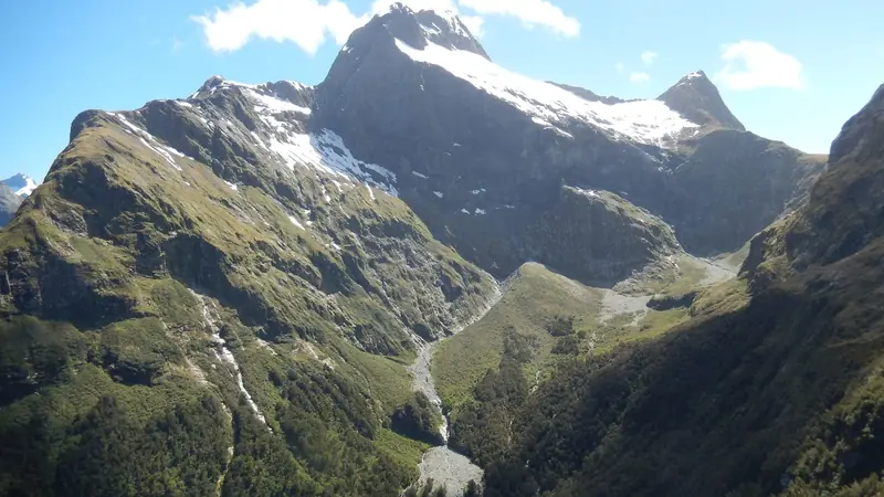
Milford Track
New Zealand · Fiordland · 54 km · 4 stages

Routeburn Track
New Zealand · Fiordland · 31 km · 3 stages
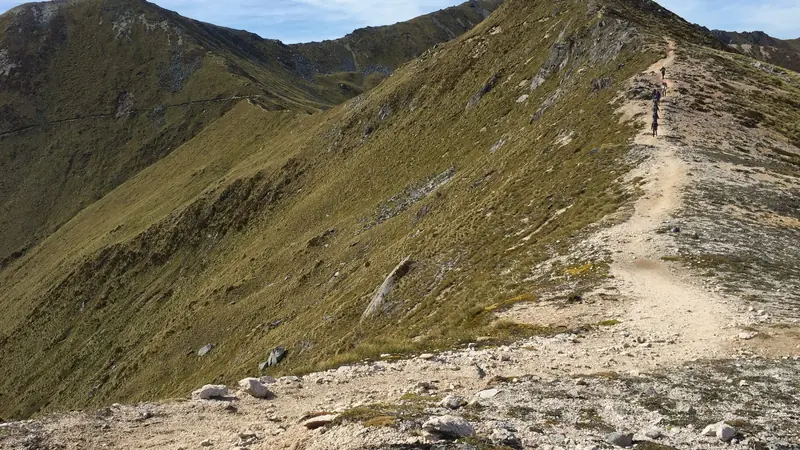
Kepler Track
New Zealand · Fiordland · 57 km · 4 stages

Tongariro Northern Circuit
New Zealand · Tongariro · 44 km · 4 stages

Abel Tasman Coast Track
New Zealand · Nelson Tasman · 60 km · 5 stages

Heaphy Track
New Zealand · Kahurangi · 73 km · 6 stages
Queen Charlotte Track · Paparoa Track · Rakiura Track · Lake Waikaremoana Great Walk · Hump Ridge Track · Tour du Mont Blanc · Alta Via 1 · GR 20 · John Muir Trail · Laugavegur · Cotswold Way · Kerry Way · Camino Finisterre · West Highland Way · Walker's Haute Route · Kungsleden · Tour of Monte Rosa · Coast to Coast Walk · Pembrokeshire Coast Path · Hadrian's Wall Path · South Downs Way · Dingle Way · Wicklow Way · Fishermen's Trail · Camino Portugués · Alta Via 2 · Malerweg · Peaks of the Balkans · Overland Track · Lycian Way · St Paul Trail · Camino Francés · Inca Trail · W Trek · Everest Base Camp Trek · Annapurna Circuit · Kumano Kodo Nakahechi · Camino del Norte · Via Francigena · GR10 · Pennine Way · Carian Trail · Evliya Çelebi Way · Kaçkar Mountains Traverse · Phrygian Way · Sultans Trail · Mount Ararat Climb · Hittite Trail · Troy Culture Route · Independence Way · Mysia Ways · Rheinsteig · Westweg · Goldsteig · GR54 Tour des Écrins · Via Alpina · Path of the Gods · Cinque Terre Trail · Alta Via 4 · GR221 Dry Stone Route · Stubai High Trail · Larapinta Trail · Great Ocean Walk · West Coast Trail · Wonderland Trail · Teton Crest Trail · Annapurna Base Camp Trek · Markha Valley Trek · Salkantay Trek · Huayhuash Circuit · Kilimanjaro Machame Route · Toubkal Circuit · Jordan Trail: Dana to Petra · Torres del Paine O Circuit · Three Capes Track · Mestia to Ushguli Trek · Nakasendo Way · Berg Lake Trail · Skyline Trail (Jasper) · Fitz Roy & Cerro Torre Loop · Santa Cruz Trek · Otter Trail · Fish River Canyon Hiking Trail · Camino Primitivo · Camino Inglés · Eagle Walk (Adlerweg) · Berliner Höhenweg · Cape Wrath Trail · Great Glen Way · Offa's Dyke Path · Cleveland Way · Rota Vicentina Historical Way · Via Podiensis (GR 65) · Cape to Cape Track · Rockwall Trail · Juan de Fuca Marine Trail · Quilotoa Loop · Nahuel Huapi Traverse · Ala Kul Trek · Tiger Leaping Gorge High Trail · Mount Kenya Sirimon–Chogoria Traverse · Ghorepani Poon Hill Trek · Kilimanjaro Lemosho Route · Lebanon Mountain Trail · Aladağlar Traverse · Kokoda Track · Chilkoot Trail · Lost City Trek · Choquequirao Trek · GR R2 Réunion · M'Goun Traverse · Royal National Park Coast Track · Grand Cliff Top Walk · Snowies Alpine Walk · Rwenzori Central Circuit · Whale Trail · Ausangate Circuit · Thorsborne Trail · Mount Assiniboine Traverse · Sunshine Coast Trail · Sinai Trail · Grand Canyon Rim to Rim · Via degli Dei · Stevenson Trail (GR 70) · Juliana Trail · Camí de Cavalls · Karhunkierros Trail · Lost Coast Trail · East Coast Trail · Kalalau Trail · Mount Rinjani Trek · MacLehose Trail · Jatbula Trail · Druk Path Trek · Mardi Himal Trek · Mount Kinabalu Climb · Kilimanjaro Marangu Route · Amatola Trail · Mount Olympus Traverse · Dales Way · Tour de la Vanoise · Lechweg · High Coast Trail · Rennsteig · Gokyo Lakes Trek · Corfu Trail · Leleg Way · Anillo de Picos · Fundy Footpath
Hike it with the route in your pocket
Outest has the Old Ghost Road route offline, with elevation, water and village points, and a trail guide you can ask about stages, weather and where to sleep.