
Hittite Trail hiking guide: route map, stages & where to stay
The Hittite Trail in Çorum, Turkey: about 96 km from Hattuşa, the Hittite capital, past Yazılıkaya and Şapinuva to the İncesu Canyon. The official walk takes 7 days, with hotels in Boğazkale and Alaca and wild camps by village ponds.
Best time to hike the Hittite Trail →

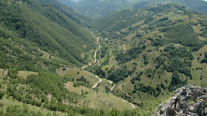
Photo: Bernard Gagnon, CC BY-SA 3.0, cropped
The Hittite Trail (Hitit Yolu) is a waymarked walking route in Çorum province, in the dry hills of north-central Turkey. It links the three great cities of the Hittites, the Bronze Age people who ruled much of Anatolia 3,500 years ago: Hattuşa, their capital and a UNESCO World Heritage Site, Alacahöyük and Şapinuva. The Çorum Governorship marked the network in 2010 along old caravan and migration roads, and opened it in May 2011. It has 17 walking routes, about 236 km waymarked and 380 km with all the alternatives, plus six mountain-bike routes.
This guide follows the official seven-day walk from Hattuşa to the İncesu Canyon, the through-route of the network. It is about 96 km long and splits into 7 stages of about 13.7 km. The days are short and the climbing is modest, but you walk through farmland and small villages with few services, and the official plan has several nights of camping by irrigation ponds.
The route
The walk starts at the gate of Hattuşa in Boğazkale. After a short climb to the rock sanctuary of Yazılıkaya, with its reliefs of the Hittite gods, it crosses the high plateau past Yüksekyayla, at about 1,420 m the highest point, and drops through Küçükhırka into the valley of Büyükhırka. The second day follows the stream down past an old mill and through Evci to the Evci (Alaca) pond. A short third day reaches Alaca, the only town on the way.
From Alaca the official plan takes a dolmuş for 6 km to Ünalan; this guide walks that road instead, so the fourth day is longer. The trail then goes through Kızıllı and Çatak to the Çatak pond, and on day five over the hills past Sultanköy and the Soğucak pond to the Kızılhamza pond. The sixth day is downhill through Karahacip to Şapinuva, the Hittite royal city near Ortaköy. The last day follows the valley east, past the edge of Ortaköy, to İncesu village at the mouth of the İncesu Canyon. A path of about 1.7 km leads into the canyon to a relief of the goddess Kybele.
The line in this guide follows the official GPS waypoints, on the OpenStreetMap route where it exists. Between Şapinuva and İncesu, where the old migration path is not mapped, it uses tracks and the Ortaköy road.
Highlights
- Hattuşa: the Hittite capital, with the Lion Gate, the King's Gate, the Yerkapı tunnel under the ramparts and the Great Temple
- Yazılıkaya: an open-air rock sanctuary with a procession of gods carved in the rock
- Boğazköy Museum: finds and cuneiform tablets from Hattuşa, in the village at the start
- The Büyükhırka valley: a green stream valley with mills and willow trees, between bare hills
- The ponds: Evci, Çatak, Soğucak and Kızılhamza, the camping places of the official plan
- Şapinuva: a Hittite royal city where thousands of clay tablets have been found since 1990
- İncesu Canyon: a 12 km gorge with a walkway, cisterns, wall ruins and a Kybele relief
When to walk the Hittite Trail
The official site says the trail can be walked in every season except winter. The best months are April to June, when the fields are green and the streams run, and September to October. July and August are hot, often above 30 °C, with almost no shade on the plateau; start at dawn and carry plenty of water. Winters are cold, with snow and frozen tracks.
How many days do you need?
The official plan takes seven days, and this guide keeps its 7 stages, from about 9 to 19 km a day. Fit walkers can join stages: Evci Göleti to Alaca is only 9 km, so many walk from Büyükhırka to Alaca in one day (about 24 km) and sleep in a bed. Add a day to visit Hattuşa and Yazılıkaya before you start, and half a day for Alacahöyük, which is not on this line: it is about 15 km north-west of Alaca, so take a taxi.
Getting there and logistics
Boğazkale is reached by bus to Sungurlu, on the Ankara-Çorum highway, and then by dolmuş or taxi (about 30 km). Ankara Esenboğa Airport is about 200 km away; Amasya Merzifon Airport, with flights from Istanbul, is closer to Çorum. Alaca and Ortaköy have bus or dolmuş links to Çorum. From İncesu, at the end, arrange a taxi to Ortaköy and go on to Çorum.
You sleep in hotels only at the start (Boğazkale) and in Alaca. The other nights are wild camps by the ponds and near Şapinuva, or a village house if one is offered in Büyükhırka and İncesu. Carry a tent, a stove and food for two days. Fill water at village fountains (çeşme); the ponds are for irrigation and not safe to drink without treatment. There are shops in Boğazkale, Alaca and Ortaköy, and small grocers in some villages.
Bring Turkish lira in cash; cards work in hotels and larger shops in the towns, and there are ATMs in Alaca, Ortaköy, Sungurlu and Çorum. Mobile coverage is good near villages and patchy in the deeper valleys. A foreign phone works with a Turkish SIM card for 120 days before it must be registered.
Difficulty
The Hittite Trail is a moderate walk. There are no technical sections and the total ascent is only about 1,000 m, but much of it is on dirt roads, tractor tracks and faint field paths, with stream crossings. The red-and-white waymarks date from 2010-11 and are faded or missing in places, so carry the GPS track and a phone map. Heat and lack of shade are the main dangers in summer.
Large sheepdogs guard the flocks around villages. Keep away from flocks, do not run, and shout for the shepherd. Ask before you camp near a village, light no fires in the dry season, and do not climb on the ruins or camp inside the archaeological sites. In an emergency call 112.
What to pack
Pack a tent, sleeping bag and mat, a stove and pot, water treatment, and at least 3 litres of water capacity. Bring sun protection, a wide hat, light long sleeves and trekking poles. Carry a waterproof for spring storms, a warm layer for cold nights on the plateau, and a first-aid and blister kit.
History
The Hittites built an empire from their capital Hattuşa from about 1650 BC until it collapsed around 1200 BC. At its height it was one of the great powers of the Near East, beside Egypt. Thousands of clay tablets in cuneiform from Hattuşa, the Boğazköy archives, are on UNESCO's Memory of the World register. Among them is a copy of the peace treaty between the Hittite king Hattušili III and the Egyptian pharaoh Ramesses II. Hattuşa was added to the World Heritage List in 1986. Alacahöyük, older than the Hittite state, is known for its Sphinx Gate and its rich Early Bronze Age royal tombs. Şapinuva, a Hittite administrative and religious centre near Ortaköy, has been excavated since 1990, revealing large buildings and thousands of tablets. The area of Hattuşa and Alacahöyük has been a historical national park since 1988.
Hittite Trail map
The whole Hittite Trail with its 7 stages, Hattuşa to the İncesu Canyon. Tap a stage on the map to open it. To follow the route with GPS and offline maps on the trail, open it in the free Outest app.
The 7 stages
The official seven-day walk of the Hitit Yolu from Hattuşa, the Hittite capital at Boğazkale, past Yazılıkaya to Büyükhırka, the Evci pond and Alaca, then by Ünalan and Kızıllı to the Çatak and Kızılhamza ponds, down to the Hittite city of Şapinuva and on to the İncesu Canyon. Walking times allow for rough farm tracks, stream crossings and summer heat. Each stage page has a map, elevation profile, places to sleep or camp, and the nearest help.
| # | Stage | Distance | Level |
|---|---|---|---|
| 1 | Hattuşa → Büyükhırka | 16.2 km | moderate |
| 2 | Büyükhırka → Evci Göleti | 14.8 km | moderate |
| 3 | Evci Göleti → Alaca | 8.7 km | easy |
| 4 | Alaca → Çatak Göleti | 18.5 km | moderate |
| 5 | Çatak Göleti → Kızılhamza Göleti | 11.5 km | moderate |
| 6 | Kızılhamza Göleti → Şapinuva | 13.9 km | moderate |
| 7 | Şapinuva → İncesu Kanyonu | 12.3 km | easy |
Emergency, hospitals and services
In an emergency call 112: one free number for ambulance, gendarmerie, police, fire and AFAD rescue, from any phone. 6 hospitals with an emergency service are within reach of the trail, small district hospitals in Boğazkale, Alaca and Ortaköy and larger ones in Sungurlu, Yozgat and Çorum; every stage page lists the nearest one, plus pharmacies, shops and water on that stage.
Where to stay on the Hittite Trail
Hotels, a teachers' guesthouse and the official camping places, grouped by stage from Hattuşa to the İncesu Canyon. Listings were checked online in October 2026. Places marked "listed, not confirmed" appear on a public listing (OpenStreetMap, Yandex Maps or the official Hitit Yolu plan) but could not be confirmed on their own website. Beds exist only in Boğazkale and Alaca. Elsewhere you camp by the ponds or ask in the village for a room; camp away from houses, ask permission near a village, and never camp inside the archaeological sites.
Hattuşa (trailhead)
4 places
- 4 with rooms
- 2 camping
- 3 with meals
Boğazkale
Hattuşa → Büyükhırka
1 place
- 1 camping
Büyükhırka
Büyükhırka → Evci Göleti
1 place
- 1 camping
Büyüksöğütözü
Evci Göleti → Alaca
2 places
- 2 with rooms
Alaca
Alaca → Çatak Göleti
1 place
- 1 camping
Çatak
Çatak Göleti → Kızılhamza Göleti
1 place
- 1 camping
Kızılhamza
Kızılhamza Göleti → Şapinuva
1 place
- 1 camping
Ortaköy
Şapinuva → İncesu Kanyonu
1 place
- 1 camping
İncesu
Plan your days
Pick any Hittite Trail stage in the free hike planner to see walking time, water to carry, calories, difficulty, the weather forecast and daylight.
More trail guides
Evliya Çelebi Way
Turkey · Marmara & Aegean · 611 km · 31 stages

Kaçkar Mountains Traverse
Turkey · Kaçkar Mountains · 34 km · 3 stages
Sultans Trail
Turkey · Eastern Thrace · 336 km · 15 stages
Mount Ararat Climb
Turkey · Ağrı · 12 km · 3 stages
Troy Culture Route
Turkey · Çanakkale · 119 km · 7 stages
Independence Way
Turkey · Kastamonu · 94 km · 6 stages
Mysia Ways · Aladağlar Traverse · Tour du Mont Blanc · Alta Via 1 · GR 20 · John Muir Trail · Laugavegur · Cotswold Way · Kerry Way · Camino Finisterre · West Highland Way · Walker's Haute Route · Kungsleden · Tour of Monte Rosa · Coast to Coast Walk · Pembrokeshire Coast Path · Hadrian's Wall Path · South Downs Way · Dingle Way · Wicklow Way · Fishermen's Trail · Camino Portugués · Alta Via 2 · Malerweg · Peaks of the Balkans · Overland Track · Lycian Way · St Paul Trail · Camino Francés · Inca Trail · W Trek · Everest Base Camp Trek · Annapurna Circuit · Kumano Kodo Nakahechi · Camino del Norte · Via Francigena · GR10 · Pennine Way · Carian Trail · Phrygian Way · Rheinsteig · Westweg · Goldsteig · GR54 Tour des Écrins · Via Alpina · Path of the Gods · Cinque Terre Trail · Alta Via 4 · GR221 Dry Stone Route · Stubai High Trail · Milford Track · Routeburn Track · Kepler Track · Tongariro Northern Circuit · Larapinta Trail · Great Ocean Walk · West Coast Trail · Wonderland Trail · Teton Crest Trail · Annapurna Base Camp Trek · Markha Valley Trek · Salkantay Trek · Huayhuash Circuit · Kilimanjaro Machame Route · Toubkal Circuit · Jordan Trail: Dana to Petra · Torres del Paine O Circuit · Abel Tasman Coast Track · Three Capes Track · Mestia to Ushguli Trek · Nakasendo Way · Berg Lake Trail · Skyline Trail (Jasper) · Fitz Roy & Cerro Torre Loop · Santa Cruz Trek · Otter Trail · Fish River Canyon Hiking Trail · Camino Primitivo · Camino Inglés · Eagle Walk (Adlerweg) · Berliner Höhenweg · Cape Wrath Trail · Great Glen Way · Offa's Dyke Path · Cleveland Way · Rota Vicentina Historical Way · Via Podiensis (GR 65) · Heaphy Track · Queen Charlotte Track · Cape to Cape Track · Rockwall Trail · Juan de Fuca Marine Trail · Quilotoa Loop · Nahuel Huapi Traverse · Ala Kul Trek · Tiger Leaping Gorge High Trail · Mount Kenya Sirimon–Chogoria Traverse · Ghorepani Poon Hill Trek · Kilimanjaro Lemosho Route · Lebanon Mountain Trail · Kokoda Track · Chilkoot Trail · Lost City Trek · Choquequirao Trek · GR R2 Réunion · M'Goun Traverse
Hike it with the route in your pocket
Outest has the Hittite Trail route offline, with elevation, water and village points, and a trail guide you can ask about stages, weather and where to sleep.