
Skyline Trail (Jasper) hiking guide: route map, stages & where to stay
The Skyline Trail in Jasper National Park: 44 km over three passes and The Notch (2,510 m), from Maligne Lake to the Signal trailhead near Jasper. Most hikers take 3 days, camping at quota-limited Parks Canada campgrounds or staying at Shovel Pass Lodge.
Best time to hike the Skyline Trail (Jasper) →

Photo: Michael Lawton, CC BY-SA 2.0, cropped
The Skyline Trail is the highest trail in Jasper National Park and one of the best backpacking routes in the Canadian Rockies. It runs 44.1 km from Maligne Lake to the Signal trailhead above Jasper town, and almost 25 km of it is above the treeline. It crosses Little Shovel Pass, Big Shovel Pass and The Notch, then follows a long open ridge with views over the Athabasca valley to Mount Edith Cavell. Most hikers take 3 days. You sleep at small Parks Canada campgrounds that must be booked months ahead, or at the historic Shovel Pass Lodge halfway along.
The route
From the Maligne Lake trailhead (1,690 m) the trail climbs gently through forest past Lorraine and Mona lakes to Evelyn Creek, then up to Little Shovel Pass (2,240 m) and down into the meadows of the Snowbowl. A long rise leads to Big Shovel Pass (2,320 m) and the Curator junction, where a side trail drops to Curator campground and Shovel Pass Lodge. Above Curator Lake comes the hardest part: a very steep 2.6 km climb on scree to The Notch, the highest point of the trail at about 2,510 m. Then comes about 3 km along a broad ridge, the highlight of the trip, and a 5.5 km descent to Tekarra campground below Mount Tekarra. On the last day the trail crosses the slopes of Signal Mountain to Signal campground and descends 8.4 km on the wide Signal fire road to the trailhead at 1,160 m.
This guide follows the route mapped on OpenStreetMap and splits it into 3 stages, about 15.1 km each: Maligne Lake to Snowbowl, Snowbowl to Tekarra, and Tekarra to the Signal trailhead. Most hikers walk south to north, as here: the start is higher than the finish and you climb, not descend, the steep side of The Notch.
Highlights
- Little Shovel Pass and the Snowbowl: the first big views back over Maligne Lake, then wide flower meadows
- Big Shovel Pass: the high point of the meadows, named on the 1911 survey trip to Maligne Lake
- Curator Lake and The Notch: an alpine lake below a steep scree wall, and the top of the trail at 2,510 m
- The ridge walk: about 3 km on the crest above the Athabasca valley, with Mount Edith Cavell and the peaks around Jasper on the skyline
- Signal fire road: since the 2024 wildfire this descent is open, burned forest with wide views over Jasper and the Athabasca valley
When to hike the Skyline Trail
The season is from early July to early October. The Notch can be blocked by snow until mid-July, and some years later, so the best window is from late July to mid-September. Snow can fall in any month. Afternoon thunderstorms in summer are dangerous on the open passes and the ridge, and by late September the nights are below freezing.
How many days do you need?
Three days is standard: Maligne Lake to Snowbowl (about 12 km), Snowbowl to Tekarra (about 19 km, the hard day over The Notch) and Tekarra out to the Signal trailhead (about 13–14 km). Fit hikers do it in 2 days with a night at Curator campground or Shovel Pass Lodge. A relaxed 4-day trip stops at Little Shovel, Curator and Tekarra. Have two or three itineraries ready on reservation day.
Permits and booking
A Parks Canada backcountry camping permit is mandatory for every night, and you may only camp at the campground you booked. The six campgrounds are small: Evelyn Creek and Signal have 4 sites each, and Little Shovel, Snowbowl, Curator and Tekarra 8 each. There is no walk-in or random camping. Reservations for the whole summer open in late January (in 2026 on 28 January at 8 am MT) on the Parks Canada Reservation Service, and Snowbowl, Tekarra and Curator sell out within hours. Cancellations come up all summer.
Camping costs CA$15 per person per night, plus a reservation fee of CA$11.50 online. You also need a park pass (CA$12.25 per adult per day, or the annual Discovery Pass). Shovel Pass Lodge is booked separately on its own website; it is open from 1 July to 15 September, and bookings for 2027 opened on 1 October 2026. The lodge price includes dinner, breakfast and a packed lunch, but it no longer sells meals or drinks to campers.
Getting there and logistics
Jasper is about 365 km (4 hours) west of Edmonton by Highway 16, and VIA Rail trains stop in town. The Maligne Lake trailhead is 48 km from Jasper at the end of Maligne Road, on the right just before the parking lot on the west side of the lake. The Signal trailhead is about 8 km up Maligne Road from Highway 16; its car park is small, with overflow at the Maligne Canyon overlook 500 m further on.
The two ends are an hour apart by road, so you need a shuttle. Maligne Adventures runs a reserved hiker shuttle: park at the Signal trailhead, take the 9:15 am pickup to Maligne Lake and walk back to your car. It also picks up in Jasper and at Whistlers Campground. Jasper lost about a fifth of its rooms in the 2024 wildfire, so book your night before and after the hike early.
Money and phone signal
Prices are in Canadian dollars and cards work almost everywhere in Jasper; Shovel Pass Lodge takes only cash for extras and tips. Buy everything in Jasper: there are no shops at Maligne Lake or on the trail. Mobile signal is unreliable or absent for most of the hike, so carry a satellite messenger or a personal locator beacon.
What to pack
Carry a tent, sleeping bag rated to below freezing, a stove (fires are not allowed), food for the whole trip and a water filter or tablets, since all water comes from creeks. Bring bear spray within reach, and rope or cord for the plastic tent pads at Snowbowl and Tekarra, where you cannot use pegs. Pack full waterproofs, warm layers and trekking poles for the scree and the long descent. Carry an offline map and a paper map (Gem Trek Jasper and Maligne Lake).
Difficulty and safety
The Skyline is a moderate to hard trail. There is no technical climbing, but you spend two days above 2,000 m with no shelter. The Notch is very steep and loose, often holds snow, and has a drop on one side near the top; do not cross it in cloud, thunderstorms or strong wind. In bad weather the Wabasso trail from Curator is the escape route to the Icefields Parkway; it reopened in summer 2026 after the fire, but check its status first. Grizzly and black bears live along the whole trail: make noise, carry bear spray, keep 100 m away and store all food and scented items in the campground lockers. Dogs and bikes are not allowed.
Check the Parks Canada trail report before you leave. In an emergency call 911 (or 780-852-3100 from a satellite phone) and ask for Parks Canada.
History
The route follows old outfitter trails: the Otto brothers cut the first trail in 1911 for Mary Schäffer's survey of Maligne Lake, Fred Brewster set up the camp that became Shovel Pass Lodge in 1921, and the northern half was finished in 1937. The July 2024 wildfire burned the forest on the lower slopes of Signal Mountain and destroyed about a third of the buildings in Jasper town; the Skyline reopened from Maligne Lake in November 2024 and from the Signal trailhead in December 2024.
Skyline Trail (Jasper) map
The whole Skyline Trail (Jasper) with its 3 stages, Maligne Lake to Signal Mountain. Tap a stage on the map to open it. To follow the route with GPS and offline maps on the trail, open it in the free Outest app.
The 3 stages
The classic three days from Maligne Lake to the Signal trailhead above Jasper: over Little Shovel Pass to Snowbowl, over Big Shovel Pass and The Notch (2,510 m) to Tekarra, then along Signal Mountain and down the fire road. Walking times allow for steep scree, snow patches and a full pack. Each stage page has a map, elevation profile, the campgrounds and the nearest help.
| # | Stage | Distance | Level |
|---|---|---|---|
| 1 | Maligne Lake → Snowbowl | 12.1 km | moderate |
| 2 | Snowbowl → Tekarra | 18.9 km | hard |
| 3 | Tekarra → Signal trailhead | 14.2 km | moderate |
Emergency, hospitals and services
In an emergency call 911 and ask for Parks Canada (from a satellite phone call 780-852-3100). Mobile signal is unreliable or absent on most of the trail, so carry a satellite messenger or PLB. 3 hospitals with a 24-hour emergency department are within reach by road, the nearest in Jasper; serious cases are flown out by helicopter. Every stage page lists the nearest help.
Where to stay on the Skyline Trail (Jasper)
Parks Canada backcountry campgrounds, Shovel Pass Lodge and places to stay in Jasper, grouped by stage from Maligne Lake to the Signal trailhead. Listings were checked online in October 2026. Places marked "not confirmed by the operator" are listed on OpenStreetMap or in guides but could not be checked on an official page. Every campground night needs a reservation, made when bookings open in late January; book the hiker shuttle and your room in Jasper early too.
Maligne Lake (trailhead)
1 place
Maligne Lake
Maligne Lake → Snowbowl
3 places
- 3 camping
Evelyn Creek · Little Shovel · Snowbowl
Snowbowl → Tekarra
4 places
- 1 with rooms
- 3 camping
- 1 with meals
Curator · Tekarra · Watchtower
Tekarra → Signal trailhead
6 places
- 4 with rooms
- 2 camping
- 3 with meals
Jasper · Signal
Plan your days
Pick any Skyline Trail (Jasper) stage in the free hike planner to see walking time, water to carry, calories, difficulty, the weather forecast and daylight.
More trail guides

West Coast Trail
Canada · British Columbia · 76 km · 6 stages

Berg Lake Trail
Canada · British Columbia · 21 km · 5 stages
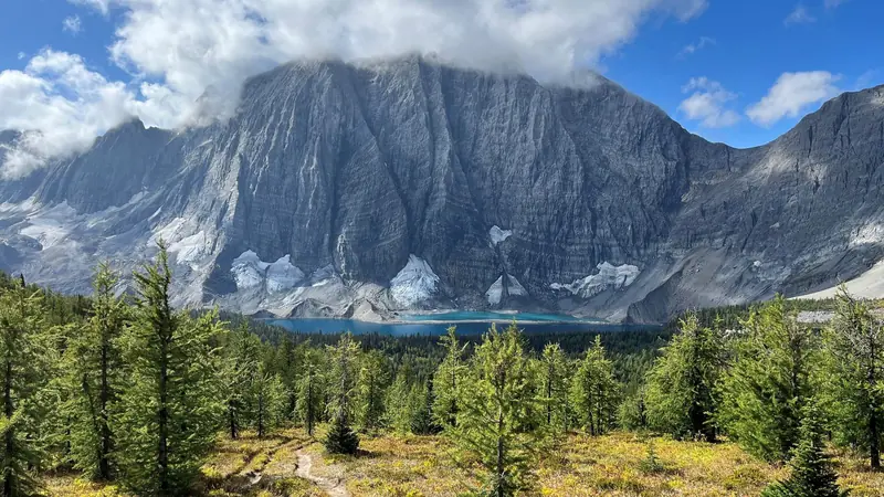
Rockwall Trail
Canada · British Columbia · 53 km · 5 stages

Juan de Fuca Marine Trail
Canada · British Columbia · 40 km · 4 stages

Tour du Mont Blanc
France · Italy · Switzerland · 166 km · 11 stages

Alta Via 1
Italy · Dolomites · 118 km · 11 stages
GR 20 · John Muir Trail · Laugavegur · Cotswold Way · Kerry Way · Camino Finisterre · West Highland Way · Walker's Haute Route · Kungsleden · Tour of Monte Rosa · Coast to Coast Walk · Pembrokeshire Coast Path · Hadrian's Wall Path · South Downs Way · Dingle Way · Wicklow Way · Fishermen's Trail · Camino Portugués · Alta Via 2 · Malerweg · Peaks of the Balkans · Overland Track · Lycian Way · St Paul Trail · Camino Francés · Inca Trail · W Trek · Everest Base Camp Trek · Annapurna Circuit · Kumano Kodo Nakahechi · Camino del Norte · Via Francigena · GR10 · Pennine Way · Carian Trail · Evliya Çelebi Way · Kaçkar Mountains Traverse · Phrygian Way · Sultans Trail · Mount Ararat Climb · Hittite Trail · Troy Culture Route · Independence Way · Mysia Ways · Rheinsteig · Westweg · Goldsteig · GR54 Tour des Écrins · Via Alpina · Path of the Gods · Cinque Terre Trail · Alta Via 4 · GR221 Dry Stone Route · Stubai High Trail · Milford Track · Routeburn Track · Kepler Track · Tongariro Northern Circuit · Larapinta Trail · Great Ocean Walk · Wonderland Trail · Teton Crest Trail · Annapurna Base Camp Trek · Markha Valley Trek · Salkantay Trek · Huayhuash Circuit · Kilimanjaro Machame Route · Toubkal Circuit · Jordan Trail: Dana to Petra · Torres del Paine O Circuit · Abel Tasman Coast Track · Three Capes Track · Mestia to Ushguli Trek · Nakasendo Way · Fitz Roy & Cerro Torre Loop · Santa Cruz Trek · Otter Trail · Fish River Canyon Hiking Trail · Camino Primitivo · Camino Inglés · Eagle Walk (Adlerweg) · Berliner Höhenweg · Cape Wrath Trail · Great Glen Way · Offa's Dyke Path · Cleveland Way · Rota Vicentina Historical Way · Via Podiensis (GR 65) · Heaphy Track · Queen Charlotte Track · Cape to Cape Track · Quilotoa Loop · Nahuel Huapi Traverse · Ala Kul Trek · Tiger Leaping Gorge High Trail · Mount Kenya Sirimon–Chogoria Traverse · Ghorepani Poon Hill Trek · Kilimanjaro Lemosho Route · Lebanon Mountain Trail · Aladağlar Traverse · Kokoda Track · Chilkoot Trail · Lost City Trek · Choquequirao Trek · GR R2 Réunion · M'Goun Traverse
Hike it with the route in your pocket
Outest has the Skyline Trail (Jasper) route offline, with elevation, water and village points, and a trail guide you can ask about stages, weather and where to sleep.