
Whale Trail hiking guide: route map, stages & where to stay
The Whale Trail in South Africa's De Hoop Nature Reserve: about 55 km (34 miles) in 5 days from Potberg mountain to Koppie Alleen on the Indian Ocean coast, staying in five equipped CapeNature huts with optional luggage transfer. Groups of 6 or 12, booked a year ahead.
Best time to hike the Whale Trail →

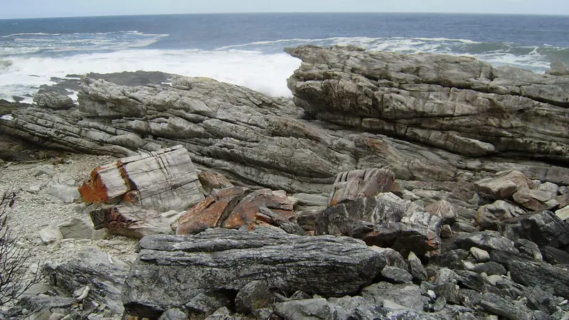
Photo: Josep M. Gracia, CC BY-SA 4.0, cropped
The Whale Trail is a 5-day, hut-to-hut hike through the De Hoop Nature Reserve on the Western Cape coast of South Africa, about 3 to 4 hours' drive east of Cape Town. It runs about 55 km from Potberg, a fynbos-covered mountain in the north of the reserve, over the mountain and down to the Indian Ocean, then west along one of the wildest coastlines in the country to Koppie Alleen. CapeNature runs it as a slackpacking trail: you sleep in five comfortable huts with kitchens and hot showers, and for a fee your luggage is driven to the next hut each day, so you walk with only a day pack. Between June and November southern right whales come close inshore to calve, which gives the trail its name.
The route
You arrive at Potberg in the afternoon, attend the briefing and sleep in Potberg Hut. Day 1 is the big one: a rocky climb to the top of Potberg (611 m), with views north to Swellendam and south over the sea, then a descent through mountain fynbos to Cupidoskraal Hut and its farm dam. Day 2 follows the Potberg ridge east with views over the Breede River mouth, crosses limestone hills with a different kind of fynbos and drops to the coast at Noetsie. From there the trail turns west. Day 3 is short, past the rock pools at Stilgat and along a sandy beach to Hamerkop. Day 4 is a long beach and rock walk past calcrete platforms and turquoise pools to Vaalkrans, a hut above the sea. Day 5 is an easy morning past the Hippo Pools and over the dunes to the Koppie Alleen parking, where a shuttle takes you back to your car at Potberg.
This guide follows the trail as mapped on OpenStreetMap and splits it into the 5 official days, about 10.6 km each. The hike takes 5 days and 5 nights, including the night at Potberg before you start. Days 1 and 2 are full days; days 3 to 5 are short and leave time for rock pools and whales. The stage times are walking times; CapeNature's day times (6 to 8 hours) include breaks.
Highlights
- Potberg: the summit ridge and the only breeding colony of Cape vultures left in the Western Cape
- Fynbos: mountain and limestone fynbos with plants found nowhere else, in flower for much of the year
- Noetsie and Stilgat: a quiet bay and clear tidal pools for snorkelling at low tide
- Southern right whales: often close inshore from June to November, with bottlenose dolphins in the waves
When to walk the Whale Trail
The trail is open all year and groups start every day. June to November is whale season and the most popular time; it is also winter and spring, with cool days, some rain and strong cold fronts. December to March is hot, dry and often windy, with little shade on Potberg: start early on days 1 and 2. CapeNature charges a higher tariff from June to December.
Permits, booking and costs
The only way to walk the trail is with a CapeNature booking, which is also your entry permit. CapeNature takes groups of 6 or 12 only; a group of 12 has the trail to itself. Dates open one year ahead, one week at a time, on the CapeNature online booking site or through the Contact Centre on 087 087 8250, and most dates sell out quickly, so plan a year ahead. In the 2025–26 tariff the trail costs R2,940 per person from January to May and R4,180 from June to December; the 2026–27 tariff had not been published in October 2026. The fee covers five nights in the huts and the shuttle from Koppie Alleen. Porterage is optional at R560 per box per trip. Children under 8 are not allowed.
Getting there and away
There is no public transport. Drive from Cape Town on the N2 to Caledon, then via Bredasdorp (R316) and the R319 towards Swellendam, and take the gravel road signposted Infanta, Malgas and De Hoop for about 50 km to the Potberg gate. Cape Town airport is about 225 km and 3 to 4 hours away. The gate is locked at 16:00 and check-in is from 14:00, so leave early. You leave your car in the Whale Trail parking area at Potberg; at the end the shuttle collects you at Koppie Alleen between about 09:00 and 12:00 and drives you back in about 45 minutes.
Huts, food and water
The five huts each sleep up to 12 people, usually in three rooms of four bunks with foam mattresses. Each has a kitchen with a gas stove, pots, crockery and a solar fridge, a braai with firewood, toilets and hot showers heated by solar and gas. Bring a sleeping bag, pillow and towel. The trail is self-catering and self-guided, so bring all your food; with porterage you can pack fresh food and a cool box. Borehole water at the huts can be salty: at Noetsie, drink only from the tap marked drinking water, and carry purification tablets or extra water. There is only one water point on the trail, on day 1, so carry at least 2 litres a day.
Money and phone signal
There are no shops, ATMs or restaurants at Potberg or on the trail; the Potberg office has only a curio shop. Draw cash and buy food in Bredasdorp or Swellendam. Porterage can be paid by card at the reserve. Mobile signal is patchy: you get it mainly on the high parts of Potberg, on the hard dunes and along the coast. The huts have solar lights but do not count on charging: carry a power bank. There is no Wi-Fi.
What to pack
A day pack, sturdy shoes or trail runners that grip on wet rock, a windproof rain jacket, warm layers for winter evenings, sun hat, sunscreen, 2 litres of water, swimwear, a headlamp, a first aid kit with antihistamines, insect repellent, toilet paper and a small trowel. Binoculars are worth it in whale season.
Difficulty
CapeNature rates the trail moderate to strenuous. The path is well marked with white footprints. Day 1 has a steady climb of almost 600 m on rocky ground, and most injuries and evacuations happen on days 1 and 2. The coastal days are short but walking on soft sand, boulders and calcrete is slower than it looks.
Safety
Never turn your back on the sea: freak waves and rip currents are real on this coast, so keep off wave-washed rocks and swim only in sheltered pools. Other risks are heatstroke, sunburn, stings, snakes and, in winter storms, hypothermia. Any injured hiker is taken off the trail. The eastern part of the reserve borders the Denel missile test range, and CapeNature may stop or move groups during tests. Keep hut doors and windows closed because of baboons, and never feed them. In an emergency call 10177 (ambulance), 112 from a mobile, or the Western Cape mountain rescue line 021 937 0300, and tell the reserve office on 028 542 1114.
Whale Trail map
The whole Whale Trail with its 5 stages, Potberg to Koppie Alleen. Tap a stage on the map to open it. To follow the route with GPS and offline maps on the trail, open it in the free Outest app.
The 5 stages
The five official CapeNature days from Potberg Hut over Potberg mountain to Cupidoskraal, along the ridge to the sea at Noetsie, then west along the De Hoop coast via Hamerkop and Vaalkrans to the Koppie Alleen parking and the shuttle. Walking times allow for rocky climbs, soft sand and boulder beaches; CapeNature day times include breaks. Each stage page has a map, elevation profile, the hut and the nearest help.
| # | Stage | Distance | Level |
|---|---|---|---|
| 1 | Potberg → Cupidoskraal | 14.3 km | hard |
| 2 | Cupidoskraal → Noetsie | 13.8 km | hard |
| 3 | Noetsie → Hamerkop | 6.9 km | easy |
| 4 | Hamerkop → Vaalkrans | 10.7 km | moderate |
| 5 | Vaalkrans → Koppie Alleen | 7.1 km | easy |
Emergency, hospitals and services
In an emergency call 10177 for an ambulance, 112 from a mobile, or Wilderness Search and Rescue on 021 937 0300, and tell the De Hoop reserve office on 028 542 1114. Mobile signal is patchy, best on Potberg, the high dunes and the coast. 3 hospitals with 24-hour emergency care are within reach by road, the nearest in Bredasdorp, about 45 minutes from Potberg. Every stage page lists the nearest help.
Where to stay on the Whale Trail
The five CapeNature trail huts, the shuttle and the campsite, cottages and restaurant at De Hoop, grouped by stage from Potberg to Koppie Alleen. Listings were checked online in October 2026. Places marked "not confirmed by the operator" are listed on OpenStreetMap or in guides but could not be checked on an official page. The huts come only with a full Whale Trail booking for a group of 6 or 12; dates open a year ahead and sell out fast.
Potberg (trailhead)
2 places
- 1 with rooms
Potberg
Potberg → Cupidoskraal
1 place
- 1 with rooms
Cupidoskraal
Cupidoskraal → Noetsie
1 place
- 1 with rooms
Noetsie
Noetsie → Hamerkop
1 place
- 1 with rooms
Hamerkop
Hamerkop → Vaalkrans
1 place
- 1 with rooms
Vaalkrans
Vaalkrans → Koppie Alleen
4 places
- 2 with rooms
- 1 camping
- 1 with meals
De Hoop (Opstal) · Koppie Alleen
Plan your days
Pick any Whale Trail stage in the free hike planner to see walking time, water to carry, calories, difficulty, the weather forecast and daylight.
More trail guides
Otter Trail
South Africa · Garden Route · 38 km · 5 stages

Tour du Mont Blanc
France · Italy · Switzerland · 166 km · 11 stages

Alta Via 1
Italy · Dolomites · 118 km · 11 stages

GR 20
France · Corsica · 184 km · 16 stages

John Muir Trail
USA · California · 353 km · 18 stages

Laugavegur
Iceland · Highlands · 53 km · 4 stages
Cotswold Way · Kerry Way · Camino Finisterre · West Highland Way · Walker's Haute Route · Kungsleden · Tour of Monte Rosa · Coast to Coast Walk · Pembrokeshire Coast Path · Hadrian's Wall Path · South Downs Way · Dingle Way · Wicklow Way · Fishermen's Trail · Camino Portugués · Alta Via 2 · Malerweg · Peaks of the Balkans · Overland Track · Lycian Way · St Paul Trail · Camino Francés · Inca Trail · W Trek · Everest Base Camp Trek · Annapurna Circuit · Kumano Kodo Nakahechi · Camino del Norte · Via Francigena · GR10 · Pennine Way · Carian Trail · Evliya Çelebi Way · Kaçkar Mountains Traverse · Phrygian Way · Sultans Trail · Mount Ararat Climb · Hittite Trail · Troy Culture Route · Independence Way · Mysia Ways · Rheinsteig · Westweg · Goldsteig · GR54 Tour des Écrins · Via Alpina · Path of the Gods · Cinque Terre Trail · Alta Via 4 · GR221 Dry Stone Route · Stubai High Trail · Milford Track · Routeburn Track · Kepler Track · Tongariro Northern Circuit · Larapinta Trail · Great Ocean Walk · West Coast Trail · Wonderland Trail · Teton Crest Trail · Annapurna Base Camp Trek · Markha Valley Trek · Salkantay Trek · Huayhuash Circuit · Kilimanjaro Machame Route · Toubkal Circuit · Jordan Trail: Dana to Petra · Torres del Paine O Circuit · Abel Tasman Coast Track · Three Capes Track · Mestia to Ushguli Trek · Nakasendo Way · Berg Lake Trail · Skyline Trail (Jasper) · Fitz Roy & Cerro Torre Loop · Santa Cruz Trek · Fish River Canyon Hiking Trail · Camino Primitivo · Camino Inglés · Eagle Walk (Adlerweg) · Berliner Höhenweg · Cape Wrath Trail · Great Glen Way · Offa's Dyke Path · Cleveland Way · Rota Vicentina Historical Way · Via Podiensis (GR 65) · Heaphy Track · Queen Charlotte Track · Cape to Cape Track · Rockwall Trail · Juan de Fuca Marine Trail · Quilotoa Loop · Nahuel Huapi Traverse · Ala Kul Trek · Tiger Leaping Gorge High Trail · Mount Kenya Sirimon–Chogoria Traverse · Ghorepani Poon Hill Trek · Kilimanjaro Lemosho Route · Lebanon Mountain Trail · Aladağlar Traverse · Kokoda Track · Chilkoot Trail · Lost City Trek · Choquequirao Trek · GR R2 Réunion · M'Goun Traverse · Royal National Park Coast Track · Grand Cliff Top Walk · Snowies Alpine Walk · Rwenzori Central Circuit · Ausangate Circuit · Thorsborne Trail · Paparoa Track · Mount Assiniboine Traverse · Sunshine Coast Trail · Sinai Trail · Rakiura Track · Grand Canyon Rim to Rim
Hike it with the route in your pocket
Outest has the Whale Trail route offline, with elevation, water and village points, and a trail guide you can ask about stages, weather and where to sleep.