
Malerweg hiking guide: route map, stages & where to stay
Germany's Malerweg (Painters' Way): a loop of about 116 km in eight stages from Pirna-Liebethal through the sandstone rocks of Saxon Switzerland, past the Bastei, the Schrammsteine and the Großer Winterberg, and back to Pirna over the table mountains. Most walkers take eight days and sleep in village inns and guesthouses.
Best time to hike the Malerweg →

Photo: John Samuel, CC BY-SA 4.0, cropped
The Malerweg (Painters' Way) is a long-distance walk in the Elbe Sandstone Mountains in Saxony, eastern Germany, a short train ride from Dresden. The region is called Sächsische Schweiz (Saxon Switzerland). In the late 18th and 19th centuries painters such as Adrian Zingg, Caspar David Friedrich and Ludwig Richter came here to draw the rocks, gorges and views, and the trail follows their favourite paths. It is a loop of about 116 km in eight stages. It starts in Pirna-Liebethal, crosses the Saxon Switzerland National Park on the right bank of the Elbe to the Czech border at Schmilka, and returns on the left bank over the flat-topped table mountains to the old town of Pirna. It is waymarked all the way with a curvy black "M" on a white sign.
The route
Stage 1 follows the little Wesenitz river through the Liebethaler Grund gorge, past a large Richard Wagner monument, and then crosses fields and the Uttewalder Grund with its rock arch to Stadt Wehlen on the Elbe. Stage 2 climbs to the Bastei, the most famous viewpoint of the region, crosses the Bastei Bridge and continues past the Hockstein to the castle town of Hohnstein. Stage 3 goes over the Brand viewpoint, down more than 800 steps and through quiet valleys to Altendorf. Stage 4 is the wild heart of the national park: iron ladders up into the Schrammsteine rocks, the ridge path, the Lichtenhain waterfall and the Kuhstall rock cave, down to the old Neumannmühle mill. Stage 5 follows the Kirnitzsch valley and climbs to the Großer Winterberg (556 m), the highest point of the trail, before a long descent to Schmilka. A ferry then takes you across the Elbe. On the left bank, stages 6 to 8 climb the table mountains Papststein, Gohrisch and Pfaffenstein, pass below the Königstein Fortress, cross the Rauenstein ridge and follow the Elbe to the Canaletto-Haus on the market square of Pirna.
This guide follows the route as mapped on OpenStreetMap and splits it into 8 stages, about 14.6 km each, the same eight stages as the official plan. The trail is low, but it goes up and down all the time: our elevation profile adds up to about 3,600 m of climbing, the same as the official figure.
Highlights
- Liebethaler Grund: a romantic gorge with old mills and the Wagner monument, where Wagner worked on Lohengrin in 1846
- The Bastei: rock towers 194 m above the Elbe, joined by the sandstone Bastei Bridge of 1851
- Brand viewpoint: one of the widest views over the Polenz valley and the rocks of the national park
- The Schrammsteine: a long jagged rock wall, climbed on iron ladders, with a ridge path and wide views
- Kuhstall and the Kirnitzsch valley: a huge rock arch above a quiet, wooded valley with old mills
- Großer Winterberg: the highest point of the trail at 556 m, near the Czech border
- The table mountains: Papststein, Gohrisch, Pfaffenstein and Rauenstein, with ladders, narrow rock passages and views of the Elbe valley
- Königstein Fortress and Pirna: a huge hilltop fortress on stage 7 and the old town of Pirna, painted by Canaletto, at the finish
When to walk the Malerweg
All paths are open all year, but the best months are April to October. Spring brings fresh green and flowers in the woods, summer is busy but the deep gorges stay cool, and autumn has golden light and colourful leaves. May to October, long weekends and school holidays are the busiest times, so book rooms ahead; from November to Easter rooms are easier to find, but some places close for the winter. In winter, snow and ice can make the steps and ladders dangerous; do not walk after strong storms. Ticks are common: the area is a risk zone for tick-borne encephalitis.
How many days do you need?
The official plan is eight days, and the 8 stages in this guide follow it, with 11 to 18 km a day. That does not sound like much, but the many steps and climbs make the days long: the official walking times are 3.5 to just over 7 hours a stage, without breaks. Fit walkers can do it faster: the official site also suggests plans of seven, six or even five days with longer stages. Many people stay in one or two bases, such as Pirna or Bad Schandau, and use buses, the S-Bahn and the ferries to reach each stage. Plan extra time for the Königstein Fortress (about two hours) and the many viewpoints.
Getting there and logistics
Dresden has an international airport and fast trains. From Dresden the S-Bahn S1 runs along the Elbe about every 30 minutes to Pirna, Stadt Wehlen, Kurort Rathen, Königstein, Bad Schandau and Schmilka-Hirschmühle. The start in Liebethal is a short bus ride from Pirna (bus stop "Pirna Liebethaler Grund"). Most stage ends have a bus or train link, and small ferries cross the Elbe at Stadt Wehlen, Kurort Rathen and Schmilka. If you stay overnight in most towns of the region, your host gives you the Gästekarte mobil, which lets you use the buses, trains and ferries for free.
You sleep in hotels, guesthouses, inns and a few hostels and campsites. Wild camping is not allowed: in the national park all camping is banned, and "Boofen" (sleeping under a rock overhang) is only for climbers at marked places. Shops are few at the stage ends, so carry food for the day; stage 5 has no place to eat at all. Luggage transfer between the stage ends can be booked all year. Take a day pack only if you can, because some passages are narrow and steep.
In 2026 there are diversions. After a severe storm on 31 July 2026, part of stage 2 near Kurort Rathen is closed: from the Bastei you go down through the Schwedenlöcher gorge, and near Hohnstein you use the green-marked path instead of the Schindergraben. On stage 3 the Kohlichtgraben is closed because of dead trees (detour via Goßdorf, about 2 km longer). On stage 5 the lower Bergsteig into Schmilka is closed (detour of about 700 m). The forest fire of summer 2022 burned about 105 hectares around the Großer Winterberg, but the Malerweg through that area is open again. Check the current notices on the official Malerweg site and the national park's path service before you go.
Difficulty
The Malerweg is a moderate to demanding walk. There are no mountains over 556 m, but there are many stone steps, steep climbs, iron ladders and narrow rock passages, and some viewpoints have no railings. The official site rates stage 1 easy to moderate, stages 2, 3 and 8 moderate and stages 4 to 7 demanding; the Schrammsteine section needs sure feet and a head for heights. Wear good walking boots. Sandstone becomes slippery when wet, and many dead spruces can fall in strong wind. In the national park you must stay on marked paths and keep dogs on a lead; there are signed bypasses for the ladders. In an emergency call 112 and give the four-digit number on the nearest signpost.
History
The rocks of the Elbe Sandstone Mountains were "discovered" by artists in the 18th century. Court painters such as Johann Alexander Thiele and Bernardo Bellotto, called Canaletto, painted the area, and the Swiss painters Adrian Zingg and Anton Graff from the Dresden art academy probably gave it the name Saxon Switzerland. Caspar David Friedrich, Ludwig Richter, Carl Maria von Weber, Richard Wagner and Hans Christian Andersen were among the many visitors. Their favourite paths joined into a classic route, which was forgotten when the railway came in the mid-19th century. The tourism board revived it, added a part on the left bank of the Elbe and opened the Malerweg in 2006. A year later Wandermagazin named it Germany's most beautiful hiking trail. Today art panels along the route show the old views, and you can collect stamps in a Malerweg pass and get a certificate at the tourist office in Pirna.
Malerweg map
The whole Malerweg with its 8 stages, Pirna-Liebethal to Pirna. Tap a stage on the map to open it. To follow the route with GPS and offline maps on the trail, open it in the free Outest app.
The 8 stages
The official eight stages from Pirna-Liebethal via Stadt Wehlen, Hohnstein, Altendorf, the Neumannmühle, Schmilka, Kurort Gohrisch and Weißig back to Pirna. Walking times allow for the many steps and iron ladders. Each stage page has a map, elevation profile, places to sleep and eat, and the nearest help.
| # | Stage | Distance | Level |
|---|---|---|---|
| 1 | Liebethal → Stadt Wehlen | 11.7 km | moderate |
| 2 | Stadt Wehlen → Hohnstein | 10.9 km | moderate |
| 3 | Hohnstein → Altendorf | 14.3 km | hard |
| 4 | Altendorf → Neumannmühle | 18.4 km | hard |
| 5 | Neumannmühle → Schmilka | 13.4 km | hard |
| 6 | Schmilka → Gohrisch | 17.7 km | hard |
| 7 | Gohrisch → Weißig | 16.4 km | hard |
| 8 | Weißig → Pirna | 13.9 km | moderate |
Emergency, hospitals and services
In an emergency call 112 for the ambulance, the fire brigade and the Bergwacht mountain rescue, and give the four-digit number on the nearest signpost. For a doctor at night or at the weekend call 116 117. 3 hospitals with a 24/7 emergency department are within reach; every stage page lists the nearest one, plus clinics, pharmacies, ATMs, shops and bus stops on that stage.
Where to stay on the Malerweg
Hotels, guesthouses, inns, hostels and campsites, grouped by stage from Pirna-Liebethal to Pirna. Listings were checked online in October 2026. Places marked "listed by the tourist board" are on the official Sächsische Schweiz tourism listing but could not be confirmed on their own website. Wild camping is not allowed, and rooms for one night fill up from May to October, so book ahead.
Liebethal (trailhead)
1 place
- 1 with rooms
- 1 with meals
Liebethal
Liebethal → Stadt Wehlen
5 places
- 4 with rooms
- 5 with meals
Stadt Wehlen · Uttewalde
Stadt Wehlen → Hohnstein
4 places
- 4 with rooms
- 4 with meals
Bastei · Hohnstein · Polenztal
Hohnstein → Altendorf
2 places
- 2 with rooms
- 2 with meals
Altendorf · Brand
Altendorf → Neumannmühle
6 places
- 5 with rooms
- 1 camping
- 5 with meals
Kirnitzschtal · Kuhstall · Neumannmühle · Ostrau
Neumannmühle → Schmilka
3 places
- 3 with rooms
- 2 with meals
Kirnitzschtal · Schmilka
Schmilka → Gohrisch
6 places
- 4 with rooms
- 1 camping
- 5 with meals
Kurort Gohrisch · Papststein · Schöna
Gohrisch → Weißig
6 places
- 5 with rooms
- 5 with meals
Königstein · Pfaffendorf · Pfaffenstein · Weißig
Weißig → Pirna
4 places
- 3 with rooms
- 3 with meals
Pirna · Rauenstein
Plan your days
Pick any Malerweg stage in the free hike planner to see walking time, water to carry, calories, difficulty, the weather forecast and daylight.
More trail guides
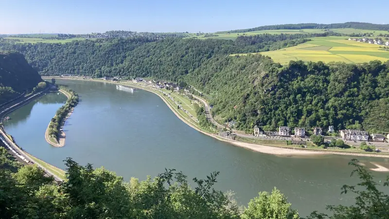
Rheinsteig
Germany · Rhine Valley · 313 km · 21 stages

Westweg
Germany · Black Forest · 285 km · 12 stages

Goldsteig
Germany · Bavaria · 416 km · 23 stages

Tour du Mont Blanc
France · Italy · Switzerland · 166 km · 11 stages

Alta Via 1
Italy · Dolomites · 118 km · 11 stages

GR 20
France · Corsica · 184 km · 16 stages
John Muir Trail · Laugavegur · Cotswold Way · Kerry Way · Camino Finisterre · West Highland Way · Walker's Haute Route · Kungsleden · Tour of Monte Rosa · Coast to Coast Walk · Pembrokeshire Coast Path · Hadrian's Wall Path · South Downs Way · Dingle Way · Wicklow Way · Fishermen's Trail · Camino Portugués · Alta Via 2 · Peaks of the Balkans · Overland Track · Lycian Way · St Paul Trail · Camino Francés · Inca Trail · W Trek · Everest Base Camp Trek · Annapurna Circuit · Kumano Kodo Nakahechi · Camino del Norte · Via Francigena · GR10 · Pennine Way · Carian Trail · Evliya Çelebi Way · Kaçkar Mountains Traverse · Phrygian Way · Sultans Trail · Mount Ararat Climb · Hittite Trail · Troy Culture Route · Independence Way · Mysia Ways · GR54 Tour des Écrins · Via Alpina · Path of the Gods · Cinque Terre Trail · Alta Via 4 · GR221 Dry Stone Route · Stubai High Trail · Milford Track · Routeburn Track · Kepler Track · Tongariro Northern Circuit · Larapinta Trail · Great Ocean Walk · West Coast Trail · Wonderland Trail · Teton Crest Trail · Annapurna Base Camp Trek · Markha Valley Trek · Salkantay Trek · Huayhuash Circuit · Kilimanjaro Machame Route · Toubkal Circuit · Jordan Trail: Dana to Petra · Torres del Paine O Circuit · Abel Tasman Coast Track · Three Capes Track · Mestia to Ushguli Trek · Nakasendo Way · Berg Lake Trail · Skyline Trail (Jasper) · Fitz Roy & Cerro Torre Loop · Santa Cruz Trek · Otter Trail · Fish River Canyon Hiking Trail · Camino Primitivo · Camino Inglés · Eagle Walk (Adlerweg) · Berliner Höhenweg · Cape Wrath Trail · Great Glen Way · Offa's Dyke Path · Cleveland Way · Rota Vicentina Historical Way · Via Podiensis (GR 65) · Heaphy Track · Queen Charlotte Track · Cape to Cape Track · Rockwall Trail · Juan de Fuca Marine Trail · Quilotoa Loop · Nahuel Huapi Traverse · Ala Kul Trek · Tiger Leaping Gorge High Trail · Mount Kenya Sirimon–Chogoria Traverse · Ghorepani Poon Hill Trek · Kilimanjaro Lemosho Route · Lebanon Mountain Trail · Aladağlar Traverse · Kokoda Track · Chilkoot Trail · Lost City Trek · Choquequirao Trek · GR R2 Réunion · M'Goun Traverse
Hike it with the route in your pocket
Outest has the Malerweg route offline, with elevation, water and village points, and a trail guide you can ask about stages, weather and where to sleep.