
Camino Finisterre hiking guide: route map, stages & where to stay
The Camino de Santiago route that starts in Santiago: about 115 km west to the Atlantic at Fisterra and on to Muxía, past Ponte Maceira, Negreira, Olveiroa and Cee, sleeping in pilgrim albergues. Most walkers take 4 or 5 days.
Best time to hike the Camino Finisterre →

The Camino Finisterre (in Galician Camiño de Fisterra-Muxía) is the only route of the Camino de Santiago that starts in Santiago de Compostela instead of ending there. It runs west through the green hills of Galicia to the Atlantic at Fisterra, which the Romans thought was the end of the known world, and then north along the Costa da Morte to Muxía. It is waymarked with yellow arrows and stone markers with the scallop shell, and most people walk it in 4 or 5 days, sleeping in pilgrim hostels (albergues).
The route
The walk starts at the cathedral on Praza do Obradoiro and soon leaves the city for woods and farmland. It crosses the river Tambre on the old stone bridge at Ponte Maceira and reaches Negreira. The second day is the longest: through quiet villages such as Vilaserío and Santa Mariña, over the highest ground of the route (about 470 m), to Olveiroa. Soon after Olveiroa, at Hospital, the way splits: one branch goes to Cee and Fisterra, the other to Dumbría and Muxía. After a 13 km stretch with no services, the path drops steeply to the sea at Cee, follows the coast through Corcubión and along Langosteira beach, and enters the fishing town of Fisterra. The lighthouse on Cape Fisterra is a further 3.4 km each way, on a road and path above the sea. The last day goes north across the peninsula to the river mouth at Lires and over the hills to Muxía, ending at the Virxe da Barca sanctuary on the rocks.
This guide follows the route as mapped on OpenStreetMap: Santiago to Fisterra via Cee, then Fisterra to Muxía. It splits it into 5 stages, about 23.0 km each, ending at the towns with public albergues. The total climb is about 2,000 m. The walk to the cape and back is not counted in the stages.
Highlights
- Ponte Maceira: a stone bridge over the river Tambre, in a village often listed among the most beautiful in Spain
- The descent to Cee: wide views over the Corcubión estuary and the Atlantic after two days inland
- Cape Fisterra: the lighthouse from 1853, the waymark stone that marks the end of the Camino, and the sunset over the ocean
- Langosteira and Lires: a long sandy beach before Fisterra and a quiet estuary halfway to Muxía
- Muxía: the Virxe da Barca sanctuary on the rocks by the sea, and the A Ferida sculpture that remembers the Prestige oil spill of 2002
- The Fisterrana and the Muxiana: free certificates for pilgrims who finish at Fisterra or Muxía
When to walk the Camino Finisterre
You can walk the Camino Finisterre all year, and the public albergues are open all year. The sea keeps winters mild, but this is one of the rainiest parts of Spain, so bring good rain gear in any month. May to June and September to early October usually have the best mix of weather and space in the albergues. July and August are the busiest months. In winter many private albergues close, so check before you go. In 2026 the public albergue in Olveiroa is closed from 28 September to 13 October.
How many days do you need?
The 5 stages in this guide take 5 days. Many walkers do Santiago to Fisterra in 4 days and take a bus back; strong walkers sometimes do it in 3. The second stage, Negreira to Olveiroa, is 33 km; you can split it at Vilaserío or Santa Mariña and take 6 days in total. You can also walk to Muxía first: from the Hospital junction it is about 27 km to Muxía via Dumbría, and then about 28 km along the coast to Fisterra.
Getting there and logistics
Santiago de Compostela has an airport and a railway station. You can use the credencial (pilgrim passport) from your Camino or get one at the Pilgrim Welcome Office in Rúa Carretas, near the cathedral. Public albergues of the Xunta de Galicia in Negreira, Olveiroa, Fisterra and Muxía cost 10 € a night and cannot be booked, so arrive in the afternoon; they open at 13:00. Private albergues cost about 15 to 20 € and most take bookings. There are no shops or bars between Hospital and Cee (13 km) or between Lires and Muxía (14 km), so carry water and food. Monbus buses connect Fisterra, Cee and Muxía with Santiago.
Difficulty
The Camino Finisterre is an easy to moderate walk on country lanes, forest tracks and some roads. The climbs are short; the highest point is under 500 m. The hard part is the distance: two days are around 30 km. Rain, mud and long stretches of asphalt are the usual problems. Wild camping is not allowed in Galicia, so plan to sleep in albergues, hotels or campsites.
History
The cape at Fisterra (from Latin finis terrae, "end of the earth") was seen as the end of the known world in Roman times. In the Middle Ages, hospitals were set up along the road from Santiago so that pilgrims could continue to the cape. The lighthouse was built in 1853. Muxía has long been a place of pilgrimage to the Virxe da Barca; its sanctuary burned after a lightning strike on 25 December 2013. The Compostela is only given for walking to Santiago, so the towns at the end give their own certificates: the Fisterrana and the Muxiana.
Camino Finisterre map
The whole Camino Finisterre with its 5 stages, Santiago de Compostela to Fisterra and Muxía. Tap a stage on the map to open it. To follow the route with GPS and offline maps on the trail, open it in the free Outest app.
The 5 stages
The classic five days from the cathedral in Santiago de Compostela to Fisterra on the Atlantic, via Negreira, Olveiroa and Cee, and on along the coast to Muxía. Each stage ends at a town with a public albergue. Each stage page has a map, elevation profile, the albergues and hotels on the way, and the nearest help.
| # | Stage | Distance | Level |
|---|---|---|---|
| 1 | Santiago de Compostela → Negreira | 21.8 km | hard |
| 2 | Negreira → Olveiroa | 33.2 km | hard |
| 3 | Olveiroa → Cee | 19.0 km | moderate |
| 4 | Cee → Fisterra | 12.3 km | easy |
| 5 | Fisterra → Muxía | 28.6 km | hard |
Emergency, hospitals and services
In an emergency call 112; for medical emergencies in Galicia you can also call 061. 2 hospitals with a 24/7 emergency department are within reach, in Santiago and in Cee, and the health centres in Negreira and Cee have out-of-hours emergency points (PAC). Every stage page lists the nearest help, plus pharmacies, ATMs, shops and bus stops on that stage.
Where to stay on the Camino Finisterre
Public and private albergues, pensions and hotels, grouped by stage from Santiago de Compostela to Fisterra and Muxía. Listings were checked online in October 2026. Places marked "listed in pilgrim guides" are on a pilgrim guide or map listing but could not be confirmed on their own website. Public albergues cannot be booked; in July and August, and in winter when many private places close, call ahead.
Santiago de Compostela (trailhead)
3 places
- 3 with rooms
- 1 with meals
Santiago de Compostela
Santiago de Compostela → Negreira
5 places
- 5 with rooms
- 1 with meals
Negreira
Negreira → Olveiroa
5 places
- 5 with rooms
- 4 with meals
Olveiroa · Santa Mariña · Vilaserío
Olveiroa → Cee
3 places
- 3 with rooms
- 1 with meals
Cee · Hospital
Cee → Fisterra
8 places
- 8 with rooms
- 1 with meals
Corcubión · Fisterra
Fisterra → Muxía
6 places
- 6 with rooms
- 4 with meals
Lires · Muxía
Plan your days
Pick any Camino Finisterre stage in the free hike planner to see walking time, water to carry, calories, difficulty, the weather forecast and daylight.
More trail guides

Camino del Norte
Spain · Northern coast · 840 km · 35 stages
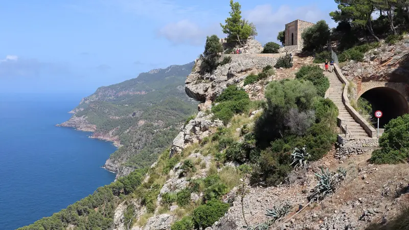
GR221 Dry Stone Route
Spain · Mallorca · 144 km · 8 stages

Camino Primitivo
Spain · Asturias & Galicia · 308 km · 14 stages
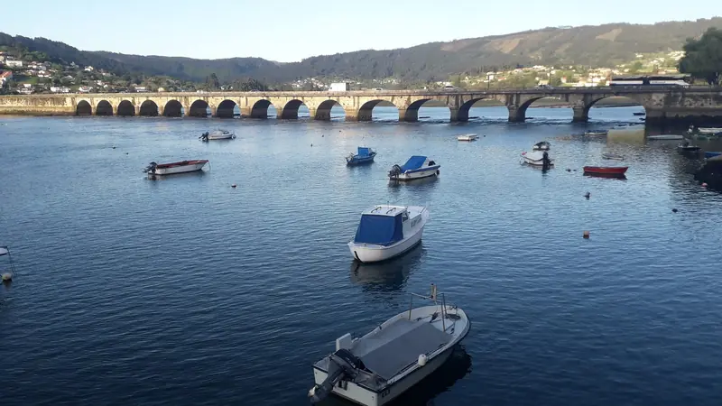
Camino Inglés
Spain · Galicia · 113 km · 5 stages

Tour du Mont Blanc
France · Italy · Switzerland · 166 km · 11 stages

Alta Via 1
Italy · Dolomites · 118 km · 11 stages
GR 20 · John Muir Trail · Laugavegur · Cotswold Way · Kerry Way · West Highland Way · Walker's Haute Route · Kungsleden · Tour of Monte Rosa · Coast to Coast Walk · Pembrokeshire Coast Path · Hadrian's Wall Path · South Downs Way · Dingle Way · Wicklow Way · Fishermen's Trail · Camino Portugués · Alta Via 2 · Malerweg · Peaks of the Balkans · Overland Track · Lycian Way · St Paul Trail · Camino Francés · Inca Trail · W Trek · Everest Base Camp Trek · Annapurna Circuit · Kumano Kodo Nakahechi · Via Francigena · GR10 · Pennine Way · Carian Trail · Evliya Çelebi Way · Kaçkar Mountains Traverse · Phrygian Way · Sultans Trail · Mount Ararat Climb · Hittite Trail · Troy Culture Route · Independence Way · Mysia Ways · Rheinsteig · Westweg · Goldsteig · GR54 Tour des Écrins · Via Alpina · Path of the Gods · Cinque Terre Trail · Alta Via 4 · Stubai High Trail · Milford Track · Routeburn Track · Kepler Track · Tongariro Northern Circuit · Larapinta Trail · Great Ocean Walk · West Coast Trail · Wonderland Trail · Teton Crest Trail · Annapurna Base Camp Trek · Markha Valley Trek · Salkantay Trek · Huayhuash Circuit · Kilimanjaro Machame Route · Toubkal Circuit · Jordan Trail: Dana to Petra · Torres del Paine O Circuit · Abel Tasman Coast Track · Three Capes Track · Mestia to Ushguli Trek · Nakasendo Way · Berg Lake Trail · Skyline Trail (Jasper) · Fitz Roy & Cerro Torre Loop · Santa Cruz Trek · Otter Trail · Fish River Canyon Hiking Trail · Eagle Walk (Adlerweg) · Berliner Höhenweg · Cape Wrath Trail · Great Glen Way · Offa's Dyke Path · Cleveland Way · Rota Vicentina Historical Way · Via Podiensis (GR 65) · Heaphy Track · Queen Charlotte Track · Cape to Cape Track · Rockwall Trail · Juan de Fuca Marine Trail · Quilotoa Loop · Nahuel Huapi Traverse · Ala Kul Trek · Tiger Leaping Gorge High Trail · Mount Kenya Sirimon–Chogoria Traverse · Ghorepani Poon Hill Trek · Kilimanjaro Lemosho Route · Lebanon Mountain Trail · Aladağlar Traverse · Kokoda Track · Chilkoot Trail · Lost City Trek · Choquequirao Trek · GR R2 Réunion · M'Goun Traverse
Hike it with the route in your pocket
Outest has the Camino Finisterre route offline, with elevation, water and village points, and a trail guide you can ask about stages, weather and where to sleep.