
Lycian Way hiking guide: route map, stages & where to stay
Turkey's flagship long-distance trail, from Ölüdeniz to Geyikbayırı, following old Roman roads, mule paths, and coastal ridges past the ruins of ancient Lycia.
Lycian Way conditions today →Best time to hike the Lycian Way →

The Lycian Way is Turkey's first long-distance hiking trail, opened in 1999 along the southwestern coast of the Teke Peninsula. It runs from Ovacık, above Ölüdeniz near Fethiye, east to Geyikbayırı on the outskirts of Antalya. Most hikers complete it end-to-end over three to four weeks, though it is commonly walked as week-long sections.
Route
The trail follows the ancient territory of Lycia, mostly within sight of the Mediterranean. The western half is coastal and forested, with frequent descents to beaches and small fishing villages. The middle section pushes inland into the Bey Mountains, where stages climb above the sea and pass remote yayla settlements. The eastern half returns to the coast through Olympos and the ruins of Phaselis before finishing in the foothills near Antalya.
Surface is mostly stony footpath, old Roman road, and mule track. It is waymarked with red-and-white GR-style stripes throughout. The highest points sit just under 1,800 metres.
Highlights
- Butterfly Valley and Kabak — early stages with the trail's most photographed coastal cliffs
- Patara — long sandy beach and the ancient Lycian capital
- Kaş and Kalkan — small harbour towns useful for resupply and rest days
- Myra (Demre) — rock-cut tombs and the church of St Nicholas
- Olympos and Chimaera — ruined city beside the sea and the natural burning vents at Yanartaş
- Tahtalı Dağı — the trail passes the base of the 2,365 m peak with cable-car access to the summit
- Phaselis — Roman harbour ruins on the final approach to Antalya
When to go
Best seasons are mid-March through May and mid-September through November. Summer is unsuitable: temperatures regularly exceed 35°C with little shade on exposed sections, and water sources run low. Winter is walkable on lower coastal stages but high inland passes can hold snow into March.
Logistics
The trail is well supported by villages, pensions, and small shops, particularly in the western half. Wild camping is permitted in most areas. Water is available from village taps and seasonal springs, though hikers should carry capacity for at least one full day between sources on the mountain stages.
Most hikers walk west to east, starting from Ovacık and finishing at Geyikbayırı. Dalaman Airport is the closest airport for the western trailhead; Antalya Airport is closest for the eastern end. Frequent dolmuş (minibus) services connect the trail to coastal towns, making it straightforward to exit or rejoin at multiple points.
Difficulty
Moderate overall, but unrelenting in cumulative effort. The challenge is not technical — no scrambling or exposure beyond standard hill walking — but the rocky surface, repeated steep climbs, and Mediterranean heat make it physically demanding. Hikers should be comfortable with consecutive long days on uneven ground.
Navigation is straightforward where waymarks are fresh, but markings degrade in places. Carrying a GPS track is recommended.
History
The trail was researched and waymarked by Kate Clow, a British historian based in Turkey, and opened in 1999 as Turkey's first long-distance walking route. Most of its course follows pre-existing paths — Roman roads, Byzantine tracks, and shepherd routes — that have linked the coastal Lycian cities for over two thousand years.
Lycian Way map
The whole Lycian Way with its 27 stages, Ovacık to Geyikbayırı. Tap a stage on the map to open it. To follow the route with GPS and offline maps on the trail, open it in the free Outest app.
The 27 stages
From Ovacık above Ölüdeniz to Geyikbayırı near Antalya. Each stage page has a map, elevation profile and the places to sleep along the way.
| # | Stage | Distance | Level |
|---|---|---|---|
| 1 | Ovacık → Kabak | 18.3 km | hard |
| 2 | Kabak → Gey | 12.1 km | moderate |
| 3 | Gey → Gavurağılı | 13.0 km | moderate |
| 4 | Gavurağılı → Kınık | 16.5 km | moderate |
| 5 | Kınık → Akbel | 22.3 km | hard |
| 6 | Akbel → Patara | 11.6 km | easy |
| 7 | Patara → Kalkan | 23.0 km | hard |
| 8 | Kalkan → Bezirgan | 10.0 km | moderate |
| 9 | Bezirgan → Gökçeören | 17.7 km | moderate |
| 10 | Gökçeören → Çukurbağ | 20.5 km | hard |
| 11 | Çukurbağ → Kaş | 7.5 km | easy |
| 12 | Kaş → Üzümlü İskelesi | 13.2 km | moderate |
| 13 | Üzümlü İskelesi → Aperlai | 12.5 km | moderate |
| 14 | Aperlai → Üçağız | 7.9 km | easy |
| 15 | Üçağız → Demre | 21.3 km | moderate |
| 16 | Demre → Alakilise | 13.1 km | moderate |
| 17 | Alakilise → Belos | 15.6 km | hard |
| 18 | Belos → Finike | 11.5 km | easy |
| 19 | Finike → Karaöz | 29.5 km | hard |
| 20 | Karaöz → Adrasan | 20.4 km | hard |
| 21 | Adrasan → Çıralı | 15.1 km | moderate |
| 22 | Çıralı → Tekirova | 20.3 km | hard |
| 23 | Tekirova → Kuzdere | 20.7 km | hard |
| 24 | Kuzdere → Göynük Yaylası | 18.0 km | hard |
| 25 | Göynük Yaylası → Göynük | 12.7 km | moderate |
| 26 | Göynük → Hisarçandır | 22.1 km | hard |
| 27 | Hisarçandır → Geyikbayırı | 22.5 km | hard |
Emergency, hospitals and services
In an emergency call 112. The trail passes 11 hospitals with a 24/7 emergency department within reach, plus village health centres, pharmacies, ATMs, shops and dolmuş stops. Every stage page lists the ones on that stage.
Where to stay on the Lycian Way
Pensions, village guesthouses, campsites and places to eat, grouped by route section from Fethiye to Antalya. Every listing below was checked online in September 2026. Small village businesses open and close with the season, so call or message before you rely on one.
Fethiye → Ovacık
6 confirmed places
- 4 with rooms
- 1 camping
- 3 with meals
Kayaköy · Ölüdeniz · Ovacık
Ovacık → Faralya
6 confirmed places
- 6 with rooms
- 6 with meals
Faralya · Kirme
Faralya → Kabak
3 confirmed places
- 3 with rooms
- 3 with meals
Kabak
Kabak → Alınca
1 confirmed place
- 1 camping
- 1 with meals
Alınca
Alınca → Sidyma → Bel
1 confirmed place
- 1 with rooms
- 1 with meals
Sidyma
Bel → Gavuragili → Karadere / Özlen
2 confirmed places
- 2 with rooms
- 1 camping
- 2 with meals
Gavurağılı
Karadere / Özlen → Xanthos
1 confirmed place
- 1 with rooms
- 1 camping
- 1 with meals
Kumluova / Kınık
Üzümlü → Gelemiş
2 confirmed places
- 2 with rooms
- 1 camping
- 1 with meals
Gelemiş / Patara
Bezirgan → Gökçeören
5 confirmed places
- 4 with rooms
- 2 camping
- 5 with meals
Gökçeören · Sarıbelen
Gökçeören → Çukurbağ
2 confirmed places
- 1 with rooms
- 1 with meals
Çukurbağ
Çukurbağ → Kaş
5 confirmed places
- 4 with rooms
- 2 camping
- 3 with meals
Kaş
Kaş → Üzümlü Pier
2 confirmed places
- 2 with rooms
- 2 with meals
Üzümlü Pier - Sısla
Üzümlü Pier → Boğazcık
1 confirmed place
- 1 camping
- 1 with meals
Boğazcık
Boğazcık → Aperlai
3 confirmed places
- 1 with rooms
- 3 with meals
Aperlai - Sıcak Pier
Aperlai → Kaleköy
6 confirmed places
- 6 with rooms
- 6 with meals
Kaleköy / Simena · Üçağız
Kaleköy → Çayağzı
4 confirmed places
- 3 with rooms
- 1 camping
- 4 with meals
Çayağzı / Andriake · Kapaklı
Çayağzı → Davazlar
1 confirmed place
- 1 with rooms
- 1 with meals
Hoyran
Çayağzı → Myra
1 confirmed place
- 1 with rooms
- 1 with meals
Demre
Myra → Alakilise → Finike
1 confirmed place
- 1 with rooms
- 1 with meals
Finike
Finike → Karaöz
2 confirmed places
- 2 with rooms
- 2 with meals
Karaöz
Karaöz → Adrasan
4 confirmed places
- 4 with rooms
- 1 camping
- 4 with meals
Adrasan
Adrasan → Çıralı
10 confirmed places
- 10 with rooms
- 10 with meals
Çıralı · Olympos
Çıralı → Tekirova
1 confirmed place
- 1 with rooms
Tekirova
Çıralı → Beycik
2 confirmed places
- 1 with rooms
- 2 camping
- 2 with meals
Beycik
Beycik → Yayla Kuzdere
1 confirmed place
- 1 with rooms
- 1 camping
- 1 with meals
Yayla Kuzdere
Yayla Kuzdere → Göynük Yayla (Alp)
4 confirmed places
- 2 with rooms
- 1 camping
- 4 with meals
Gedelme · Göynük Yayla (Alp)
Aşağı Kuzdere → Göynük Yayla (Alp)
1 confirmed place
- 1 with meals
Roman Bridge
Göynük Yayla (Alp) → Göynük
1 confirmed place
- 1 with rooms
- 1 with meals
Göynük
Çitdibi → Geyikbayırı
3 confirmed places
- 3 with rooms
- 3 with meals
Geyikbayırı
Alınca → Gey → Bel
5 confirmed places
- 3 with rooms
- 1 camping
- 5 with meals
Bel · Gey
Plan your days
Pick any Lycian Way stage in the free hike planner to see walking time, water to carry, calories, difficulty, the weather forecast and daylight.
More trail guides

St Paul Trail
Türkiye · Taurus Mountains · 303 km · 18 stages

Carian Trail
Türkiye · Muğla · 288 km · 19 stages
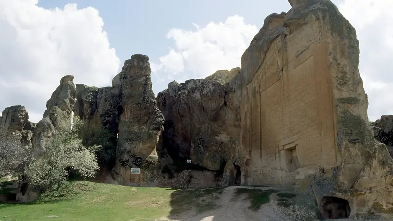
Phrygian Way
Türkiye · Phrygian Highlands · 254 km · 13 stages

Tour du Mont Blanc
France · Italy · Switzerland · 166 km · 11 stages

Alta Via 1
Italy · Dolomites · 118 km · 11 stages

GR 20
France · Corsica · 184 km · 16 stages
John Muir Trail · Laugavegur · Cotswold Way · Kerry Way · Camino Finisterre · West Highland Way · Walker's Haute Route · Kungsleden · Tour of Monte Rosa · Coast to Coast Walk · Pembrokeshire Coast Path · Hadrian's Wall Path · South Downs Way · Dingle Way · Wicklow Way · Fishermen's Trail · Camino Portugués · Alta Via 2 · Malerweg · Peaks of the Balkans · Overland Track · Camino Francés · Inca Trail · W Trek · Everest Base Camp Trek · Annapurna Circuit · Kumano Kodo Nakahechi · Camino del Norte · Via Francigena · GR10 · Pennine Way · Evliya Çelebi Way · Kaçkar Mountains Traverse · Sultans Trail · Mount Ararat Climb · Hittite Trail · Troy Culture Route · Independence Way · Mysia Ways · Rheinsteig · Westweg · Goldsteig · GR54 Tour des Écrins · Via Alpina · Path of the Gods · Cinque Terre Trail · Alta Via 4 · GR221 Dry Stone Route · Stubai High Trail · Milford Track · Routeburn Track · Kepler Track · Tongariro Northern Circuit · Larapinta Trail · Great Ocean Walk · West Coast Trail · Wonderland Trail · Teton Crest Trail · Annapurna Base Camp Trek · Markha Valley Trek · Salkantay Trek · Huayhuash Circuit · Kilimanjaro Machame Route · Toubkal Circuit · Jordan Trail: Dana to Petra · Torres del Paine O Circuit · Abel Tasman Coast Track · Three Capes Track · Mestia to Ushguli Trek · Nakasendo Way · Berg Lake Trail · Skyline Trail (Jasper) · Fitz Roy & Cerro Torre Loop · Santa Cruz Trek · Otter Trail · Fish River Canyon Hiking Trail · Camino Primitivo · Camino Inglés · Eagle Walk (Adlerweg) · Berliner Höhenweg · Cape Wrath Trail · Great Glen Way · Offa's Dyke Path · Cleveland Way · Rota Vicentina Historical Way · Via Podiensis (GR 65) · Heaphy Track · Queen Charlotte Track · Cape to Cape Track · Rockwall Trail · Juan de Fuca Marine Trail · Quilotoa Loop · Nahuel Huapi Traverse · Ala Kul Trek · Tiger Leaping Gorge High Trail · Mount Kenya Sirimon–Chogoria Traverse · Ghorepani Poon Hill Trek · Kilimanjaro Lemosho Route · Lebanon Mountain Trail · Aladağlar Traverse · Kokoda Track · Chilkoot Trail · Lost City Trek · Choquequirao Trek · GR R2 Réunion · M'Goun Traverse
Hike it with the route in your pocket
Outest has the Lycian Way route offline, with elevation, water and village points, and a trail guide you can ask about stages, weather and where to sleep.