
Corfu Trail hiking guide: route map, stages & where to stay
Corfu's island-length trail: about 155 km from Kavos in the south to Agios Spyridon in the north, through olive groves, hill villages and wild beaches and over Mount Pantokrator. Most walkers take 10 days, staying in small hotels, studios and guesthouses.
Best time to hike the Corfu Trail →

Photo: George C. Tsiagalakis, CC BY-SA 4.0, cropped
The Corfu Trail is a long-distance walking route along the whole length of Corfu, the green island off the north-west coast of Greece. It starts just south of Kavos, at the southern tip, and ends on Agios Spyridon beach in the far north, after rounding the Agia Ekaterini headland, the island's northernmost point. It was created by long-time Corfu resident Hilary Whitton Paipeti and welcomed its first hikers in 2001. It is waymarked with yellow "CT" signs and walked from south to north, so the most dramatic scenery comes at the end. Most people take about ten days, sleeping in small hotels, family-run studios and rooms above tavernas.
The route
The first days cross the flat, rural south: olive groves and forest past the ruined Arkoudilla monastery, the market town of Lefkimmi, then the long sandy west coast and the juniper dunes of the Korission lagoon. From Paramonas the trail climbs inland through the hill villages of Pavliana to Stavros above Benitses, then over Agii Deka, Corfu's second highest mountain, to Pelekas. The middle of the walk follows old paths and olive-grove tracks through Vatos, the Ropa valley and Liapades to the bays of Paleokastritsa. In the north it climbs the cobbled mule paths of Lakones and Makrades, drops down a remarkable zigzag path to Agios Georgios Pagon, and crosses the quiet northern hills to Sokraki. The last two days cross the bare karst plateau of Mount Pantokrator to the half-deserted Venetian village of Old Perithia, then descend through oak woods to the north coast.
This guide follows the route as mapped on OpenStreetMap and splits it into 10 stages, about 15.5 km each, following the official ten-day planner. The official site gives 180 km; the line used here measures about 155 km, because the planner has dropped a loop on the north-east coast and the official stage distances are rounded. The highest point on the trail is about 760 m on the Pantokrator ridge; the summit (about 906 m) is a detour.
Highlights
- Arkoudilla: a ruined monastery in the forest above the white cliffs of the southern tip, on the first morning
- Korission lagoon: wild beaches, dunes and juniper forest beside a large coastal lagoon
- Agii Deka: a steep climb to Corfu's second highest summit, with views over Corfu Town and the mainland
- Myrtiotissa and Paleokastritsa: a famous small beach on stage 6 and the green bays and monastery at its end
- Lakones, Makrades and the cliff path: cobbled paths, a detour to the Angelokastro castle, and the zigzag path down a sheer cliff to Agios Georgios
- Pantokrator and Old Perithia: the wildest scenery on the island, then a Venetian mountain village of stone houses and tavernas
- The north coast: the Antinioti lagoon and the rocky Agia Ekaterini headland at the end
When to walk the Corfu Trail
The best months are May to early June and mid-September to October: spring brings wild flowers and orchids, and in autumn the sea is still warm. July and August are hot and humid for long days on open tracks, and beds in the resorts are busy. The trail is open all year, but most rooms and tavernas in the beach resorts and villages close from late October until late April or May, and after heavy rain some paths are muddy and streams hard to cross.
How many days do you need?
Ten days of walking, with stages from about 10 to 24 km and 3 to 8 hours. The longest days are Pelekas to Paleokastritsa (about 24 km) and Agios Georgios Pagon to Sokraki, which climbs about 850 m. You can walk the southern or northern half in five days each, and buses make it easy to skip a section. Fast walkers combine stages 7 and 8 or 9 and 10, but those are long, steep days.
Getting there and logistics
Corfu airport is just south of Corfu Town, and ferries arrive from Igoumenitsa on the mainland (some to Lefkimmi) and from Italy. Almost all buses start in Corfu Town: green KTEL buses go to Kavos, Lefkimmi, Agios Georgios South, Agios Mattheos (near Paramonas), Liapades, Paleokastritsa, Agios Georgios Pagon, Sokraki and Acharavi, and blue city buses go to Benitses and Pelekas. Timetables change often in summer and services are sparse in winter, so check them before each day. From Agios Spyridon you can walk to the main road at Almyros or New Perithia for a bus, or take a taxi.
There are no permits or fees. Accommodation is the main thing to plan: the official planner lists only limited beds at Lefkimmi, Paramonas, Stavros, Sokraki and Old Perithia, so book these early. At Stavros most walkers stay in Benitses, 1-2 km below the trail, and the official stage 7 end at Agros has no beds, so this guide ends that stage at Agios Georgios Pagon. Wild camping is illegal in Greece; the only campsite on the route is at Paleokastritsa. Local agencies offer self-guided trips with rooms booked and bags carried.
Money and phone signal
Greece uses the euro. Resort hotels take cards, but small studios, tavernas and village shops often want cash. There are ATMs in Kavos, Lefkimmi, Benitses, Pelekas, Paleokastritsa, Agios Georgios Pagon and Acharavi, but none in Sokraki or Old Perithia. Mobile signal is good near villages and resorts but can drop in deep valleys and on the mountain, so download the track and the map before you set off.
What to pack
Light walking boots or trail shoes with good grip for rocky and muddy paths, sun hat, sunscreen and at least 2 litres of water per person: there are long sections without shops, notably stage 2, the Korission dunes and the Pantokrator plateau. Bring a light waterproof, a small first-aid and blister kit, and the GPS track on your phone with a power bank. The Anavasi 1:40,000 Corfu map shows the trail.
Safety
The Corfu Trail is a moderate walk with no technical sections, but the first day is surprisingly tiring and the climbs on stages 4, 5 and 8 are steep. The waymarks are infrequent and easy to miss, and white-green race marks sometimes lead you the wrong way, so check the track at every junction. Cross the Pantokrator plateau only in settled weather: low cloud makes the way hard to find. Fires are strictly banned, as is walking on the nets under the olive trees. In an emergency call 112 (ambulance 166, fire and land rescue 199). Corfu has one hospital with an emergency department, in Kontokali near Corfu Town, and a health centre in Lefkimmi.
History
Corfu was ruled by Venice for about four centuries, and its millions of olive trees, many of them planted under Venetian rule, still cover much of the island that the trail crosses. In the 1930s the Durrell family lived here, and Gerald Durrell's books made the island famous. Hilary Whitton Paipeti, who also wrote about the Durrells' Corfu, mapped a route through the quiet interior away from the coastal resorts and opened the Corfu Trail in 2001. Old Perithia, near the end, was one of the island's wealthiest villages under the Venetians, was almost abandoned in the 1960s, and has slowly come back to life since 2010.
Corfu Trail map
The whole Corfu Trail with its 10 stages, Kavos to Agios Spyridon. Tap a stage on the map to open it. To follow the route with GPS and offline maps on the trail, open it in the free Outest app.
The 10 stages
The official ten-day route from just south of Kavos to Agios Spyridon beach, via Lefkimmi, Agios Georgios South, Paramonas, Stavros above Benitses, Pelekas, Paleokastritsa, Agios Georgios Pagon, Sokraki and Old Perithia. Walking times allow for rough paths and sparse waymarks. Each stage page has a map, elevation profile, places to sleep and eat, and the nearest help.
| # | Stage | Distance | Level |
|---|---|---|---|
| 1 | Kavos → Lefkimmi | 14.7 km | moderate |
| 2 | Lefkimmi → Agios Georgios South | 15.8 km | moderate |
| 3 | Agios Georgios South → Paramonas | 15.4 km | moderate |
| 4 | Paramonas → Stavros | 13.6 km | moderate |
| 5 | Stavros → Pelekas | 18.1 km | hard |
| 6 | Pelekas → Paleokastritsa | 23.7 km | hard |
| 7 | Paleokastritsa → Agios Georgios Pagon | 9.6 km | easy |
| 8 | Agios Georgios Pagon → Sokraki | 19.1 km | hard |
| 9 | Sokraki → Old Perithia | 13.2 km | moderate |
| 10 | Old Perithia → Agios Spyridon | 12.1 km | easy |
Emergency, hospitals and services
In an emergency call 112, free from any phone; for an ambulance you can also call 166, and for a wildfire or a lost walker away from roads the Fire Service on 199. Corfu has 1 hospital with an emergency department, the General Hospital in Kontokali near Corfu Town, up to an hour by road from the ends of the trail; every stage page lists the nearest help, plus health centres, pharmacies, shops and bus stops on that stage.
Where to stay on the Corfu Trail
Small hotels, family-run studios, rooms above tavernas, a few beach resorts and one campsite, grouped by stage from Kavos to Agios Spyridon. Listings were checked online in October 2026. Places marked "listed, not confirmed" appear on a public listing (OpenStreetMap, a tour operator or a booking site) but could not be confirmed on their own website. Wild camping is illegal in Greece; the only campsite on the trail is at Paleokastritsa. Most places open from about May to October, and the villages have only a few beds, so book ahead.
Kavos (trailhead)
2 places
- 2 with rooms
- 1 with meals
Kavos
Kavos → Lefkimmi
2 places
- 2 with rooms
Lefkimmi · Parakladi (Lefkimmi)
Lefkimmi → Agios Georgios South
4 places
- 4 with rooms
- 2 with meals
Agios Georgios South
Agios Georgios South → Paramonas
3 places
- 3 with rooms
- 2 with meals
Agios Mattheos (Prasoudi) · Paramonas
Paramonas → Stavros
4 places
- 3 with rooms
- 2 with meals
Benitses · Stavros (Dafnata)
Stavros → Pelekas
4 places
- 4 with rooms
- 3 with meals
Glyfada · Kontogialos (Pelekas beach) · Pelekas
Pelekas → Paleokastritsa
5 places
- 4 with rooms
- 1 camping
- 2 with meals
Liapades beach · Paleokastritsa
Paleokastritsa → Agios Georgios Pagon
3 places
- 3 with rooms
- 2 with meals
Agios Georgios Pagon
Agios Georgios Pagon → Sokraki
1 place
- 1 with rooms
- 1 with meals
Sokraki
Sokraki → Old Perithia
1 place
- 1 with rooms
- 1 with meals
Old Perithia
Old Perithia → Agios Spyridon
4 places
- 4 with rooms
- 2 with meals
Agios Spyridon · Almyros
Plan your days
Pick any Corfu Trail stage in the free hike planner to see walking time, water to carry, calories, difficulty, the weather forecast and daylight.
More trail guides
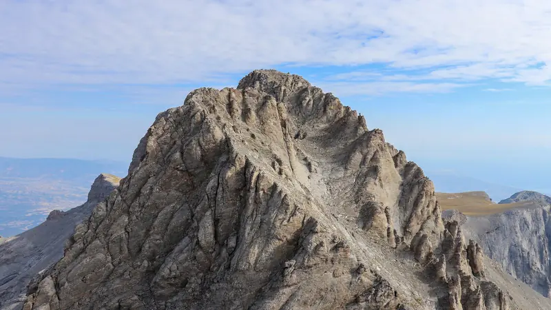
Mount Olympus Traverse
Greece · Mount Olympus · 21 km · 3 stages

Tour du Mont Blanc
France · Italy · Switzerland · 166 km · 11 stages

Alta Via 1
Italy · Dolomites · 118 km · 11 stages

GR 20
France · Corsica · 184 km · 16 stages

John Muir Trail
USA · California · 353 km · 18 stages

Laugavegur
Iceland · Highlands · 53 km · 4 stages
Cotswold Way · Kerry Way · Camino Finisterre · West Highland Way · Walker's Haute Route · Kungsleden · Tour of Monte Rosa · Coast to Coast Walk · Pembrokeshire Coast Path · Hadrian's Wall Path · South Downs Way · Dingle Way · Wicklow Way · Fishermen's Trail · Camino Portugués · Alta Via 2 · Malerweg · Peaks of the Balkans · Overland Track · Lycian Way · St Paul Trail · Camino Francés · Inca Trail · W Trek · Everest Base Camp Trek · Annapurna Circuit · Kumano Kodo Nakahechi · Camino del Norte · Via Francigena · GR10 · Pennine Way · Carian Trail · Evliya Çelebi Way · Kaçkar Mountains Traverse · Phrygian Way · Sultans Trail · Mount Ararat Climb · Hittite Trail · Troy Culture Route · Independence Way · Mysia Ways · Rheinsteig · Westweg · Goldsteig · GR54 Tour des Écrins · Via Alpina · Path of the Gods · Cinque Terre Trail · Alta Via 4 · GR221 Dry Stone Route · Stubai High Trail · Milford Track · Routeburn Track · Kepler Track · Tongariro Northern Circuit · Larapinta Trail · Great Ocean Walk · West Coast Trail · Wonderland Trail · Teton Crest Trail · Annapurna Base Camp Trek · Markha Valley Trek · Salkantay Trek · Huayhuash Circuit · Kilimanjaro Machame Route · Toubkal Circuit · Jordan Trail: Dana to Petra · Torres del Paine O Circuit · Abel Tasman Coast Track · Three Capes Track · Mestia to Ushguli Trek · Nakasendo Way · Berg Lake Trail · Skyline Trail (Jasper) · Fitz Roy & Cerro Torre Loop · Santa Cruz Trek · Otter Trail · Fish River Canyon Hiking Trail · Camino Primitivo · Camino Inglés · Eagle Walk (Adlerweg) · Berliner Höhenweg · Cape Wrath Trail · Great Glen Way · Offa's Dyke Path · Cleveland Way · Rota Vicentina Historical Way · Via Podiensis (GR 65) · Heaphy Track · Queen Charlotte Track · Cape to Cape Track · Rockwall Trail · Juan de Fuca Marine Trail · Quilotoa Loop · Nahuel Huapi Traverse · Ala Kul Trek · Tiger Leaping Gorge High Trail · Mount Kenya Sirimon–Chogoria Traverse · Ghorepani Poon Hill Trek · Kilimanjaro Lemosho Route · Lebanon Mountain Trail · Aladağlar Traverse · Kokoda Track · Chilkoot Trail · Lost City Trek · Choquequirao Trek · GR R2 Réunion · M'Goun Traverse · Royal National Park Coast Track · Grand Cliff Top Walk · Snowies Alpine Walk · Rwenzori Central Circuit · Whale Trail · Ausangate Circuit · Thorsborne Trail · Paparoa Track · Mount Assiniboine Traverse · Sunshine Coast Trail · Sinai Trail · Rakiura Track · Grand Canyon Rim to Rim · Via degli Dei · Stevenson Trail (GR 70) · Juliana Trail · Camí de Cavalls · Karhunkierros Trail · Lost Coast Trail · East Coast Trail · Kalalau Trail · Mount Rinjani Trek · MacLehose Trail · Lake Waikaremoana Great Walk · Hump Ridge Track · Jatbula Trail · Druk Path Trek · Mardi Himal Trek · Mount Kinabalu Climb · Kilimanjaro Marangu Route · Amatola Trail · Dales Way · Tour de la Vanoise · Lechweg · High Coast Trail · Rennsteig · Old Ghost Road · Gokyo Lakes Trek · Leleg Way · Anillo de Picos · Fundy Footpath
Hike it with the route in your pocket
Outest has the Corfu Trail route offline, with elevation, water and village points, and a trail guide you can ask about stages, weather and where to sleep.