
Eagle Walk (Adlerweg) hiking guide: route map, stages & where to stay
The Adlerweg (Eagle Walk) crosses North Tyrol for about 359 km from St. Johann in Tirol to St. Christoph am Arlberg, through the Wilder Kaiser, the Karwendel, Innsbruck's Nordkette and the Lechtal Alps. 24 stages, with nights in Alpine club huts and village inns.
Best time to hike the Eagle Walk (Adlerweg) →

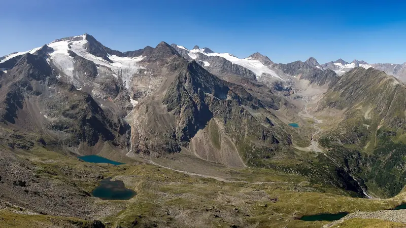
Photo: Karl Winkler, CC BY-SA 3.0, cropped
The Adlerweg (Eagle Walk) is Tyrol's signature long-distance trail. Its North Tyrol main route crosses the Austrian state from east to west, from St. Johann in Tirol below the Wilder Kaiser to St. Christoph on the Arlberg pass, through the Kaiser mountains, the Brandenberg Alps and the Rofan, the Karwendel, the Nordkette above Innsbruck, the Wetterstein and Mieming ranges and the Lechtal Alps. Tirol Werbung, the Tyrol tourist board, splits it into 24 official stages. A second, separate section of 9 stages crosses East Tyrol around the Grossvenediger and the Grossglockner in the Hohe Tauern National Park, from Ströden to the Lucknerhaus; it is not part of this guide. Signposts along the way carry the Adlerweg logo.
The route
The first days are green and low: alpine pastures, waterfalls and the Klamml gorge above St. Johann, the south side of the Wilder Kaiser to the Gaudeamushütte and the Kaindlhütte, and down to Kufstein and its fortress. The Brandenberg Alps follow, with the cable-protected climb to the Plessenberg, then the Rofan above the Achensee. In the Karwendel, Austria's largest nature park, the trail goes from hut to hut: Lamsenjochhütte, the Eng with its old maple trees, the Falkenhütte below the Laliderer Wände, the Karwendelhaus and the long scree of the Schlauchkar to the Hallerangerhaus. The Goetheweg along the Nordkette leads to the Hafelekar, high above Innsbruck. West of Innsbruck the trail climbs to the Solsteinhaus, crosses the Eppzirler Scharte to Leutasch, follows the Gaistal below the Wetterstein to Ehrwald and the Zugspitze, and crosses the Fernpass. The last week, in the Lechtal Alps, is the wildest part, from hut to hut over high cols to the Kaiserjochhaus, the Leutkircher Hütte and the Ulmer Hütte, and down to St. Christoph.
This guide measures every stage on foot along one continuous line, about 359 km in 24 stages of about 14.9 km each, with about 22,800 m of climbing. The official plan is shorter (about 330 km for the 24 stages) because it uses transport five times: the train from Kufstein to Langkampfen (7.7 km on foot), the Rofan cable car down to Maurach (4.1 km, 830 m of descent), the Nordkette cable cars down to Innsbruck (8 km, 1,700 m of descent), the S-Bahn from Innsbruck to Hochzirl, and the Grubigstein lifts at Lermoos (4.2 km, 720 m of climbing). You can take any of these and save the walk. Official stage 13 is a day trip on the Zirbenweg from the Patscherkofel to the Glungezer, reached by cable car and bus; it is a good rest day in Innsbruck. In its place this guide walks from Innsbruck to Zirl (stage 13), on the walking route that Tirol Werbung gives as the alternative to the train, so that stages 14 to 24 keep their official numbers.
When to walk the Adlerweg
The high huts are open from mid or late June to mid or late September; in the Lechtal Alps several close around 20 September. The best time for the whole route is late June to mid-September. The low stages between St. Johann and the Rofan can be walked from May to October. Early in the season hard snowfields can lie in the Schlauchkar (stage 11), below the Stempeljoch (stage 12), on the Eppzirler Scharte and in the Lechtal Alps, so ask the hut keepers. Afternoon thunderstorms are common in July and August: start early.
How hard is it?
Most stages are graded red (medium) or black (difficult) mountain paths. Stages 5 (Plessenberg), 11 (Schlauchkarsattel, 2,639 m, with the optional Birkkarspitze, 2,749 m), 12 (Stempeljoch and the Goetheweg) and several Lechtal stages have steep scree, exposed sections and fixed cables; you need a steady head, sure feet and good fitness for 6 to 9 hours a day. No via ferrata kit is needed on the main route. Many hikers walk the route in two or three summers, or pick the classic hut stretches: the Karwendel (stages 8 to 12) or the Lechtal Alps (stages 18 to 24).
Huts, booking and money
Nights are in Alpine club huts (ÖAV and DAV), private huts and village inns, usually with half board. Most club huts take bookings only through their online system, the Kaiserjochhaus only by phone in season and the Kaindlhütte by email; book July and August early. A sleeping-bag liner is required in club huts. The Loreahütte at the end of stage 17 is self-catering and opens only with the Alpine club key, so most walkers stop at Fernstein or Nassereith instead, or carry food and go with a club member. Alpine club members pay less at huts. Take cash: several huts do not accept cards. Phone signal is patchy in the Karwendel and the Lechtal Alps; near the Eng and Hinterriss your phone may switch to a German network.
Getting there and away
St. Johann in Tirol is on the railway from Wörgl (trains from Innsbruck, Salzburg and Munich); stage 1 starts at the station. Kufstein, Langkampfen, Jenbach (bus to the Achensee), Scharnitz, Innsbruck, Hochzirl, Seefeld and Ehrwald are on railway lines, so it is easy to start or stop in the middle. In the Lechtal Alps the huts are reached from the valley villages of Boden, Madau, Gramais, Zams, Flirsch, Pettneu and Kaisers. At the end, bus 760 runs from St. Christoph to St. Anton am Arlberg station, with fast trains to Innsbruck, Munich, Bregenz and Zurich. The nearest airports are Innsbruck, Munich and Salzburg.
What to pack
Pack as for a hut trek: good boots with grip, poles, rain and wind gear, warm layers, sun protection, a hut sleeping-bag liner, a head torch, a first-aid kit and the official GPX on your phone with a power bank. Carry food and water for the long stages; there are no shops between the valley towns.
Safety and 2026 notes
In an emergency call 140 (alpine rescue) or 112. Rescue and helicopter costs in Austria are billed to the patient, so carry insurance or an Alpine club membership. Keep your distance from cows with calves and keep dogs on a short lead. Wild camping is forbidden in Tyrol. In autumn 2026 two sections were closed: path 601 between the Tarrentonalm and the Hinterbergjoch on stage 18 (rockfall), and part of stage 24 after mudflows, with a signed detour via the lower Höhenweg and the Galzig. The Hanauer Hütte has no winter room until summer 2027, and the castle hotel at Fernsteinsee is closed for a business break. Check the stage pages on tirol.at and call the huts before you go.
Eagle Walk (Adlerweg) map
The whole Eagle Walk (Adlerweg) with its 24 stages, St. Johann in Tirol to St. Christoph am Arlberg. Tap a stage on the map to open it. To follow the route with GPS and offline maps on the trail, open it in the free Outest app.
The 24 stages
The 24 official North Tyrol stages from St. Johann in Tirol, over the Wilder Kaiser, the Brandenberg Alps, the Rofan, the Karwendel, the Nordkette above Innsbruck, the Mieming and Wetterstein ranges and the Lechtal Alps, to St. Christoph on the Arlberg. Every stage is measured on foot, including the sections where the official plan takes a train or a cable car. Walking times allow for steep scree and cable-protected paths. Each stage page has a map, elevation profile, huts and inns on the way, and the nearest help.
Emergency, hospitals and services
In an emergency in the mountains call 140 (alpine rescue) or 112. In Tyrol both reach the Leitstelle Tirol, which sends the Bergrettung, the ambulance and the helicopter. 6 hospitals with a 24/7 emergency department are within reach; every stage page lists the nearest one, plus pharmacies, ATMs, shops and bus stops on that stage.
Where to stay on the Eagle Walk (Adlerweg)
Alpine club huts, private huts and village inns, grouped by stage from St. Johann in Tirol to St. Christoph am Arlberg. Listings were checked online in October 2026. Places marked "listed by the tourist office" are on an official tourism or map listing but could not be confirmed on their own website. Most huts are open only in summer and fill up in July and August, so book ahead.
St. Johann in Tirol (trailhead)
3 places
- 3 with rooms
- 3 with meals
St. Johann in Tirol
St. Johann in Tirol → Gaudeamushütte
3 places
- 3 with rooms
- 3 with meals
Ellmau · Going am Wilden Kaiser
Gaudeamushütte → Kaindlhütte
2 places
- 2 with rooms
- 2 with meals
Scheffau am Wilden Kaiser
Kaindlhütte → Kufstein
3 places
- 3 with rooms
- 3 with meals
Kufstein
Kufstein → Gasthof Buchacker
1 place
- 1 with rooms
- 1 with meals
Angerberg
Gasthof Buchacker → Pinegg
2 places
- 2 with rooms
- 2 with meals
Brandenberg
Pinegg → Steinberg am Rofan
1 place
- 1 with rooms
- 1 with meals
Steinberg am Rofan
Steinberg am Rofan → Erfurter Hütte
2 places
- 2 with rooms
- 2 with meals
Maurach am Achensee
Erfurter Hütte → Lamsenjochhütte
3 places
- 3 with rooms
- 3 with meals
Pertisau · Vomp
Lamsenjochhütte → Falkenhütte
2 places
- 2 with rooms
- 2 with meals
Eng (Hinterriß) · Hinterriß
Falkenhütte → Karwendelhaus
1 place
- 1 with rooms
- 1 with meals
Scharnitz
Karwendelhaus → Hallerangerhaus
2 places
- 2 with rooms
- 2 with meals
Absam
Hallerangerhaus → Innsbruck
3 places
- 3 with rooms
- 3 with meals
Innsbruck
Innsbruck → Zirl
2 places
- 2 with rooms
- 2 with meals
Zirl
Zirl → Solsteinhaus
2 places
- 2 with rooms
- 2 with meals
Zirl
Solsteinhaus → Leutasch
3 places
- 3 with rooms
- 3 with meals
Leutasch
Leutasch → Ehrwald
3 places
- 3 with rooms
- 3 with meals
Ehrwald
Ehrwald → Loreahütte
3 places
- 3 with rooms
- 2 with meals
Nassereith
Loreahütte → Anhalter Hütte
1 place
- 1 with rooms
- 1 with meals
Imst
Anhalter Hütte → Hanauer Hütte
1 place
- 1 with rooms
- 1 with meals
Boden (Pfafflar)
Hanauer Hütte → Württemberger Haus
1 place
- 1 with rooms
- 1 with meals
Zams
Württemberger Haus → Memminger Hütte
1 place
- 1 with rooms
- 1 with meals
Zams
Memminger Hütte → Ansbacher Hütte
1 place
- 1 with rooms
- 1 with meals
Flirsch
Ansbacher Hütte → Kaiserjochhaus
2 places
- 2 with rooms
- 2 with meals
Pettneu am Arlberg · St. Anton am Arlberg
Kaiserjochhaus → St. Christoph am Arlberg
2 places
- 2 with rooms
- 2 with meals
Klösterle / St. Anton · St. Anton am Arlberg
Plan your days
Pick any Eagle Walk (Adlerweg) stage in the free hike planner to see walking time, water to carry, calories, difficulty, the weather forecast and daylight.
More trail guides
Stubai High Trail
Austria · Tyrol · 81 km · 9 stages

Berliner Höhenweg
Austria · Zillertal Alps · 79 km · 8 stages

Tour du Mont Blanc
France · Italy · Switzerland · 166 km · 11 stages

Alta Via 1
Italy · Dolomites · 118 km · 11 stages

GR 20
France · Corsica · 184 km · 16 stages

John Muir Trail
USA · California · 353 km · 18 stages
Laugavegur · Cotswold Way · Kerry Way · Camino Finisterre · West Highland Way · Walker's Haute Route · Kungsleden · Tour of Monte Rosa · Coast to Coast Walk · Pembrokeshire Coast Path · Hadrian's Wall Path · South Downs Way · Dingle Way · Wicklow Way · Fishermen's Trail · Camino Portugués · Alta Via 2 · Malerweg · Peaks of the Balkans · Overland Track · Lycian Way · St Paul Trail · Camino Francés · Inca Trail · W Trek · Everest Base Camp Trek · Annapurna Circuit · Kumano Kodo Nakahechi · Camino del Norte · Via Francigena · GR10 · Pennine Way · Carian Trail · Evliya Çelebi Way · Kaçkar Mountains Traverse · Phrygian Way · Sultans Trail · Mount Ararat Climb · Hittite Trail · Troy Culture Route · Independence Way · Mysia Ways · Rheinsteig · Westweg · Goldsteig · GR54 Tour des Écrins · Via Alpina · Path of the Gods · Cinque Terre Trail · Alta Via 4 · GR221 Dry Stone Route · Milford Track · Routeburn Track · Kepler Track · Tongariro Northern Circuit · Larapinta Trail · Great Ocean Walk · West Coast Trail · Wonderland Trail · Teton Crest Trail · Annapurna Base Camp Trek · Markha Valley Trek · Salkantay Trek · Huayhuash Circuit · Kilimanjaro Machame Route · Toubkal Circuit · Jordan Trail: Dana to Petra · Torres del Paine O Circuit · Abel Tasman Coast Track · Three Capes Track · Mestia to Ushguli Trek · Nakasendo Way · Berg Lake Trail · Skyline Trail (Jasper) · Fitz Roy & Cerro Torre Loop · Santa Cruz Trek · Otter Trail · Fish River Canyon Hiking Trail · Camino Primitivo · Camino Inglés · Cape Wrath Trail · Great Glen Way · Offa's Dyke Path · Cleveland Way · Rota Vicentina Historical Way · Via Podiensis (GR 65) · Heaphy Track · Queen Charlotte Track · Cape to Cape Track · Rockwall Trail · Juan de Fuca Marine Trail · Quilotoa Loop · Nahuel Huapi Traverse · Ala Kul Trek · Tiger Leaping Gorge High Trail · Mount Kenya Sirimon–Chogoria Traverse · Ghorepani Poon Hill Trek · Kilimanjaro Lemosho Route · Lebanon Mountain Trail · Aladağlar Traverse · Kokoda Track · Chilkoot Trail · Lost City Trek · Choquequirao Trek · GR R2 Réunion · M'Goun Traverse
Hike it with the route in your pocket
Outest has the Eagle Walk (Adlerweg) route offline, with elevation, water and village points, and a trail guide you can ask about stages, weather and where to sleep.