
Lechweg hiking guide: route map, stages & where to stay
A waymarked 125 km trail along the river Lech, from its source near the Formarinsee in Vorarlberg to the Lechfall in Füssen, Germany, via Lech, Warth, Holzgau and the wild Lechtal. Most hikers take 7 days, staying in hotels and guesthouses in the villages.
Best time to hike the Lechweg →

Photo: Petr1888, CC BY-SA 3.0, cropped
The Lechweg is a waymarked long-distance trail that follows the river Lech from its source near the Formarinsee in Vorarlberg (Austria) to the Lechfall waterfall in Füssen in the Allgäu (Germany). It is 125 km long and links five regions: the Arlberg around Lech, Warth-Schröcken, the Lechtal, the Naturparkregion Reutte and Füssen. It was the first trail certified by the European Ramblers' Association as a "Leading Quality Trail – Best of Europe". It is a moderate trail with no climbing or fixed-rope sections, and you sleep in hotels, guesthouses and inns in the villages along the river. It is waymarked with a white L on a black square, in both directions.
The route
The trail starts at the Formarinsee bus stop at about 1,870 m, above the lake (1,793 m) and below the Rote Wand. It follows the Formarinbach, one of the two source streams of the Lech, past the ibex monument at Alpe Formarin, through the Zug valley to the Walser village of Lech am Arlberg. From Lech it stays high above the young river to Warth, then crosses into Tyrol at Lechleiten and drops into the Lechtal at Steeg. Between Holzgau and Elbigenalp it crosses the Höhenbach gorge on a suspension bridge about 200 m long; a lower path past the Simms waterfall avoids it. From Elbigenalp the trail follows the wide, braided gravel bed of the Naturpark Tiroler Lech through Häselgehr, Elmen, Vorderhornbach and Stanzach, crosses the river on long suspension bridges and reaches the Reutte basin at Weißenbach and Wängle. The last stage climbs onto a panoramic path above Reutte, crosses into Bavaria, passes the Alpsee with a view of Neuschwanstein castle and ends at the Lechfall on the edge of Füssen.
This guide follows the route as mapped on OpenStreetMap, 124 km, and splits it into 7 stages, about 17.8 km each, following the official classic plan. The trail drops about 1,100 m from start to finish, with about 2,700 m of climbing and 3,800 m of descent in total. The highest point is the start; after Warth the trail stays below 1,600 m.
Highlights
- The Formarinsee and the source of the Lech: a lake below the Rote Wand that was voted Austria's most beautiful place in 2015, and springs beside the path in early summer
- Lech and Warth: Walser villages high in the Arlberg, with wide meadows and the Lech gorge below
- Holzgau: painted houses and the suspension bridge high over the Höhenbach gorge
- Elbigenalp: the woodcarving village of the painter Anna Stainer-Knittel, the "Geierwally", with an open-air stage
- The wild Lech: braided gravel banks, alpine flowers and the long suspension bridges between Elmen and Weißenbach
- The finish: the Alpsee, the view of Neuschwanstein and the Lechfall in Füssen
When to walk the Lechweg
The whole trail is walkable from about mid to late June until early October. In 2026 the full route from the Formarinsee opened on 18 June. In May and early June there is still snow on the first two stages, the hotels in Lech and Warth are closed between the winter and summer seasons, and the hiking bus to the Formarinsee only runs from the third weekend in June. Early in the season, or from October, walk the shorter spring variant from Steeg to Füssen, which stays in the valley. July and August are the busiest months. Afternoon thunderstorms are common in summer.
How many days do you need?
Most hikers take 7 days, which is the official classic plan in this guide. Days are 11 to 23 km, with the longest stages at the end. The official relaxed plan takes 8 days (Lech, Warth, Steeg, Bach, Elmen, Weißenbach, Pflach, Füssen), and the 15 short official sections let you build shorter days. Buses run along the whole valley, so you can skip a section or split a long day. You can also walk it the other way, uphill from Füssen.
Getting there and away
Arrive in Lech the evening before. The nearest stations are Langen am Arlberg and St. Anton am Arlberg, with buses to Lech. The hiking bus from the post office in Lech to the Formarinsee runs almost every hour and takes about 40 minutes; it is included in the Lech Card that your host gives you. Füssen has trains to Munich. To get back to Lech from Füssen, take bus 74 or 100 to Reutte station and then bus 110 up the Lechtal: about 3 hours and about €20, with the last bus from Füssen at about 14:00. You can leave a car for the whole walk in the Anger garage in Lech (about €10 a day) or in Füssen.
Booking, money and phone signal
Nights are in hotels, family guesthouses (Pension, Gasthof) and holiday flats; there are no huts after the start, apart from the Freiburger Hütte above the Formarinsee. Book ahead for July and August, especially in Lech and Warth, where many places open only for the summer and winter seasons. The Lechweg shuttle (Feuerstein, Steeg) carries your bags to the next host for €13 per bag and stage if you book two days ahead. Wild camping is not allowed; campsites are only in Häselgehr, Vorderhornbach, Reutte and Füssen. No permit or fee is needed.
Austria and Germany both use the euro. Most hotels take cards, but carry cash for small guesthouses, cafés and buses. ATMs are in Lech, Warth, Steeg, Holzgau, Elbigenalp, Reutte and Füssen, and small supermarkets are in most villages. Mobile signal is generally good in the villages; download your map for offline use in case it drops between them. EU roaming rules apply in both countries.
Difficulty and safety
The Lechweg is moderate: no technical sections, but the stages are long, the official site rates stages 4 and 7 as demanding hiking trails with steeper climbs, and you walk day after day. The first two stages are mountain paths at 1,400 to 1,900 m, where the weather can turn quickly. Everything after Steeg is valley walking on paths, forest tracks and riverside trails. In the Naturpark Tiroler Lech, keep off the marked gravel banks from 1 April to 31 July, when birds breed on them, and keep dogs on a lead. Mountain bikes are not allowed on the trail.
In an emergency call 112 (or 144 for an ambulance in Austria). Lech and Elbigenalp have doctors; the hospitals are in Reutte, Füssen and Bludenz.
What to pack
Hiking boots or trail shoes with good grip, a waterproof jacket, a warm layer for the first two stages, sun protection, 1.5 litres of water and snacks for the stretches between villages, blister care, a small first-aid kit and your passport or ID card for the border.
History
For centuries the Lech valley was a route for trade and timber: rafters floated logs down the river, and children from the poor mountain valleys walked to Swabia each spring to work on farms. Lech and Warth were settled by Walser people from the Valais, and Holzgau is known for the painted façades (Lüftlmalerei) of its old houses. The upper Lech is one of the last wild rivers in the northern Alps, protected in Tyrol as the Naturpark Tiroler Lech. The Lechweg opened on 15 June 2012, already with the European "Leading Quality Trail" label.
Lechweg map
The whole Lechweg with its 7 stages, Formarinsee to Füssen. Tap a stage on the map to open it. To follow the route with GPS and offline maps on the trail, open it in the free Outest app.
The 7 stages
The official classic seven stages from the Formarinsee, near the source of the Lech in Vorarlberg, via Lech am Arlberg, Warth, Holzgau, Elbigenalp, Stanzach and Wängle to the Lechfall in Füssen, Germany. Walking times follow the generous official ones, which allow for short stops. Each stage page has a map, elevation profile, places to sleep and eat, and the nearest help.
| # | Stage | Distance | Level |
|---|---|---|---|
| 1 | Formarinsee → Lech | 14.2 km | moderate |
| 2 | Lech → Warth | 11.0 km | moderate |
| 3 | Warth → Holzgau | 20.8 km | hard |
| 4 | Holzgau → Elbigenalp | 13.9 km | hard |
| 5 | Elbigenalp → Stanzach | 18.6 km | hard |
| 6 | Stanzach → Wängle | 22.9 km | hard |
| 7 | Wängle → Füssen | 23.1 km | hard |
Emergency, hospitals and services
In an emergency call 112; it works in Austria and Germany. In Austria you can also call 144 for an ambulance and 140 for mountain rescue. 3 hospitals with an emergency service are within reach: Reutte for the Lechtal, Füssen for the last stage and Bludenz for Lech and Warth. Every stage page lists the nearest one, plus doctors, pharmacies, ATMs, shops and bus stops on that stage.
Where to stay on the Lechweg
Hotels, family guesthouses (Pension, Gasthof), holiday flats and a youth hostel in Füssen, grouped by stage from the Formarinsee to Füssen. Listings were checked online in October 2026. Places marked "listed on a map only" appear on OpenStreetMap but could not be confirmed on their own website or an official tourism list. Wild camping is not allowed; campsites are only in Häselgehr, Vorderhornbach, Reutte and Füssen. Lech and Warth fill up and open only in season, so book ahead.
Formarinsee (trailhead)
1 place
- 1 with rooms
- 1 with meals
Formarinsee
Formarinsee → Lech
4 places
- 4 with rooms
- 4 with meals
Lech
Lech → Warth
4 places
- 4 with rooms
- 3 with meals
Warth
Warth → Holzgau
4 places
- 4 with rooms
- 3 with meals
Holzgau
Holzgau → Elbigenalp
3 places
- 3 with rooms
- 3 with meals
Elbigenalp
Elbigenalp → Stanzach
4 places
- 4 with rooms
- 1 with meals
Stanzach · Vorderhornbach
Stanzach → Wängle
4 places
- 4 with rooms
- 2 with meals
Wängle
Wängle → Füssen
5 places
- 5 with rooms
- 5 with meals
Füssen
Plan your days
Pick any Lechweg stage in the free hike planner to see walking time, water to carry, calories, difficulty, the weather forecast and daylight.
More trail guides
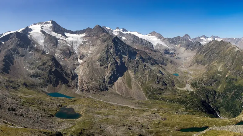
Stubai High Trail
Austria · Tyrol · 81 km · 9 stages

Eagle Walk (Adlerweg)
Austria · Tyrol · 359 km · 24 stages

Berliner Höhenweg
Austria · Zillertal Alps · 79 km · 8 stages

Tour du Mont Blanc
France · Italy · Switzerland · 166 km · 11 stages

Alta Via 1
Italy · Dolomites · 118 km · 11 stages

GR 20
France · Corsica · 184 km · 16 stages
John Muir Trail · Laugavegur · Cotswold Way · Kerry Way · Camino Finisterre · West Highland Way · Walker's Haute Route · Kungsleden · Tour of Monte Rosa · Coast to Coast Walk · Pembrokeshire Coast Path · Hadrian's Wall Path · South Downs Way · Dingle Way · Wicklow Way · Fishermen's Trail · Camino Portugués · Alta Via 2 · Malerweg · Peaks of the Balkans · Overland Track · Lycian Way · St Paul Trail · Camino Francés · Inca Trail · W Trek · Everest Base Camp Trek · Annapurna Circuit · Kumano Kodo Nakahechi · Camino del Norte · Via Francigena · GR10 · Pennine Way · Carian Trail · Evliya Çelebi Way · Kaçkar Mountains Traverse · Phrygian Way · Sultans Trail · Mount Ararat Climb · Hittite Trail · Troy Culture Route · Independence Way · Mysia Ways · Rheinsteig · Westweg · Goldsteig · GR54 Tour des Écrins · Via Alpina · Path of the Gods · Cinque Terre Trail · Alta Via 4 · GR221 Dry Stone Route · Milford Track · Routeburn Track · Kepler Track · Tongariro Northern Circuit · Larapinta Trail · Great Ocean Walk · West Coast Trail · Wonderland Trail · Teton Crest Trail · Annapurna Base Camp Trek · Markha Valley Trek · Salkantay Trek · Huayhuash Circuit · Kilimanjaro Machame Route · Toubkal Circuit · Jordan Trail: Dana to Petra · Torres del Paine O Circuit · Abel Tasman Coast Track · Three Capes Track · Mestia to Ushguli Trek · Nakasendo Way · Berg Lake Trail · Skyline Trail (Jasper) · Fitz Roy & Cerro Torre Loop · Santa Cruz Trek · Otter Trail · Fish River Canyon Hiking Trail · Camino Primitivo · Camino Inglés · Cape Wrath Trail · Great Glen Way · Offa's Dyke Path · Cleveland Way · Rota Vicentina Historical Way · Via Podiensis (GR 65) · Heaphy Track · Queen Charlotte Track · Cape to Cape Track · Rockwall Trail · Juan de Fuca Marine Trail · Quilotoa Loop · Nahuel Huapi Traverse · Ala Kul Trek · Tiger Leaping Gorge High Trail · Mount Kenya Sirimon–Chogoria Traverse · Ghorepani Poon Hill Trek · Kilimanjaro Lemosho Route · Lebanon Mountain Trail · Aladağlar Traverse · Kokoda Track · Chilkoot Trail · Lost City Trek · Choquequirao Trek · GR R2 Réunion · M'Goun Traverse · Royal National Park Coast Track · Grand Cliff Top Walk · Snowies Alpine Walk · Rwenzori Central Circuit · Whale Trail · Ausangate Circuit · Thorsborne Trail · Paparoa Track · Mount Assiniboine Traverse · Sunshine Coast Trail · Sinai Trail · Rakiura Track · Grand Canyon Rim to Rim · Via degli Dei · Stevenson Trail (GR 70) · Juliana Trail · Camí de Cavalls · Karhunkierros Trail · Lost Coast Trail · East Coast Trail · Kalalau Trail · Mount Rinjani Trek · MacLehose Trail · Lake Waikaremoana Great Walk · Hump Ridge Track · Jatbula Trail · Druk Path Trek · Mardi Himal Trek · Mount Kinabalu Climb · Kilimanjaro Marangu Route · Amatola Trail · Mount Olympus Traverse · Dales Way · Tour de la Vanoise · High Coast Trail · Rennsteig · Old Ghost Road · Gokyo Lakes Trek · Corfu Trail · Leleg Way · Anillo de Picos · Fundy Footpath
Hike it with the route in your pocket
Outest has the Lechweg route offline, with elevation, water and village points, and a trail guide you can ask about stages, weather and where to sleep.