
Mysia Ways hiking guide: route map, stages & where to stay
Mysia Ways (Mysia Yolları) near Bursa, Turkey: this guide covers the Trans Mysia main line, about 61 km in 6 short stages from the old village of Misi over forested hills to Gölyazı on Lake Uluabat, with guesthouses at the ends and camping or day walks between.
Best time to hike the Mysia Ways →

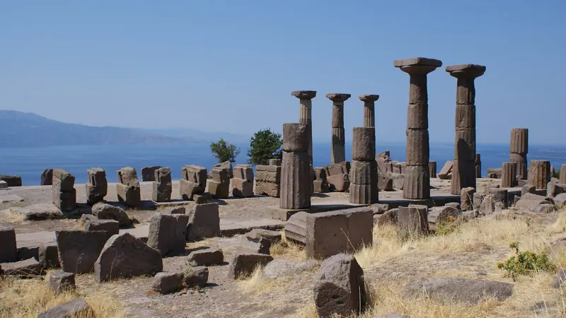
Photo: Ece Nur Saygın, CC BY-SA 4.0, cropped
The Mysia Ways (Mysia Yolları) are a network of waymarked walking and cycling routes in the hills and lakelands west of Bursa, in north-west Turkey. They are named after the Mysians, the ancient people of this corner of Anatolia. Nilüfer Municipality created them from a design by the Bursa guide Serdar Kuşku and still runs them. The network has about 800 km of routes: 270 km for walking, 475 km for cycling and one through-route, the Trans Mysia.
This guide covers only the Trans Mysia, the main line of the network. It runs for about 61 km from the historic village of Misi, on the edge of Bursa, over the wooded hills south of Nilüfer to Gölyazı, the ancient Apollonia on a peninsula in Lake Uluabat. The municipality splits it into six official stages, T1 to T6, and this guide keeps them: 6 stages of about 10.1 km. The other walking routes (P1 to P22, including the 77 km circuit of Lake Uluabat) are not covered here.
The route
The Trans Mysia follows the old paths that mountain villagers used to walk down to the plain, mostly on forest paths, dirt roads and meadows.
Stage 1 climbs steeply out of Misi and follows the west slope of the Nilüfer valley through pine forest to Doğancı Sırtı, a ridge between Doğancı and Atlas. There is no village at the end: the Dağyenice pond, with a lakeside resort and camping, is 1 km west. Stage 2 follows a ridge west through pine and oak to Gölcük Tepe, at 869 m the highest point, with Uludağ behind you, then drops to Kadriye, the highest village in Nilüfer.
Stage 3 runs west through oak and beech forest, past the marble quarries on the Orhaneli border, to Güngören. At about 5.5 km a waymarked 3 km side path leads down to Üçpınar and its guesthouse. Stage 4 is short: old forest paths past twin plane trees and a fountain, then under wind turbines with views of Lake Uluabat, to Maksempınar. Stage 5 passes a fire lookout tower with views over the lake and the Sea of Marmara and descends to Akçalar, at lake level. Stage 6 is flat: farm tracks, olive groves and meadows by Lake Uluabat, the old "King's Road" through the reed beds and the Apollonia necropolis, to the Weeping Plane Tree (Ağlayan Çınar) at the Gölyazı bridge.
The line in this guide is the official GPX track of each stage (2023-24).
Highlights
- Misi: an old silk village of stone and timber houses on the Nilüfer stream, with small museums of photography, literature and ethnography
- Gölcük Tepe ridge: the highest point, with views of Uludağ and the Bursa plain
- The fire tower above Akçalar: a view over Lake Uluabat and, on a clear day, the Sea of Marmara
- Lake Uluabat: a Ramsar wetland since 1998, with storks and many water birds along stage 6
- Gölyazı: the ancient Apollonia ad Rhyndacum, a fishing village on a near-island in the lake, with Byzantine walls, an old church and a plane tree about 750 years old
When to walk
Spring (April to June) and autumn (late September to November) are best: green woods, flowers and mild days. Summer is hot and dry, and in the fire season the Bursa Governorship closes forest land to the public; in 2026 the ban ran from 20 June to 15 October. Stages 1 to 5 are mostly in forest, so check the ban before a summer walk. The upper stages can be walked in winter; stage 2 is popular in snow. Stage 6 turns to deep mud from autumn to spring, when the lake is high.
How many days do you need?
The official six stages are short, from about 6.5 to 14.5 km, and each takes 2 to 4.5 hours. You can walk them in six easy days, or in four or five by joining stages: stage 4 and stage 5 together (Güngören to Akçalar) make an easy 16 km day. Because Misi, Akçalar and Gölyazı are on Bursa's city bus network and the hill villages are 15 to 30 km from Nilüfer by road, many people walk the stages as day walks from Bursa or Misi.
Getting there and where to stay
Bursa is two to three hours by bus from Istanbul, or take the İDO or BUDO ferry to Mudanya and a bus into the city. Misi is about 15 km from the centre of Bursa: city buses run from Acemler, or take a taxi. Akçalar is on the Bursa-İzmir road with frequent buses. Gölyazı has the Burulaş city bus 5-G from Küçük Sanayi (about an hour); check times on the Burulaş app. Kadriye, Güngören and Maksempınar have few buses, so plan on a taxi from Nilüfer.
Beds are few. Misi has a boutique hotel and a guesthouse, Dağyenice Göleti has bungalows and camping 1 km from the end of stage 1, the municipal Üçpınar Evi (6 beds and camping, booked online) is 3 km off stage 3, and Gölyazı has pensions. Kadriye, Güngören, Maksempınar and Akçalar have little or nothing: ask the muhtar about the guest room in Kadriye, camp where the official guide allows it, or return to a hotel in Nilüfer or Görükle.
Money, food and phone signal
Cards work in Bursa, Misi and Gölyazı, but carry Turkish lira in cash for village coffee houses (kahve), shops and taxis. Misi and Gölyazı have restaurants and Akçalar has supermarkets and pharmacies; the hill villages have a kahve and sometimes a small shop. Mobile signal is good in the villages and patchy in the forest valleys. A foreign phone works with a Turkish SIM card for 120 days before it must be registered.
Difficulty
The Trans Mysia is an easy to moderate walk with no technical sections, but stage 1 has very steep pitches, and stages 1 and 2 climb about 1,250 m between them on the official figures. The Trans Mysia is waymarked with red-and-white stripes and signposts at junctions, but forest and quarry roads create many side tracks, and parts of stages 3 and 4 are overgrown, so carry the official GPX files on your phone. Watch for quarry trucks on stages 3 to 5.
Large sheepdogs guard flocks around the villages: keep away from flocks, do not run, and call for the shepherd. Light no fires in the forest. In an emergency call 112.
What to pack
Pack shoes or boots with grip for steep, muddy ground, trekking poles, 2 litres of water (fill up at village fountains), sun protection, a light waterproof and a warm layer for the ridges. Carry a tent, mat and stove only if you plan to camp. Bring a first-aid and blister kit and the GPX tracks downloaded for offline use.
History
Mysia was the ancient region between the Troad and Bithynia, with the "Mysian Olympus" (Uludağ) at its eastern edge. Apollonia ad Rhyndacum, today's Gölyazı, was founded in the 7th century BC and walled in Byzantine times; it was a Greek village until the population exchange of the 1920s. Kite, at Ürünlü near the network, was the first Ottoman administrative centre in the region before the conquest of Bursa in 1326. Misi keeps the name of the Mysians.
Mysia Ways map
The whole Mysia Ways with its 6 stages, Misi to Gölyazı (Trans Mysia). Tap a stage on the map to open it. To follow the route with GPS and offline maps on the trail, open it in the free Outest app.
The 6 stages
The six official stages of the Trans Mysia, the main line of the Mysia Ways: from the old village of Misi up through pine forest to Doğancı Sırtı, along the ridge over Gölcük Tepe to Kadriye, through oak and beech woods past Üçpınar to Güngören, down to Maksempınar and Akçalar on Lake Uluabat, and along the lake shore to Gölyazı. Walking times allow for steep pitches, overgrown paths and winter mud by the lake. Each stage page has a map, elevation profile, places to sleep or camp, and the nearest help.
| # | Stage | Distance | Level |
|---|---|---|---|
| 1 | Misi → Doğancı Sırtı | 8.8 km | moderate |
| 2 | Doğancı Sırtı → Kadriye | 11.5 km | moderate |
| 3 | Kadriye → Güngören | 10.3 km | moderate |
| 4 | Güngören → Maksempınar | 6.6 km | easy |
| 5 | Maksempınar → Akçalar | 9.1 km | easy |
| 6 | Akçalar → Gölyazı | 14.4 km | moderate |
Emergency, hospitals and services
In an emergency call 112: one free number for ambulance, gendarmerie, police, fire and AFAD rescue, from any phone. 3 hospitals with an emergency service are within 5 to 25 km of the trail in Nilüfer: Bursa Uludağ University Hospital in Görükle, Bursa City Hospital and the private Acıbadem Bursa; every stage page lists the nearest one, plus pharmacies, shops and water on that stage.
Where to stay on the Mysia Ways
Guesthouses, hotels, the municipal walkers' house and the official camping places, grouped by stage from Misi to Gölyazı. Listings were checked online in October 2026. Places marked "listed, not confirmed" appear on a public listing (Yandex Maps, OpenStreetMap, booking sites or the official Mysia Yolları guide) but could not be confirmed on their own website. Misi and Gölyazı have small hotels and pensions, and Üçpınar Evi and the Dağyenice pond are near the trail. Kadriye, Güngören, Maksempınar and Akçalar have little or nothing, so camp where the official guide allows it or sleep in Nilüfer and use a taxi or bus.
Misi (trailhead)
3 places
- 2 with rooms
- 1 camping
- 1 with meals
Misi (Gümüştepe)
Misi → Doğancı Sırtı
2 places
- 2 with rooms
- 1 camping
- 1 with meals
Dağyenice · Doğancı
Doğancı Sırtı → Kadriye
1 place
- 1 with rooms
Kadriye
Kadriye → Güngören
2 places
- 1 with rooms
- 2 camping
Güngören · Üçpınar
Güngören → Maksempınar
2 places
- 1 with rooms
- 1 camping
Maksempınar
Maksempınar → Akçalar
3 places
- 2 with rooms
- 1 camping
- 1 with meals
Fadıllı · Görükle
Akçalar → Gölyazı
3 places
- 3 with rooms
- 1 with meals
Gölyazı
Plan your days
Pick any Mysia Ways stage in the free hike planner to see walking time, water to carry, calories, difficulty, the weather forecast and daylight.
More trail guides
Evliya Çelebi Way
Turkey · Marmara & Aegean · 611 km · 31 stages

Kaçkar Mountains Traverse
Turkey · Kaçkar Mountains · 34 km · 3 stages
Sultans Trail
Turkey · Eastern Thrace · 336 km · 15 stages
Mount Ararat Climb
Turkey · Ağrı · 12 km · 3 stages
Hittite Trail
Turkey · Çorum · 96 km · 7 stages
Troy Culture Route
Turkey · Çanakkale · 119 km · 7 stages
Independence Way · Aladağlar Traverse · Tour du Mont Blanc · Alta Via 1 · GR 20 · John Muir Trail · Laugavegur · Cotswold Way · Kerry Way · Camino Finisterre · West Highland Way · Walker's Haute Route · Kungsleden · Tour of Monte Rosa · Coast to Coast Walk · Pembrokeshire Coast Path · Hadrian's Wall Path · South Downs Way · Dingle Way · Wicklow Way · Fishermen's Trail · Camino Portugués · Alta Via 2 · Malerweg · Peaks of the Balkans · Overland Track · Lycian Way · St Paul Trail · Camino Francés · Inca Trail · W Trek · Everest Base Camp Trek · Annapurna Circuit · Kumano Kodo Nakahechi · Camino del Norte · Via Francigena · GR10 · Pennine Way · Carian Trail · Phrygian Way · Rheinsteig · Westweg · Goldsteig · GR54 Tour des Écrins · Via Alpina · Path of the Gods · Cinque Terre Trail · Alta Via 4 · GR221 Dry Stone Route · Stubai High Trail · Milford Track · Routeburn Track · Kepler Track · Tongariro Northern Circuit · Larapinta Trail · Great Ocean Walk · West Coast Trail · Wonderland Trail · Teton Crest Trail · Annapurna Base Camp Trek · Markha Valley Trek · Salkantay Trek · Huayhuash Circuit · Kilimanjaro Machame Route · Toubkal Circuit · Jordan Trail: Dana to Petra · Torres del Paine O Circuit · Abel Tasman Coast Track · Three Capes Track · Mestia to Ushguli Trek · Nakasendo Way · Berg Lake Trail · Skyline Trail (Jasper) · Fitz Roy & Cerro Torre Loop · Santa Cruz Trek · Otter Trail · Fish River Canyon Hiking Trail · Camino Primitivo · Camino Inglés · Eagle Walk (Adlerweg) · Berliner Höhenweg · Cape Wrath Trail · Great Glen Way · Offa's Dyke Path · Cleveland Way · Rota Vicentina Historical Way · Via Podiensis (GR 65) · Heaphy Track · Queen Charlotte Track · Cape to Cape Track · Rockwall Trail · Juan de Fuca Marine Trail · Quilotoa Loop · Nahuel Huapi Traverse · Ala Kul Trek · Tiger Leaping Gorge High Trail · Mount Kenya Sirimon–Chogoria Traverse · Ghorepani Poon Hill Trek · Kilimanjaro Lemosho Route · Lebanon Mountain Trail · Kokoda Track · Chilkoot Trail · Lost City Trek · Choquequirao Trek · GR R2 Réunion · M'Goun Traverse
Hike it with the route in your pocket
Outest has the Mysia Ways route offline, with elevation, water and village points, and a trail guide you can ask about stages, weather and where to sleep.