
Inca Trail hiking guide: route map, stages & where to stay
The Classic Inca Trail in Peru: about 40 km in 4 days from Km 82 (Piscacucho) in the Urubamba valley to Machu Picchu, over Dead Woman's Pass (4,215 m) and past a chain of Inca ruins. Permit-only with a licensed operator; you camp at official campsites.
Inca Trail conditions today →Best time to hike the Inca Trail →

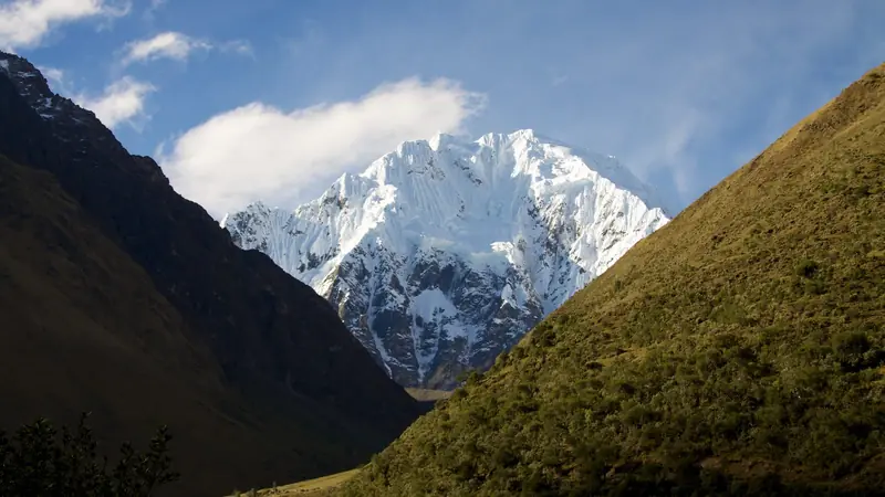
Photo: bobistraveling, CC BY 2.0, cropped
The Classic Inca Trail is the four-day walk on an original Inca road from Km 82 on the Urubamba River to Machu Picchu. It crosses the Historic Sanctuary of Machu Picchu, a UNESCO World Heritage Site, and passes a chain of Inca ruins, cloud forest and three high passes, the highest being Warmiwañusca (Dead Woman's Pass) at 4,215 m. You cannot walk it alone: every hiker needs a named permit and must go with a licensed operator and an official guide, and you sleep in tents at campsites assigned by the Ministry of Culture. Operators quote 39 to 43 km; the line on our map is 34 km, because mapped paths smooth out the many switchbacks and steps.
The route
The trail starts at the checkpoint at Piscacucho (Km 82 of the railway), crosses the Urubamba and follows the valley past the Inca site of Patallaqta (Llactapata) to the hamlet of Wayllabamba. Day 2 is the hard one: a long climb through woodland and the open valley of Llulluchapampa to Warmiwañusca, then a steep descent on stone steps to Pacaymayo. On day 3 the trail climbs past Runkurakay to a second pass, visits Sayacmarca, and follows a paved Inca road with a short tunnel along the ridge to Phuyupatamarca, before dropping about 1,000 m through the terraces of Intipata to Wiñay Wayna. On day 4 you start before dawn and walk an hour or so to Intipunku, the Sun Gate, for the first view of Machu Picchu, then descend to the citadel.
This guide follows the route mapped on OpenStreetMap and splits it into 4 stages, about 8.4 km each, ending at the official campsites of the standard plan: Wayllabamba, Pacaymayo and Wiñay Wayna. Many groups are given a different plan, such as Ayapata, Chaquicocha and Wiñay Wayna, or Phuyupatamarca as the last camp; the route is the same, only the daily split changes.
Highlights
- Patallaqta: a large Inca farming and storage town seen from above on day 1
- Warmiwañusca (4,215 m): the highest point, with views back down the Llulluchapampa valley
- Runkurakay and Sayacmarca: a round lookout post and a fortress-like town on a rock spur
- Phuyupatamarca: "the town above the clouds", with ceremonial baths and a famous sunrise view
- Intipata and Wiñay Wayna: huge terraces above the Urubamba gorge
- Intipunku: the Sun Gate and your first view over Machu Picchu
When to go
The trail is open from March to January and closed every February for maintenance. The dry season, May to September, has the clearest views and cold nights, often below freezing at the high camps, and permits for these months sell out first. October, November, March and April are greener and quieter, with afternoon showers. December and January are the wettest months: steps get slippery and the trail can close at short notice after heavy rain or landslides.
How many days do you need?
The classic trek is 4 days and 3 nights. Allow at least 2 days in Cusco (3,400 m) or the Sacred Valley before you start, to get used to the altitude. Most people then take the train from Aguas Calientes back to Ollantaytambo on day 4; a night in Aguas Calientes lets you revisit Machu Picchu or climb Huayna Picchu the next day with a separate ticket. Short of time? The 2-day trail from Km 104 joins at Wiñay Wayna.
Permits and booking
Only licensed agencies can buy Inca Trail tickets, on the Ministry of Culture's Tu Boleto platform. Tickets are named, dated, tied to your passport, and cannot be changed or refunded. The daily limit is 500 people, including guides, cooks and porters, so only about 200 hikers start each day. Tickets for the next year go on sale in November; book 4 to 6 months ahead, more for May to August. The official Route 1 fee is S/292 for adults (S/147 students, S/135 minors), and in 2026 operators add the Machu Picchu circuit 3-B ticket (S/152), so expect about S/444 in permits within your trek price. Groups are at most 16 hikers with one or two guides. Carry your original passport every day; the name must match your ticket exactly.
Getting there and away
Operators collect you in Cusco or Ollantaytambo and drive to Km 82: about 2.5 to 3 hours from Cusco, or 30 minutes from Ollantaytambo. At the end, buses run from the Machu Picchu entrance down to Aguas Calientes (25 to 30 minutes, about US$12 one way in 2026), and PeruRail and Inca Rail trains take about 1.5 to 2 hours to Ollantaytambo, from where it is about 2 hours by road to Cusco. Most operators include the bus and train.
Money and phone signal
Bring Peruvian soles in cash from Cusco or Ollantaytambo: there are no cash machines on the trail. Villagers sell water and snacks on day 1 up to Wayllabamba, and toilets there cost 1 sol. Budget for tips to the porters, cooks and guide; your operator will suggest an amount. Mobile signal is patchy and found mostly on high points, so do not rely on it.
Difficulty
The Classic Inca Trail is a hard trek because of altitude and steps, not distance. Day 2 climbs about 1,200 m to 4,215 m, and day 3 ends with a knee-jarring descent of about 1,000 m on uneven Inca stairs. Walking times are 5 to 8 hours a day. Porters carry the tents, food and cooking gear; you carry a day pack with water, layers and rain gear, or hire an extra porter for your sleeping bag and clothes. Anyone fit enough for long hill days can do it after acclimatising.
What to pack
A warm sleeping bag (comfort about -5 °C in the dry season), a down jacket, hat and gloves for the camps, a light waterproof, sun hat and high-factor sunscreen, insect repellent for the lower forest, a head torch, water purification or a bottle to refill with boiled water, and walking poles with rubber tips (metal tips are not allowed). Leave drones, glass bottles and alcohol behind: they are banned.
Safety
Altitude sickness is the main risk: go up slowly, drink well and tell your guide at once about a headache, nausea or breathlessness; the cure is to go down. Guides carry first aid and usually oxygen. There is a small health post at Wayllabamba; otherwise a sick hiker is carried by porters to Km 82 or down to Aguas Calientes, and serious cases go on to Cusco. In Peru call 106 for an ambulance or 105 for the police. Get travel insurance that covers trekking up to 4,300 m and helicopter evacuation.
History
The Inca built this road in the 15th century as a royal pilgrim route to Machu Picchu, linking a string of religious and farming sites. It lay overgrown for centuries until Hiram Bingham's 1915 expedition traced and cleared parts of it. The sanctuary was protected in 1981 and listed by UNESCO in 1983, and since 2001 the number of walkers has been capped and access limited to licensed operators.
Inca Trail map
The whole Inca Trail with its 4 stages, Km 82 to Machu Picchu. Tap a stage on the map to open it. To follow the route with GPS and offline maps on the trail, open it in the free Outest app.
The 4 stages
The classic four days from Km 82 on the Urubamba River to Machu Picchu, camping at Wayllabamba, Pacaymayo and Wiñay Wayna, the standard plan in the official regulation. Your campsites are assigned with your permit and may differ (for example Ayapata and Chaquicocha). Walking times allow for altitude, stone steps and stops at the Inca sites. Each stage page has a map, elevation profile, the campsites and the nearest help.
| # | Stage | Distance | Level |
|---|---|---|---|
| 1 | Km 82 → Wayllabamba | 10.5 km | moderate |
| 2 | Wayllabamba → Pacaymayo | 7.7 km | hard |
| 3 | Pacaymayo → Wiñay Wayna | 10.6 km | moderate |
| 4 | Wiñay Wayna → Machu Picchu | 4.9 km | easy |
Emergency, hospitals and services
In an emergency tell your guide at once: every group has an official guide with first aid and usually oxygen, and rangers at the control posts help with evacuations. Phone numbers in Peru are 106 for an ambulance (SAMU), 105 for the police and 116 for fire and rescue; 911 is not yet working in Cusco. Mobile signal is patchy. There is a health post at Wayllabamba and a 24-hour health centre in Aguas Calientes, and the nearest hospitals with a full emergency department are in Cusco. This guide lists 2 hospitals and clinics, and every stage page shows the nearest help.
Where to stay on the Inca Trail
The official Inca Trail campsites and the hotels at each end, grouped by stage from Km 82 to Machu Picchu. Listings were checked online in October 2026. Places marked "not confirmed by the operator" are listed on OpenStreetMap, in the regulation or in news reports, but could not be checked on a current official page. You can only walk with a licensed operator, and your campsites are assigned with your permit; book a hotel in Ollantaytambo or Cusco before the trek and in Aguas Calientes after it.
Km 82 (trailhead)
3 places
- 3 with rooms
- 3 with meals
Ollantaytambo
Km 82 → Wayllabamba
1 place
- 1 camping
Wayllabamba
Wayllabamba → Pacaymayo
3 places
- 3 camping
Ayapata · Llulluchapampa · Pacaymayo
Pacaymayo → Wiñay Wayna
3 places
- 3 camping
Chaquicocha · Phuyupatamarca · Wiñay Wayna
Wiñay Wayna → Machu Picchu
5 places
- 4 with rooms
- 4 with meals
Aguas Calientes (Machupicchu Pueblo) · Machu Picchu
Plan your days
Pick any Inca Trail stage in the free hike planner to see walking time, water to carry, calories, difficulty, the weather forecast and daylight.
More trail guides
Salkantay Trek
Peru · Cusco · 65 km · 4 stages

Huayhuash Circuit
Peru · Áncash · 96 km · 9 stages

Santa Cruz Trek
Peru · Cordillera Blanca · 45 km · 4 stages

Choquequirao Trek
Peru · Apurímac and Cusco · 30 km · 3 stages

Tour du Mont Blanc
France · Italy · Switzerland · 166 km · 11 stages

Alta Via 1
Italy · Dolomites · 118 km · 11 stages
GR 20 · John Muir Trail · Laugavegur · Cotswold Way · Kerry Way · Camino Finisterre · West Highland Way · Walker's Haute Route · Kungsleden · Tour of Monte Rosa · Coast to Coast Walk · Pembrokeshire Coast Path · Hadrian's Wall Path · South Downs Way · Dingle Way · Wicklow Way · Fishermen's Trail · Camino Portugués · Alta Via 2 · Malerweg · Peaks of the Balkans · Overland Track · Lycian Way · St Paul Trail · Camino Francés · W Trek · Everest Base Camp Trek · Annapurna Circuit · Kumano Kodo Nakahechi · Camino del Norte · Via Francigena · GR10 · Pennine Way · Carian Trail · Evliya Çelebi Way · Kaçkar Mountains Traverse · Phrygian Way · Sultans Trail · Mount Ararat Climb · Hittite Trail · Troy Culture Route · Independence Way · Mysia Ways · Rheinsteig · Westweg · Goldsteig · GR54 Tour des Écrins · Via Alpina · Path of the Gods · Cinque Terre Trail · Alta Via 4 · GR221 Dry Stone Route · Stubai High Trail · Milford Track · Routeburn Track · Kepler Track · Tongariro Northern Circuit · Larapinta Trail · Great Ocean Walk · West Coast Trail · Wonderland Trail · Teton Crest Trail · Annapurna Base Camp Trek · Markha Valley Trek · Kilimanjaro Machame Route · Toubkal Circuit · Jordan Trail: Dana to Petra · Torres del Paine O Circuit · Abel Tasman Coast Track · Three Capes Track · Mestia to Ushguli Trek · Nakasendo Way · Berg Lake Trail · Skyline Trail (Jasper) · Fitz Roy & Cerro Torre Loop · Otter Trail · Fish River Canyon Hiking Trail · Camino Primitivo · Camino Inglés · Eagle Walk (Adlerweg) · Berliner Höhenweg · Cape Wrath Trail · Great Glen Way · Offa's Dyke Path · Cleveland Way · Rota Vicentina Historical Way · Via Podiensis (GR 65) · Heaphy Track · Queen Charlotte Track · Cape to Cape Track · Rockwall Trail · Juan de Fuca Marine Trail · Quilotoa Loop · Nahuel Huapi Traverse · Ala Kul Trek · Tiger Leaping Gorge High Trail · Mount Kenya Sirimon–Chogoria Traverse · Ghorepani Poon Hill Trek · Kilimanjaro Lemosho Route · Lebanon Mountain Trail · Aladağlar Traverse · Kokoda Track · Chilkoot Trail · Lost City Trek · GR R2 Réunion · M'Goun Traverse
Hike it with the route in your pocket
Outest has the Inca Trail route offline, with elevation, water and village points, and a trail guide you can ask about stages, weather and where to sleep.