
Choquequirao Trek hiking guide: route map, stages & where to stay
The Choquequirao trek in Peru: about 30 km each way from Cachora down into the Apurímac canyon and up to the Inca city of Choquequirao, then back the same way. Most hikers take 4-5 days, sleeping at family campsites, simple lodges and the park campsite by the ruins.
Best time to hike the Choquequirao Trek →

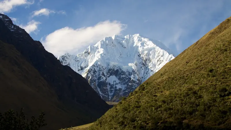
Photo: Gedankenstuecke, CC BY-SA 4.0, cropped
The Choquequirao trek is the classic walk to Choquequirao, an Inca city on a ridge 1,500 m above the Apurímac river in southern Peru. It is often called the sister of Machu Picchu, but there is no road, train or cable car: the only way in is on foot. From the village of Cachora (2,900 m) the trail drops into the Apurímac canyon to the river at about 1,460 m and climbs the far side to the ruins at about 3,050 m. It is about 30 km each way, and almost everyone walks in and out the same way in 4 or 5 days. You sleep at family campsites and simple lodges, or at the park campsite below the ruins.
The route
From the plaza in Cachora a dirt road leads 11 km to the Capuliyoc pass (2,900 m), where most groups start walking after a short drive. Here you get the first view of the canyon and the snow peaks of the Vilcabamba range. A long, dusty mule path then zigzags down past the Cocamasana camp to Chiquisca (1,930 m) and on to the Rosalina bridge over the Apurímac. On the other side the path climbs about 1,400 m in 6 km of switchbacks, past Santa Rosa, to the hamlet of Marampata (2,900 m). The last 3.5 km is a gentle contour path to the park campsite, with Choquequirao in view across a side valley.
This guide follows the route mapped on OpenStreetMap and splits the walk into 3 stages, about 10.1 km each: Cachora to Chiquisca, Chiquisca to Marampata, and Marampata to the Choquequirao campsite. You walk back by the same path. A longer option continues from Choquequirao over high passes via Maizal and Yanama to Machu Picchu in about 8 days; it is not covered here.
Highlights
- The Apurímac canyon: one of the deepest in the Americas, where condors are often seen from the Capuliyoc viewpoint
- The main plaza and the Usnu: the ceremonial platform and the houses of the upper town, with views up and down the canyon
- The llama terraces: terraces below the main sector decorated with a flock of llamas in white stone
- Pikiwasi and the Paqchayoc water channels: outlying sectors with fine stonework, almost empty of visitors
- Marampata: the balcony of the trek, with cabins, cold drinks and the first full view of Choquequirao
When to go
The dry season, May to September, is the best time: clear skies, cold nights at the top and very hot days at the river. April and October are quieter and still mostly dry. The rainy season runs from about November to March. Landslides are common then, the path becomes slippery and the authorities can close the site: in 2026 it was closed from early February until about 22 April. Start the big climbs early in the morning, because the canyon floor can pass 30°C.
How many days do you need?
4 days is standard: Cachora or Capuliyoc to Chiquisca, then Chiquisca to Marampata or the Choquequirao campsite, a day at the ruins and the descent to Chiquisca or Santa Rosa, and the climb back to Capuliyoc. 5 days gives you a full day at the ruins and a shorter last day, which most people find much better. The return is harder than the way in: from the river to Capuliyoc you climb about 1,450 m.
Getting there and logistics
Cachora is about 4 hours by road from Cusco. Take a bus or colectivo from Cusco towards Abancay and get off at the Cachora turn-off (Ramal de Cachora), then take a taxi down to Cachora or straight to Capuliyoc. From Abancay, Cachora is about 1.5 hours by colectivo. Taxis also run from Cachora to Capuliyoc, which saves about 3 hours of road walking.
No permit, quota or guide is needed, but you pay an entrance fee at the Capuliyoc control, in cash, of about S/60 for foreign adults and about S/30 for students; one agency gives US$15 instead. The ticket includes the park campsite. Most hikers book a 4- or 5-day trek with an agency in Cusco, which includes transport, a cook, tents and mules. Independent hikers can hire a mule and muleteer (arriero) in Cachora, for about S/40 a day.
Campsites on the way charge a few soles for a tent, and rooms in Chiquisca, Santa Rosa and Marampata are basic. Most places sell drinks and simple meals, but the park campsite has only water, toilets and cold showers, with no food. Bring all the cash you need in soles from Cusco or Abancay: do not count on an ATM in Cachora, which has only a Banco de la Nación agent. Expect little or no phone signal below Capuliyoc.
Difficulty
This is a hard trek, not because of altitude but because of the climbs and the heat. Each way there is about 1,500 m of descent and 1,450 m of ascent in one go, on loose, steep mule paths in full sun. The altitude is moderate (1,460-3,050 m), so if you have spent a few days in Cusco altitude sickness is rarely a problem. Allow 6-7 hours for each of the big days, and carry plenty of water: there are taps at the campsites but long dry stretches in between. Trekking poles help your knees on the descents.
What to pack
Sun hat, sunglasses and strong sun cream, a long-sleeved shirt and insect repellent for the sandflies at the river. Take a warm jacket for the nights at Capuliyoc, Marampata and the ruins, a rain jacket from October to April, water purification, a headlamp, blister care and a basic first-aid kit. If you camp independently you need a tent, stove and food for the night at the ruins.
Safety
In an emergency call 105 (police) or 106 (ambulance). There is no mountain rescue team for the canyon, the nearest road is at Capuliyoc, and help comes on foot or by mule, so it can take many hours. The nearest hospitals are Diospi Suyana in Curahuasi, about 1 hour by road from Cachora, and the regional hospital in Abancay; serious cases go on to Cusco. Do not walk alone, tell your campsite where you are going, and take travel insurance that covers hiking and evacuation.
History
Choquequirao, in Quechua roughly "cradle of gold", was built by the Incas in the 15th century, probably as a royal estate and ceremonial centre. After the Spanish conquest it is thought to have been linked to the last Inca state in Vilcabamba. Explorers reached it in the 18th and 19th centuries and Hiram Bingham visited in 1909, two years before Machu Picchu. Serious restoration began in the 1990s, the llama terraces were uncovered in the early 2000s, and much of the site is still under forest.
Choquequirao Trek map
The whole Choquequirao Trek with its 3 stages, Cachora to the Inca city of Choquequirao. Tap a stage on the map to open it. To follow the route with GPS and offline maps on the trail, open it in the free Outest app.
The 3 stages
The way in on the classic 4-5 day out-and-back trek: from Cachora over the Capuliyoc pass and down to Chiquisca, across the Apurímac and up the long climb to Marampata, then the short walk to the campsite below the Choquequirao ruins. You return by the same path, usually in 1 or 2 days. Walking times allow for the heat, the steep mule paths and a day pack or full pack. Each stage page has a map, elevation profile, the campsites and lodges on the way, and the nearest help.
| # | Stage | Distance | Level |
|---|---|---|---|
| 1 | Cachora → Chiquisca | 18.6 km | hard |
| 2 | Chiquisca → Marampata | 8.1 km | hard |
| 3 | Marampata → Choquequirao | 3.5 km | easy |
Emergency, hospitals and services
In an emergency call 105 (police) or 106 (SAMU ambulance). There is no mountain rescue team for the Apurímac canyon and no road below Capuliyoc, so help comes on foot or by mule and can take many hours; there is little or no phone signal in the canyon. 3 hospitals with a 24-hour emergency department are within reach by road, the nearest in Curahuasi, about 1 hour from Cachora, then Abancay and Cusco. Every stage page lists the nearest help.
Where to stay on the Choquequirao Trek
Family campsites, simple lodges, guesthouses in Cachora and the park campsite at the ruins, grouped by stage from Cachora to Choquequirao. Listings were checked online in October 2026. Places marked "listed in a map or guide listing" appear on OpenStreetMap, a booking site or a trekking guide, but could not be confirmed on their own website or an official tourism list. Most places sell meals and drinks and take cash only; agency groups bring their own tents and cook. Playa Rosalina by the river is closed.
Cachora (trailhead)
5 places
- 4 with rooms
- 1 camping
- 1 with meals
Cachora · Capuliyoc
Cachora → Chiquisca
3 places
- 1 with rooms
- 3 camping
- 3 with meals
Chiquisca · Cocamasana
Chiquisca → Marampata
6 places
- 3 with rooms
- 4 camping
- 5 with meals
Marampata · Santa Rosa Baja
Marampata → Choquequirao
1 place
- 1 camping
Choquequirao
Plan your days
Pick any Choquequirao Trek stage in the free hike planner to see walking time, water to carry, calories, difficulty, the weather forecast and daylight.
More trail guides

Inca Trail
Peru · Cusco · 34 km · 4 stages
Salkantay Trek
Peru · Cusco · 65 km · 4 stages

Huayhuash Circuit
Peru · Áncash · 96 km · 9 stages

Santa Cruz Trek
Peru · Cordillera Blanca · 45 km · 4 stages

Tour du Mont Blanc
France · Italy · Switzerland · 166 km · 11 stages

Alta Via 1
Italy · Dolomites · 118 km · 11 stages
GR 20 · John Muir Trail · Laugavegur · Cotswold Way · Kerry Way · Camino Finisterre · West Highland Way · Walker's Haute Route · Kungsleden · Tour of Monte Rosa · Coast to Coast Walk · Pembrokeshire Coast Path · Hadrian's Wall Path · South Downs Way · Dingle Way · Wicklow Way · Fishermen's Trail · Camino Portugués · Alta Via 2 · Malerweg · Peaks of the Balkans · Overland Track · Lycian Way · St Paul Trail · Camino Francés · W Trek · Everest Base Camp Trek · Annapurna Circuit · Kumano Kodo Nakahechi · Camino del Norte · Via Francigena · GR10 · Pennine Way · Carian Trail · Evliya Çelebi Way · Kaçkar Mountains Traverse · Phrygian Way · Sultans Trail · Mount Ararat Climb · Hittite Trail · Troy Culture Route · Independence Way · Mysia Ways · Rheinsteig · Westweg · Goldsteig · GR54 Tour des Écrins · Via Alpina · Path of the Gods · Cinque Terre Trail · Alta Via 4 · GR221 Dry Stone Route · Stubai High Trail · Milford Track · Routeburn Track · Kepler Track · Tongariro Northern Circuit · Larapinta Trail · Great Ocean Walk · West Coast Trail · Wonderland Trail · Teton Crest Trail · Annapurna Base Camp Trek · Markha Valley Trek · Kilimanjaro Machame Route · Toubkal Circuit · Jordan Trail: Dana to Petra · Torres del Paine O Circuit · Abel Tasman Coast Track · Three Capes Track · Mestia to Ushguli Trek · Nakasendo Way · Berg Lake Trail · Skyline Trail (Jasper) · Fitz Roy & Cerro Torre Loop · Otter Trail · Fish River Canyon Hiking Trail · Camino Primitivo · Camino Inglés · Eagle Walk (Adlerweg) · Berliner Höhenweg · Cape Wrath Trail · Great Glen Way · Offa's Dyke Path · Cleveland Way · Rota Vicentina Historical Way · Via Podiensis (GR 65) · Heaphy Track · Queen Charlotte Track · Cape to Cape Track · Rockwall Trail · Juan de Fuca Marine Trail · Quilotoa Loop · Nahuel Huapi Traverse · Ala Kul Trek · Tiger Leaping Gorge High Trail · Mount Kenya Sirimon–Chogoria Traverse · Ghorepani Poon Hill Trek · Kilimanjaro Lemosho Route · Lebanon Mountain Trail · Aladağlar Traverse · Kokoda Track · Chilkoot Trail · Lost City Trek · GR R2 Réunion · M'Goun Traverse
Hike it with the route in your pocket
Outest has the Choquequirao Trek route offline, with elevation, water and village points, and a trail guide you can ask about stages, weather and where to sleep.