
Sultans Trail hiking guide: route map, stages & where to stay
The Turkish section of the Vienna–Istanbul Sultans Trail: 336 km across Thrace from Edirne to the Süleymaniye Mosque in Istanbul, via Kırklareli, Vize and the Istranca foothills. Most walkers take 15 days, sleeping in town hotels, simple village lodgings and a tent.
Best time to hike the Sultans Trail →

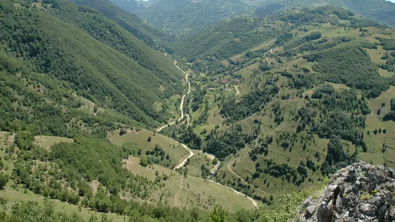
Photo: Hamdigumus, CC0, cropped
The Sultans Trail is a long-distance walking route of about 2,500 km from Vienna to Istanbul, created by the Dutch foundation Sultans Trail – A European Cultural Route. It follows the road that Sultan Suleiman the Magnificent took with his army to Vienna in 1529, through Austria, Slovakia, Hungary, Croatia, Serbia, Bulgaria, Greece and Turkey. This guide covers only the last part, the Turkish section (Section 6 of the trail): about 336 km across Eastern Thrace from Edirne, near the Greek and Bulgarian borders, to the Süleymaniye Mosque in Istanbul, where Suleiman is buried. Walkers who complete at least this section can apply for the trail's certificate, the Ferman.
The route
The trail leaves Edirne past its great Ottoman mosques and heads north-east through the wheat and sunflower fields of Thrace to Süloğlu and Kırklareli, a provincial capital with an Ottoman mosque and bath complex (Hızırbey). It then follows the southern foot of the Istranca (Strandja) mountains through Üsküpdere, Pınarhisar and Vize, a small town with a Byzantine church that became a mosque, a Roman theatre and old walls. From Saray the route enters the oak forests and rolling hills of the Istranca foothills, through Binkılıç, Gümüşpınar and Dağyenice, then passes close to Lake Terkos (Durusu) and west of Istanbul Airport. The last days cross the forests and reservoirs north-west of the city, past the Alibeyköy dam, to the Eyüp Sultan Mosque on the Golden Horn, and along the water to the Süleymaniye Mosque. An optional 4 km epilogue continues to Topkapı Palace.
This guide follows the route mapped on OpenStreetMap from the official stage list and splits it into the 15 official stages, about 22.4 km each. Stages run from 7 to 32 km. The land is low and rolling: the highest point is under 300 m, and the whole section climbs only about 3,600 m in total.
Highlights
- Edirne: the Selimiye Mosque (a UNESCO World Heritage Site), the Old Mosque and the Ottoman bridges over the Tunca and Meriç rivers
- Kırklareli: the Hızırbey complex, with its mosque, bath and covered bazaar
- Vize: the Byzantine church of Hagia Sophia, now a mosque, and the Roman theatre
- The Istranca foothills: quiet oak forests and villages between Saray and Dağyenice
- Lake Terkos (Durusu): one of Istanbul's main drinking-water lakes, near Boyalık
- Eyüp Sultan: one of the holiest mosques in Turkey, on the Golden Horn
- Süleymaniye: Sinan's masterpiece and the tombs of Suleiman and Hürrem Sultan, the end of the trail
When to walk
The best months are April to mid-June and September to early November. Spring brings green fields and flowers but also rain, which turns field tracks to mud. July and August are hot, often above 30 °C, with little shade on the farm roads. Winters are cold and wet, with snow possible in the Istranca hills. In summer the provincial governors may close forests to visitors because of fire risk; check before you go. During Ramadan (in 2027 roughly February to early March) village cafés and restaurants may be closed in the daytime.
How many days do you need?
Most walkers take 15 days, one per official stage. The last stage, from Eyüpsultan to Süleymaniye, is only 7 km, so you can add it to stage 14 or walk it as a slow half day with time for the mosques. Fit walkers sometimes join the two short stages after Kırklareli (Üsküpdere and Pınarhisar). Add a day each in Edirne and Istanbul.
Accommodation and logistics
Edirne, Kırklareli, Pınarhisar, Vize, Saray and Istanbul have hotels. Several stage ends do not: Ortakçı, Üsküpdere, Gümüşpınar, Dağyenice, Boyalık, Sazlıbosna and Pirinççi are villages with a mosque, a tea house and a small shop, but no hotel. There you need a tent, village hospitality (ask the village headman, the muhtar, or at the mosque) or a taxi to a hotel nearby. The trail's foundation says that in Turkey "some improvisation may be required", and the Turkish hospitality is part of the experience. Book town hotels a day or two ahead, and call ahead for the few village places listed on each stage page.
Edirne is about 2.5 to 3 hours by intercity bus from Istanbul. Walkers arriving on the trail from Greece reach Edirne over the Kastanies–Pazarkule border crossing and the village of Karaağaç; check before you plan it that you can cross there on foot. District towns have bus links to Istanbul, and villages have a few minibuses (dolmuş) a day, mostly on weekdays. Istanbul Airport is close to stages 11 to 13. At the end, Süleymaniye is a short walk from the Vezneciler metro and the Eminönü trams and ferries.
Money and phone signal
The currency is the Turkish lira. There are cash machines in the towns, but villages and small shops take cash only, so carry enough for two or three days. Mobile coverage is good on almost the whole route. A Turkish SIM card is sold with your passport; a phone bought abroad works with a Turkish SIM for a limited period (120 days) before it must be registered.
Waymarking and navigation
The trail is not fully waymarked. You will see the occasional Sultans Trail sticker or red-white mark, but you need the GPS track on your phone. The official Digital Information Package (GPX tracks and addresses) is sold on the Sultans Trail website, and the route is also on OpenStreetMap.
What to pack
Light hiking shoes are enough for the lanes and tracks. Bring sun protection and a hat, waterproofs for spring and autumn, a power bank, a first-aid and blister kit, and a stick or poles against dogs. A light tent and sleeping mat make the village stages much easier. Water fountains (çeşme) are common in villages, but carry 1.5 to 2 litres on the long forest stages. Dress modestly to visit mosques.
Difficulty and safety
The Turkish section is an easy to moderate walk with no technical ground, but the days are long and much of it is on hard surfaces, with stretches on busier roads near Istanbul. The main risks are traffic, heat, shepherd and stray dogs, and getting lost where tracks are overgrown. Keep away from military zones (signed "Askeri Yasak Bölge"), and do not fly a drone. In an emergency call 112. The nearest hospital for each stage is listed on the stage pages.
History
Suleiman the Magnificent left Istanbul on 10 May 1529 and reached Vienna on 23 September, but failed to take the city; a second campaign in 1532 also stopped short. He died in 1566 during his last campaign in Hungary and was buried at the Süleymaniye Mosque, which his architect Mimar Sinan had built for him. Edirne, the Ottoman capital before Istanbul, was the first great stop on the army's road west. The Sultans Trail was first walked as a test in 2009 by Sedat Çakır and is maintained by volunteers. Today it presents itself as a route of peace that links the cultures of south-eastern Europe.
Sultans Trail map
The whole Sultans Trail with its 15 stages, Edirne to the Süleymaniye Mosque, Istanbul. Tap a stage on the map to open it. To follow the route with GPS and offline maps on the trail, open it in the free Outest app.
The 15 stages
The 15 official stages of the Turkish section of the Vienna–Istanbul Sultans Trail, from Edirne via Süloğlu, Kırklareli, Pınarhisar, Vize, Saray and the Istranca foothills (Binkılıç, Gümüşpınar, Dağyenice) to Boyalık, Sazlıbosna, Pirinççi, Eyüpsultan and the Süleymaniye Mosque. Walking times assume a steady pace on lanes and tracks with short climbs. Several stage ends are villages with no hotel, so check the places to sleep before you set off. Each stage page has a map, elevation profile, places to sleep, and the nearest help.
| # | Stage | Distance | Level |
|---|---|---|---|
| 1 | Edirne → Ortakçı | 23.7 km | hard |
| 2 | Ortakçı → Süloğlu | 16.9 km | moderate |
| 3 | Süloğlu → Kırklareli | 32.4 km | hard |
| 4 | Kırklareli → Üsküpdere | 19.4 km | moderate |
| 5 | Üsküpdere → Pınarhisar | 18.3 km | moderate |
| 6 | Pınarhisar → Vize | 27.9 km | hard |
| 7 | Vize → Saray | 23.2 km | moderate |
| 8 | Saray → Binkılıç | 29.1 km | hard |
| 9 | Binkılıç → Gümüşpınar | 20.8 km | moderate |
| 10 | Gümüşpınar → Dağyenice | 22.3 km | moderate |
| 11 | Dağyenice → Boyalık | 25.1 km | hard |
| 12 | Boyalık → Sazlıbosna | 16.6 km | moderate |
| 13 | Sazlıbosna → Pirinççi | 27.2 km | hard |
| 14 | Pirinççi → Eyüpsultan | 26.2 km | hard |
| 15 | Eyüpsultan → Süleymaniye | 7.1 km | easy |
Emergency, hospitals and services
In an emergency call 112, Turkey's single number for ambulance, police, gendarmerie, fire and rescue; it is free from any phone. 11 hospitals with a 24-hour emergency department are within reach of the trail, in Edirne, Kırklareli, Pınarhisar, Vize, Saray, Çatalca and Istanbul; every stage page lists the nearest one, plus health centres, pharmacies, shops and water points on that stage.
Where to stay on the Sultans Trail
Hotels, a few village lodgings and campsites, grouped by stage from Edirne to Istanbul. Listings were checked online in October 2026. Places marked "listed, not confirmed" appear on OpenStreetMap or the Culture Routes Society listing but could not be confirmed on their own website. Ortakçı, Üsküpdere, Gümüşpınar, Dağyenice, Boyalık, Sazlıbosna and Pirinççi have no hotel: bring a tent, ask the village headman (muhtar) or at the mosque for a place to sleep, or take a taxi or bus to the nearest town. Wild camping is common outside towns, but ask first and never camp in a military zone or a closed forest.
Edirne (trailhead)
5 places
- 5 with rooms
- 5 with meals
Edirne
Ortakçı → Süloğlu
1 place
- 1 with rooms
- 1 camping
Küküler
Süloğlu → Kırklareli
3 places
- 3 with rooms
- 3 with meals
Kırklareli
Kırklareli → Üsküpdere
3 places
- 2 with rooms
- 1 camping
Karıncak · Kaynarca · Üsküpdere
Üsküpdere → Pınarhisar
3 places
- 3 with rooms
- 1 with meals
Pınarhisar
Pınarhisar → Vize
2 places
- 2 with rooms
- 1 with meals
Vize
Vize → Saray
3 places
- 3 with rooms
- 1 with meals
Saray
Saray → Binkılıç
2 places
- 1 with rooms
- 1 camping
- 1 with meals
Aydınlar · Safaalan
Gümüşpınar → Dağyenice
2 places
- 1 with rooms
- 1 camping
Çatalca · Elmalı
Dağyenice → Boyalık
2 places
- 2 with rooms
- 1 with meals
Boyalık
Boyalık → Sazlıbosna
3 places
- 3 with rooms
- 3 with meals
Arnavutköy · Kayaşehir
Pirinççi → Eyüpsultan
3 places
- 3 with rooms
- 3 with meals
Ayvansaray · Eyüpsultan · Sütlüce
Eyüpsultan → Süleymaniye
3 places
- 3 with rooms
- 1 with meals
Sirkeci · Sultanahmet · Vefa
Plan your days
Pick any Sultans Trail stage in the free hike planner to see walking time, water to carry, calories, difficulty, the weather forecast and daylight.
More trail guides
Evliya Çelebi Way
Turkey · Marmara & Aegean · 611 km · 31 stages

Kaçkar Mountains Traverse
Turkey · Kaçkar Mountains · 34 km · 3 stages
Mount Ararat Climb
Turkey · Ağrı · 12 km · 3 stages
Hittite Trail
Turkey · Çorum · 96 km · 7 stages
Troy Culture Route
Turkey · Çanakkale · 119 km · 7 stages
Independence Way
Turkey · Kastamonu · 94 km · 6 stages
Mysia Ways · Aladağlar Traverse · Tour du Mont Blanc · Alta Via 1 · GR 20 · John Muir Trail · Laugavegur · Cotswold Way · Kerry Way · Camino Finisterre · West Highland Way · Walker's Haute Route · Kungsleden · Tour of Monte Rosa · Coast to Coast Walk · Pembrokeshire Coast Path · Hadrian's Wall Path · South Downs Way · Dingle Way · Wicklow Way · Fishermen's Trail · Camino Portugués · Alta Via 2 · Malerweg · Peaks of the Balkans · Overland Track · Lycian Way · St Paul Trail · Camino Francés · Inca Trail · W Trek · Everest Base Camp Trek · Annapurna Circuit · Kumano Kodo Nakahechi · Camino del Norte · Via Francigena · GR10 · Pennine Way · Carian Trail · Phrygian Way · Rheinsteig · Westweg · Goldsteig · GR54 Tour des Écrins · Via Alpina · Path of the Gods · Cinque Terre Trail · Alta Via 4 · GR221 Dry Stone Route · Stubai High Trail · Milford Track · Routeburn Track · Kepler Track · Tongariro Northern Circuit · Larapinta Trail · Great Ocean Walk · West Coast Trail · Wonderland Trail · Teton Crest Trail · Annapurna Base Camp Trek · Markha Valley Trek · Salkantay Trek · Huayhuash Circuit · Kilimanjaro Machame Route · Toubkal Circuit · Jordan Trail: Dana to Petra · Torres del Paine O Circuit · Abel Tasman Coast Track · Three Capes Track · Mestia to Ushguli Trek · Nakasendo Way · Berg Lake Trail · Skyline Trail (Jasper) · Fitz Roy & Cerro Torre Loop · Santa Cruz Trek · Otter Trail · Fish River Canyon Hiking Trail · Camino Primitivo · Camino Inglés · Eagle Walk (Adlerweg) · Berliner Höhenweg · Cape Wrath Trail · Great Glen Way · Offa's Dyke Path · Cleveland Way · Rota Vicentina Historical Way · Via Podiensis (GR 65) · Heaphy Track · Queen Charlotte Track · Cape to Cape Track · Rockwall Trail · Juan de Fuca Marine Trail · Quilotoa Loop · Nahuel Huapi Traverse · Ala Kul Trek · Tiger Leaping Gorge High Trail · Mount Kenya Sirimon–Chogoria Traverse · Ghorepani Poon Hill Trek · Kilimanjaro Lemosho Route · Lebanon Mountain Trail · Kokoda Track · Chilkoot Trail · Lost City Trek · Choquequirao Trek · GR R2 Réunion · M'Goun Traverse
Hike it with the route in your pocket
Outest has the Sultans Trail route offline, with elevation, water and village points, and a trail guide you can ask about stages, weather and where to sleep.