
Camino Francés hiking guide: route map, stages & where to stay
The classic Camino de Santiago: about 765 km on the Camino Francés from Saint-Jean-Pied-de-Port over the Pyrenees and across northern Spain to Santiago de Compostela. Most pilgrims take 30 to 35 days, sleeping in albergues, hostales and hotels.
Best time to hike the Camino Francés →

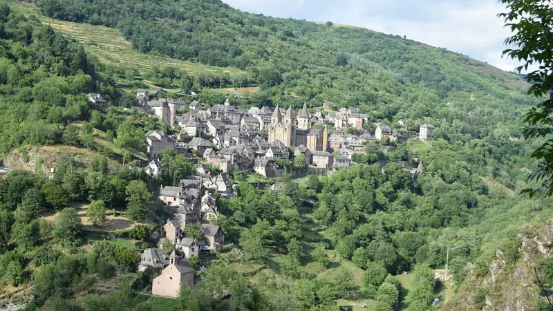
Photo: Josef Grunig, CC BY-SA 2.0, cropped
The Camino Francés (French Way) is the most popular route of the Camino de Santiago, the medieval pilgrimage to the tomb of the apostle St James in Santiago de Compostela. The classic walk starts in Saint-Jean-Pied-de-Port, a small Basque town in France at the foot of the Pyrenees, and crosses northern Spain from east to west for about 765 km: over the mountains into Navarre, through the vineyards of La Rioja, across the high plateau of the Meseta in Castile and León, over the Montes de León and the Bierzo, and into the green hills of Galicia. It is waymarked all the way with yellow arrows and scallop shells. The route is a UNESCO World Heritage Site, and in 2025 more than half a million pilgrims received the Compostela certificate, a new record. Most people walk it in 30 to 35 days and sleep in albergues, pilgrim hostels with bunk beds, in every town and many villages.
The route
This guide follows the main route as mapped on OpenStreetMap and splits it into the 33 classic stages used by most guidebooks, about 23.3 km each. The first day is the hardest: the Route Napoléon climbs about 1,400 m to the Col de Lepoeder (1,430 m) and drops steeply through beech woods to Roncesvalles. After Pamplona the Camino crosses the Alto del Perdón to Puente la Reina, Estella and Logroño, then follows La Rioja's vineyards to Nájera and Santo Domingo de la Calzada. The Montes de Oca lead to Burgos and its Gothic cathedral. From Burgos to Astorga you walk ten days across the Meseta, a flat, open plateau of wheat fields and adobe villages with little shade, through Castrojeriz, Frómista, Carrión de los Condes, Sahagún and León. After Astorga the path climbs to Foncebadón and the Cruz de Ferro, at about 1,500 m the highest point of the whole Camino, then descends to Ponferrada and the vineyards of the Bierzo. The long climb to O Cebreiro (1,300 m) brings you into Galicia, where the last 150 km wind through oak woods, farms and small villages via Triacastela, Sarria, Portomarín, Palas de Rei and Arzúa to the cathedral square in Santiago. The total climb is about 10,000 m.
The line uses the standard options: the Route Napoléon on day one, the Real Camino via Bercianos, the road-side path via Villadangos and San Martín del Camino after León, and the San Xil path from Triacastela to Sarria. The Valcarlos, Calzadilla de los Hermanillos, Villar de Mazarife and Samos options are good alternatives.
When to walk the Camino Francés
You can walk all year, but the best months are April to June and September to October. July and August are hot (often over 30 °C on the Meseta) and crowded, especially from Sarria, where many pilgrims start the last 100 km. From November to March many private albergues close, days are short, and snow is possible in the Pyrenees, on the Montes de León and at O Cebreiro. From 1 November to 31 March the Lepoeder pass on the Route Napoléon is closed to pilgrims and you must take the Valcarlos route. 2027 is a Holy Year (Xacobeo), so expect even more walkers that year.
How hard is it?
The Camino Francés is not technical: it follows farm tracks, forest paths, quiet lanes and sometimes the shoulder of a road. The challenge is the distance, day after day. Stages in this guide are 18 to 29 km and most walkers cover them in 5 to 8 hours. The hardest days are the Pyrenees crossing, the descent from the Cruz de Ferro to Molinaseca and Ponferrada, and the climb to O Cebreiro. Blisters, tendinitis and knee pain stop more pilgrims than the terrain does, so start with shorter days, keep your pack under about 10% of your body weight and take a rest day every week or so in a city such as Pamplona, Burgos or León.
Permits, Credencial and booking
No permit is needed. Get a Credencial (pilgrim passport) at the pilgrim office in Saint-Jean-Pied-de-Port or from your Camino association, and collect stamps at albergues, churches and bars. It gives you access to pilgrim albergues. To receive the Compostela in Santiago you must walk at least the last 100 km and get at least two stamps a day on that part, one of them where you start and one where you finish; the Pilgrim's Reception Office is on Rúa das Carretas and opens 9:00 to 19:00 every day except 25 December and 1 January.
Public albergues (municipal, parish and the Xunta de Galicia network) cost about 5 to 16 EUR or a donation, take no bookings, allow one night and ask you to leave by 8:00. Private albergues (about 12 to 25 EUR) and hostales, pensions and hotels can be booked, which is wise in May, June, September and October, and in Galicia from June to September. Bring a sleeping bag or liner, earplugs and flip-flops; check your bunk for bed bugs. Baggage-transfer services, including Correos' Paq Mochila and private companies, carry your pack between stages for a few euros.
Getting there and away
Saint-Jean-Pied-de-Port has a train link to Bayonne, which has TGV trains to Paris and is close to Biarritz airport. In summer, shuttle buses and taxis also run from Biarritz and Pamplona. Pamplona, Logroño, Burgos, León, Ponferrada and Sarria have train and bus stations if you want to walk only part of the route. Santiago has an airport about 10 km east of the city (the Camino passes beside it), trains to Madrid and the rest of Spain, and buses to Porto and Madrid.
Money and phone signal
Spain and France use the euro. Cards are accepted in towns and many albergues, but carry cash for donations, small bars and village albergues. There are ATMs in all the larger towns, but none in many villages (for example Roncesvalles, Hornillos, Terradillos, Foncebadón and O Cebreiro). Mobile coverage is good on most of the route, with weak spots in the Pyrenees, on the Meseta between villages and in the Montes de León. EU roaming rules apply.
What to pack
A light pack (6 to 9 kg), broken-in trail shoes, two sets of quick-drying clothes, a warm layer and a waterproof jacket all year (Galicia is wet), a sun hat and sunscreen for the Meseta, a 1.5 to 2 l water capacity, a sleeping bag liner, a small first-aid and blister kit, a headlamp and a phone with offline maps. Walking poles help on the long descents.
Safety
In an emergency call 112, which works in Spain and France and is answered in English. On the Pyrenees stage the weather changes fast: do not cross the Lepoeder pass in fog, snow or strong wind, and use the Valcarlos route when it is closed. On the Meseta start early in summer, carry water and rest in the shade at midday. Walk facing the traffic on road sections and use a light in the dark early mornings. Each stage page lists the nearest hospital with an emergency department and the health centres on the way.
Camino Francés map
The whole Camino Francés with its 33 stages, Saint-Jean-Pied-de-Port to Santiago de Compostela. Tap a stage on the map to open it. To follow the route with GPS and offline maps on the trail, open it in the free Outest app.
The 33 stages
The classic 33 stages from Saint-Jean-Pied-de-Port over the Pyrenees to Roncesvalles, then through Pamplona, Logroño, Burgos, the Meseta, León, Astorga, Ponferrada, O Cebreiro, Sarria and Arzúa to the cathedral in Santiago de Compostela. Walking times assume a steady pilgrim pace with a pack and allow for the climbs to Lepoeder, the Cruz de Ferro and O Cebreiro. Each stage page has a map, elevation profile, albergues and other places to sleep, and the nearest help.
Emergency, hospitals and services
In an emergency call 112, in Spain and in France; it is free and answered in English. In Galicia and other Spanish regions 061 is the health emergency line, and 062 reaches the Guardia Civil. 10 hospitals with a 24-hour emergency department are within reach of the route, in Bayonne, Pamplona, Estella, Logroño, Burgos, Palencia, León, Ponferrada, Lugo and Santiago; every stage page lists the nearest one, plus health centres, pharmacies, shops and bus stops on that stage.
Where to stay on the Camino Francés
Albergues (pilgrim hostels), hostales, pensions and hotels, grouped by stage from Saint-Jean-Pied-de-Port to Santiago. Listings were checked online in October 2026. Places marked "listed, not confirmed" appear on a public listing (OpenStreetMap or an albergue guide updated in 2026) but could not be confirmed on their own website. Pilgrim albergues need a Credencial; public ones cost about 5 to 16 EUR or a donation, give one night only and take no bookings. Many private albergues close from November to March, so check the season before you set off in winter.
Saint-Jean-Pied-de-Port (trailhead)
3 places
- 3 with rooms
- 2 with meals
Saint-Jean-Pied-de-Port
Saint-Jean-Pied-de-Port → Roncesvalles
3 places
- 3 with rooms
- 3 with meals
Roncesvalles
Roncesvalles → Zubiri
3 places
- 3 with rooms
- 1 with meals
Zubiri
Zubiri → Pamplona
3 places
- 3 with rooms
- 1 with meals
Pamplona
Pamplona → Puente la Reina
3 places
- 3 with rooms
- 1 with meals
Puente la Reina
Puente la Reina → Estella
3 places
- 3 with rooms
Estella
Estella → Los Arcos
3 places
- 3 with rooms
Los Arcos
Los Arcos → Logroño
3 places
- 3 with rooms
- 1 with meals
Logroño
Logroño → Nájera
3 places
- 3 with rooms
Nájera
Nájera → Santo Domingo de la Calzada
3 places
- 3 with rooms
- 1 with meals
Santo Domingo de la Calzada
Santo Domingo de la Calzada → Belorado
3 places
- 3 with rooms
- 1 with meals
Belorado
Belorado → San Juan de Ortega
2 places
- 2 with rooms
San Juan de Ortega
San Juan de Ortega → Burgos
3 places
- 3 with rooms
Burgos
Burgos → Hornillos del Camino
3 places
- 3 with rooms
Hornillos del Camino
Hornillos del Camino → Castrojeriz
3 places
- 3 with rooms
- 1 with meals
Castrojeriz
Castrojeriz → Frómista
3 places
- 3 with rooms
Frómista
Frómista → Carrión de los Condes
3 places
- 3 with rooms
- 1 with meals
Carrión de los Condes
Carrión de los Condes → Terradillos de los Templarios
2 places
- 2 with rooms
- 2 with meals
Terradillos de los Templarios
Terradillos de los Templarios → Bercianos del Real Camino
3 places
- 3 with rooms
- 1 with meals
Bercianos del Real Camino
Bercianos del Real Camino → Mansilla de las Mulas
3 places
- 3 with rooms
Mansilla de las Mulas
Mansilla de las Mulas → León
3 places
- 3 with rooms
- 1 with meals
León
León → San Martín del Camino
3 places
- 3 with rooms
San Martín del Camino
San Martín del Camino → Astorga
3 places
- 3 with rooms
- 1 with meals
Astorga
Astorga → Foncebadón
3 places
- 3 with rooms
Foncebadón
Foncebadón → Ponferrada
3 places
- 3 with rooms
- 1 with meals
Ponferrada
Ponferrada → Villafranca del Bierzo
3 places
- 3 with rooms
Villafranca del Bierzo
Villafranca del Bierzo → O Cebreiro
3 places
- 3 with rooms
- 1 with meals
O Cebreiro
O Cebreiro → Triacastela
3 places
- 3 with rooms
- 1 with meals
Triacastela
Triacastela → Sarria
3 places
- 3 with rooms
Sarria
Sarria → Portomarín
3 places
- 3 with rooms
Portomarín
Portomarín → Palas de Rei
3 places
- 3 with rooms
Palas de Rei
Palas de Rei → Arzúa
3 places
- 3 with rooms
Arzúa
Arzúa → O Pedrouzo
3 places
- 3 with rooms
O Pedrouzo
O Pedrouzo → Santiago de Compostela
3 places
- 3 with rooms
- 1 with meals
Santiago de Compostela
Plan your days
Pick any Camino Francés stage in the free hike planner to see walking time, water to carry, calories, difficulty, the weather forecast and daylight.
More trail guides

Tour du Mont Blanc
France · Italy · Switzerland · 166 km · 11 stages

GR 20
France · Corsica · 184 km · 16 stages

Walker's Haute Route
France · Switzerland · 204 km · 12 stages

GR10
France · Pyrenees · 921 km · 55 stages

GR54 Tour des Écrins
France · Écrins · 192 km · 13 stages
Via Podiensis (GR 65)
France · Le Puy to the Pyrenees · 752 km · 31 stages
GR R2 Réunion · Alta Via 1 · John Muir Trail · Laugavegur · Cotswold Way · Kerry Way · Camino Finisterre · West Highland Way · Kungsleden · Tour of Monte Rosa · Coast to Coast Walk · Pembrokeshire Coast Path · Hadrian's Wall Path · South Downs Way · Dingle Way · Wicklow Way · Fishermen's Trail · Camino Portugués · Alta Via 2 · Malerweg · Peaks of the Balkans · Overland Track · Lycian Way · St Paul Trail · Inca Trail · W Trek · Everest Base Camp Trek · Annapurna Circuit · Kumano Kodo Nakahechi · Camino del Norte · Via Francigena · Pennine Way · Carian Trail · Evliya Çelebi Way · Kaçkar Mountains Traverse · Phrygian Way · Sultans Trail · Mount Ararat Climb · Hittite Trail · Troy Culture Route · Independence Way · Mysia Ways · Rheinsteig · Westweg · Goldsteig · Via Alpina · Path of the Gods · Cinque Terre Trail · Alta Via 4 · GR221 Dry Stone Route · Stubai High Trail · Milford Track · Routeburn Track · Kepler Track · Tongariro Northern Circuit · Larapinta Trail · Great Ocean Walk · West Coast Trail · Wonderland Trail · Teton Crest Trail · Annapurna Base Camp Trek · Markha Valley Trek · Salkantay Trek · Huayhuash Circuit · Kilimanjaro Machame Route · Toubkal Circuit · Jordan Trail: Dana to Petra · Torres del Paine O Circuit · Abel Tasman Coast Track · Three Capes Track · Mestia to Ushguli Trek · Nakasendo Way · Berg Lake Trail · Skyline Trail (Jasper) · Fitz Roy & Cerro Torre Loop · Santa Cruz Trek · Otter Trail · Fish River Canyon Hiking Trail · Camino Primitivo · Camino Inglés · Eagle Walk (Adlerweg) · Berliner Höhenweg · Cape Wrath Trail · Great Glen Way · Offa's Dyke Path · Cleveland Way · Rota Vicentina Historical Way · Heaphy Track · Queen Charlotte Track · Cape to Cape Track · Rockwall Trail · Juan de Fuca Marine Trail · Quilotoa Loop · Nahuel Huapi Traverse · Ala Kul Trek · Tiger Leaping Gorge High Trail · Mount Kenya Sirimon–Chogoria Traverse · Ghorepani Poon Hill Trek · Kilimanjaro Lemosho Route · Lebanon Mountain Trail · Aladağlar Traverse · Kokoda Track · Chilkoot Trail · Lost City Trek · Choquequirao Trek · M'Goun Traverse
Hike it with the route in your pocket
Outest has the Camino Francés route offline, with elevation, water and village points, and a trail guide you can ask about stages, weather and where to sleep.