
Kalalau Trail hiking guide: route map, stages & where to stay
Hawaii's Kalalau Trail: 11 miles (17.7 km) one way along Kaua'i's Napali Coast from Ke'e Beach to Kalalau Beach, with tent camping at Hanakoa and Kalalau. Most hikers take 2 to 3 days there and back; a DLNR camping permit and a Ha'ena shuttle or parking reservation are required.
Best time to hike the Kalalau Trail →

Photo: Robert Linsdell from St. Andrews, Canada, CC BY 2.0, cropped
The Kalalau Trail is the only land route along the Napali Coast of Kaua'i, Hawaii, and one of the most famous coastal hikes in the world. It runs 11 miles (17.7 km) one way from Ke'e Beach in Ha'ena State Park, at the end of the road on the north shore, to Kalalau Beach, below the fluted green cliffs of Kalalau Valley. It crosses five big valleys, climbs and drops all day above sea cliffs, and reaches sea level only at Hanakapi'ai and Kalalau. You sleep in your own tent at the two official campsites and carry everything, and you walk back the same way. Most hikers take 2 to 3 days, or more with rest days at Kalalau.
Status in October 2026: after Hurricane Lowell, Ha'ena State Park, the shuttle and day hiking to Hanakapi'ai reopened on 15 October 2026, but hiking past the 2-mile point and all camping at Hanakoa and Kalalau stay closed until further notice. Check the DLNR park notices before you book anything.
The route
From the Ke'e Beach trailhead the path climbs at once above the reef, with the first views west along the cliffs, and drops to Hanakapi'ai Beach at mile 2. This is the limit for day hikers. Cross Hanakapi'ai Stream on rocks, then climb about 800 ft (240 m) of switchbacks to the highest part of the route and wind in and out of the hanging valleys of Ho'olulu and Waiahuakua, through forest and old terraces, to Hanakoa at mile 6. After Hanakoa the trail becomes drier, hotter and more exposed. It crosses seven small gulches and the steep slope of Pohakuao, where the path is very narrow above a long drop to the ocean, then descends Pu'ukulua (Red Hill) to Kalalau Stream. You cross the stream to the beach and the campsite, which runs under the trees to a waterfall at the west end.
This guide follows the line mapped on OpenStreetMap and splits the walk into 2 stages, about 8.0 km each: Ke'e Beach to Hanakoa, and Hanakoa to Kalalau Beach. The OSM line is 16.4 km, a little shorter than the official 11 miles because it smooths the switchbacks. The return is the same path in reverse. Fit hikers often walk Ke'e to Kalalau in one long day of 7 to 9 hours and use Hanakoa only on the way out or in bad weather.
Highlights
- The first half mile: the classic view west along the Napali cliffs
- Hanakapi'ai Valley: a wild beach and a 300 ft waterfall 1.8 miles up the valley (an extra 4 hours, good weather only)
- Hanakoa Falls: a 500 ft waterfall 0.3 miles up the valley from the Hanakoa campsite
- The last miles: open red slopes with the full view of the Kalalau cliffs
- Kalalau Beach and Valley: a long sand beach, a waterfall shower, sea caves and a 2-mile trail inland past old taro terraces
When to go
Summer, roughly May to September, is the season: the trade winds are steady, the trail is drier and the surf is smaller, and permits sell out first. Winter, October to April, brings more showers, storms, flash floods and big surf; streams can rise in minutes and the beaches become dangerous. Temperatures seldom drop below 60°F (16°C), but the sun is strong and the last section has little shade. Start early, because it gets dark quickly under the cliffs, especially in winter.
How hard is it?
DLNR calls the trail suitable only for expert hikers in good shape. The distance is modest, but the path is rarely level: in this guide's profile you climb about 1,350 m (4,400 ft) on the way in and a similar amount on the way back. It is steep, muddy and slippery when wet, rocky and narrow in places, with sheer drop-offs on the ocean side, especially past Hanakoa. Novices and anyone afraid of heights should go no further than Hanakapi'ai.
Permits and booking
You need a Napali Coast State Wilderness Park camping permit to go beyond Hanakapi'ai, even for a day hike, and there are no day permits. Permits are sold online on the State of Hawaii camping site up to 90 days ahead and often sell out, especially in summer. In 2026 they cost $35 per person per night for non-residents and $25 for Hawaii residents. The permit is issued for Kalalau and also covers Hanakoa, but never for two nights in a row there, and the maximum is 5 nights in all. A few walk-in permits for residents are sold at the State Parks office in Lihue. Camping is allowed only at Hanakoa and Kalalau, and open fires are banned.
Getting into Ha'ena State Park is booked separately on GoHaena. Non-residents need an entry reservation ($5) and a parking slot ($20 per car per slot) or a shuttle ticket, released 30 days ahead. With a Kalalau permit you need no entry reservation, but you must arrive by the shuttle, be dropped off, or book overnight parking at Ha'ena (up to 90 days ahead, paid per day). The lot is under construction in 2026, so spaces are fewer.
Getting there and away
Fly to Lihue (LIH) and drive about 1.5 hours to Hanalei and Ha'ena on Kuhio Highway, which ends at Ke'e Beach. The GoHaena shuttle runs from the Waipa Park and Ride near Hanalei and from Princeville to Ke'e Beach from 7:20 am to 5:40 pm; the round trip costs $45 for adults in 2026 and includes park entry, and campers can use it on all the days of their permit. The park gate is open from 7:00 am to 6:45 pm. Sleep the night before in Ha'ena, Hanalei or Princeville.
Water, food, money and phone signal
There is no drinking water, no shop, no trash service and no cell signal on the trail. Streams at Hanakapi'ai, Hanakoa and Kalalau are the only water: filter or treat it all, because leptospirosis is present. The campsites have composting toilets and Hanakoa has two rain shelters. Buy food, stove fuel and cash in Lihue, Kapa'a or Princeville before you drive north; Hanalei has shops and cafés but fewer choices.
What to pack
A light tent with a rain fly, sleeping bag or blanket and pad, a stove and fuel, food for every day, a water filter or tablets, a headlamp, a first aid kit, sun protection, insect repellent and boots or shoes with good grip for mud and wet rock. Keep your tent and pack closed, and carry out all your rubbish.
Safety
There is no cell coverage. In an emergency call 911 where you have signal; otherwise someone must hike out or signal a passing helicopter or boat. The Kaua'i Fire Department flies rescues with its Air 1 helicopter. Never cross a flooded stream: wait, because the water drops as fast as it rose. Do not swim at Hanakapi'ai: there are no lifeguards and rip currents drown people there every year. Stay back from cliff edges, avoid the base of cliffs and waterfalls because of falling rocks, and run to high ground if the sea suddenly drops (tsunami). The nearest emergency departments are in Lihue and Kapa'a, both more than an hour away by road.
Kalalau Trail map
The whole Kalalau Trail with its 2 stages, Ke'e Beach to Kalalau Beach. Tap a stage on the map to open it. To follow the route with GPS and offline maps on the trail, open it in the free Outest app.
The 2 stages
The walk in from Ke'e Beach at the end of the road to Kalalau Beach in two stages, split at Hanakoa, the only other place where camping is allowed: past Hanakapi'ai Beach and up out of its valley to Hanakoa, then across the open, narrow slopes of Pohakuao and down Red Hill to Kalalau. Many fit hikers walk it in one long day and stop at Hanakoa on the way back. Walking times allow for heat, mud, stream crossings and a full pack. Each stage page has a map, elevation profile, the campsite and the nearest help.
| # | Stage | Distance | Level |
|---|---|---|---|
| 1 | Ke'e Beach → Hanakoa | 9.5 km | hard |
| 2 | Hanakoa → Kalalau Beach | 6.9 km | moderate |
Emergency, hospitals and services
In an emergency call 911 (or text 911 if you cannot talk). There is no mobile signal on the Napali Coast, so someone may have to hike out or signal a passing helicopter or boat; the Kauai Fire Department flies rescues with its Air 1 helicopter. 2 places give medical care: emergency departments in Lihue and Kapaa, more than an hour by road, and an urgent care clinic in Princeville. Every stage page lists the nearest help.
Where to stay on the Kalalau Trail
The two official campsites on the trail and the inns, resorts, shuttle and parking at the trailhead, grouped by stage from Ke'e Beach to Kalalau Beach. Listings were checked online in October 2026. Places marked "not confirmed by the operator" are listed on OpenStreetMap or their own older pages but could not be confirmed as open after Hurricane Lowell. Camping needs a DLNR permit, and you must book the Ha'ena shuttle or overnight parking on GoHaena as well.
8 campsites, inns, resorts and services at 5 stops on the trail, from Ke'e Beach to Kalalau Beach. Pick a stage to see campsite facilities, permit rules, phone numbers and booking links.
Ke'e Beach (trailhead)
6 places
- 4 with rooms
- 1 camping
- 1 with meals
Ha'ena · Hanalei · Princeville
Ke'e Beach → Hanakoa
1 place
- 1 camping
Hanakoa
Hanakoa → Kalalau Beach
1 place
- 1 camping
Kalalau
On the Kalalau Trail you sleep in your own tent at the two official campsites, Hanakoa and Kalalau, with a Napali Coast camping permit from DLNR (up to 90 days ahead, 5 nights maximum). There is no drinking water, shop or cell signal, so carry a stove, a water filter and all your food. Book the Ha'ena shuttle or overnight parking on GoHaena, and a room in Ha'ena, Hanalei or Princeville for the night before. After Hurricane Lowell all camping was closed in October 2026: check the DLNR notices.
Plan your days
Pick any Kalalau Trail stage in the free hike planner to see walking time, water to carry, calories, difficulty, the weather forecast and daylight.
More trail guides

John Muir Trail
USA · California · 353 km · 18 stages

Wonderland Trail
USA · Washington · 139 km · 11 stages

Teton Crest Trail
USA · Wyoming · 64 km · 4 stages
Grand Canyon Rim to Rim
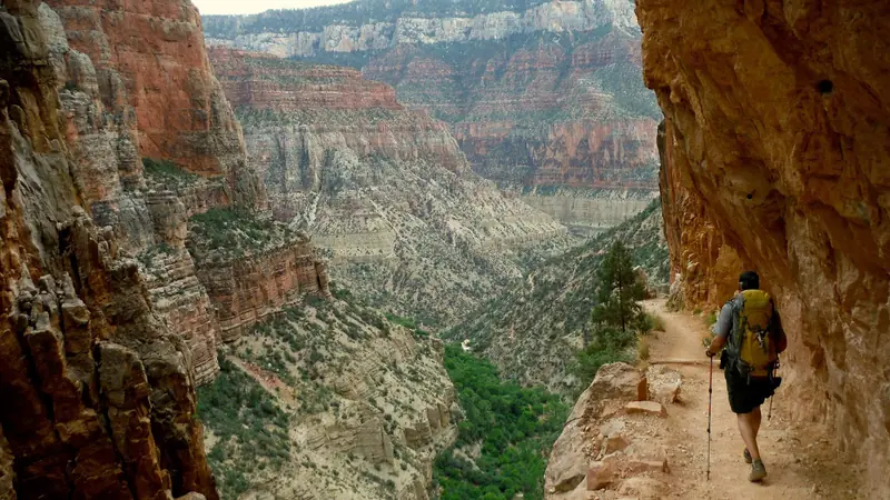
USA · Arizona · 38 km · 3 stages

Lost Coast Trail
USA · California · 40 km · 3 stages

Tour du Mont Blanc
France · Italy · Switzerland · 166 km · 11 stages
Alta Via 1 · GR 20 · Laugavegur · Cotswold Way · Kerry Way · Camino Finisterre · West Highland Way · Walker's Haute Route · Kungsleden · Tour of Monte Rosa · Coast to Coast Walk · Pembrokeshire Coast Path · Hadrian's Wall Path · South Downs Way · Dingle Way · Wicklow Way · Fishermen's Trail · Camino Portugués · Alta Via 2 · Malerweg · Peaks of the Balkans · Overland Track · Lycian Way · St Paul Trail · Camino Francés · Inca Trail · W Trek · Everest Base Camp Trek · Annapurna Circuit · Kumano Kodo Nakahechi · Camino del Norte · Via Francigena · GR10 · Pennine Way · Carian Trail · Evliya Çelebi Way · Kaçkar Mountains Traverse · Phrygian Way · Sultans Trail · Mount Ararat Climb · Hittite Trail · Troy Culture Route · Independence Way · Mysia Ways · Rheinsteig · Westweg · Goldsteig · GR54 Tour des Écrins · Via Alpina · Path of the Gods · Cinque Terre Trail · Alta Via 4 · GR221 Dry Stone Route · Stubai High Trail · Milford Track · Routeburn Track · Kepler Track · Tongariro Northern Circuit · Larapinta Trail · Great Ocean Walk · West Coast Trail · Annapurna Base Camp Trek · Markha Valley Trek · Salkantay Trek · Huayhuash Circuit · Kilimanjaro Machame Route · Toubkal Circuit · Jordan Trail: Dana to Petra · Torres del Paine O Circuit · Abel Tasman Coast Track · Three Capes Track · Mestia to Ushguli Trek · Nakasendo Way · Berg Lake Trail · Skyline Trail (Jasper) · Fitz Roy & Cerro Torre Loop · Santa Cruz Trek · Otter Trail · Fish River Canyon Hiking Trail · Camino Primitivo · Camino Inglés · Eagle Walk (Adlerweg) · Berliner Höhenweg · Cape Wrath Trail · Great Glen Way · Offa's Dyke Path · Cleveland Way · Rota Vicentina Historical Way · Via Podiensis (GR 65) · Heaphy Track · Queen Charlotte Track · Cape to Cape Track · Rockwall Trail · Juan de Fuca Marine Trail · Quilotoa Loop · Nahuel Huapi Traverse · Ala Kul Trek · Tiger Leaping Gorge High Trail · Mount Kenya Sirimon–Chogoria Traverse · Ghorepani Poon Hill Trek · Kilimanjaro Lemosho Route · Lebanon Mountain Trail · Aladağlar Traverse · Kokoda Track · Chilkoot Trail · Lost City Trek · Choquequirao Trek · GR R2 Réunion · M'Goun Traverse · Royal National Park Coast Track · Grand Cliff Top Walk · Snowies Alpine Walk · Rwenzori Central Circuit · Whale Trail · Ausangate Circuit · Thorsborne Trail · Paparoa Track · Mount Assiniboine Traverse · Sunshine Coast Trail · Sinai Trail · Rakiura Track · Via degli Dei · Stevenson Trail (GR 70) · Juliana Trail · Camí de Cavalls · Karhunkierros Trail · East Coast Trail · Mount Rinjani Trek · MacLehose Trail · Lake Waikaremoana Great Walk · Hump Ridge Track · Jatbula Trail · Druk Path Trek · Mardi Himal Trek · Mount Kinabalu Climb · Kilimanjaro Marangu Route · Amatola Trail · Mount Olympus Traverse · Dales Way · Tour de la Vanoise · Lechweg · High Coast Trail · Rennsteig · Old Ghost Road · Gokyo Lakes Trek · Corfu Trail · Leleg Way · Anillo de Picos · Fundy Footpath
Hike it with the route in your pocket
Outest has the Kalalau Trail route offline, with elevation, water and village points, and a trail guide you can ask about stages, weather and where to sleep.