
Great Glen Way hiking guide: route map, stages & where to stay
Scotland's coast-to-coast walk through the Great Glen: 79 miles (127 km) from Fort William to Inverness, along the Caledonian Canal and above Loch Lochy, Loch Oich and Loch Ness. Most walkers take 5 to 7 days, staying in hostels, B&Bs, hotels and campsites.
Best time to hike the Great Glen Way →

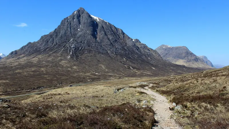
Photo: Daniel Kraft, CC BY-SA 3.0, cropped
The Great Glen Way is one of Scotland's Great Trails. It runs for 79 miles (127 km, by the official count) from the Old Fort in Fort William, at the foot of Ben Nevis, to Inverness Castle, crossing the Highlands from the west coast to the east along the Great Glen, a huge geological fault that splits Scotland in two. The route follows the towpaths of Thomas Telford's Caledonian Canal and forest tracks above three long lochs: Loch Lochy, Loch Oich and Loch Ness. It is waymarked all the way, and most people walk it from south-west to north-east, with the prevailing wind at their backs.
Fort William is also where the West Highland Way ends, so many walkers carry straight on: the West Highland Way finishes in Gordon Square, a few minutes' walk from the Great Glen Way start at the Old Fort. Together they make a walk of about 280 km from Milngavie, near Glasgow, to Inverness.
The route
The first day is flat: along Loch Linnhe to Corpach, up Neptune's Staircase, a flight of eight locks at Banavie, and along the canal towpath, with views back to Ben Nevis, to Gairlochy. From there quiet roads and forest tracks run along the north-west shore of Loch Lochy to Laggan Locks and South Laggan. The third day follows the canal and the old railway line along the south-east shore of Loch Oich, past Leitirfearn and Aberchalder, then the towpath to Fort Augustus, where five locks step down to Loch Ness.
After Fort Augustus the trail climbs into the forests above the north-west shore of Loch Ness, to Invermoriston and then, with long views over the loch, to Drumnadrochit near Urquhart Castle. The last day climbs out of Drumnadrochit through farmland and the community woods at Abriachan, reaches the highest point of the low route at about 380 m, and crosses moorland and forest at Blackfold before descending to the canal and the River Ness into Inverness.
This guide follows the official stage plan and splits the route into 6 stages, about 20.0 km each, with nights at Gairlochy, South Laggan, Fort Augustus, Invermoriston and Drumnadrochit. The line follows the original low route as mapped on OpenStreetMap and measures about 120 km. Between Fort Augustus and Drumnadrochit there are two high routes, opened in 2014, with bigger views over Loch Ness and more climbing: Fort Augustus to Invermoriston is about the same length but harder, and Invermoriston to Drumnadrochit is a little shorter but reaches 422 m, the highest point of the whole trail.
When to walk the Great Glen Way
The trail is open all year. The best months are May, June and September, with long days and fewer midges than in high summer. July and August are the busiest and the worst for midges and ticks. From October to March many campsites, the Eagle Barge at Laggan Locks and some B&Bs close and the days are short. Rain and wind are possible in any month.
How many days do you need?
Most walkers take five to seven days. The stages here range from about 12 to 31 km. Fort Augustus to Invermoriston is short, so fit walkers combine it with the next day or walk on to Alltsigh, where the official six- and seven-day plans stop. The last stage, Drumnadrochit to Inverness, is the longest; you can split it at Abriachan, where there are camping pods. A rest day in Fort Augustus or Drumnadrochit leaves time for a Loch Ness boat trip or Urquhart Castle.
Getting there and away
Fort William has trains on the West Highland Line from Glasgow and the Caledonian Sleeper from London, and Scottish Citylink coaches from Glasgow and Inverness. Inverness has trains to the south, coaches and an airport. The Citylink 919 bus runs along the A82 between Fort William and Inverness several times a day, via Spean Bridge, Invergarry, Fort Augustus, Invermoriston, Alltsigh and Drumnadrochit. Gairlochy has no bus; the nearest is on the A82 at Spean Bridge, about 4 km away.
Sleeping, eating and booking
You sleep in hostels, B&Bs, guest houses, hotels and campsites in the towns and villages, plus a few simple Trailblazer rest sites (free, no booking) by the lochs. Beds are few at Gairlochy and South Laggan: if they are full, stay in Spean Bridge or Invergarry, a short taxi ride or the Invergarry Link away. Book ahead from April to September; several companies carry bags between overnight stops. There are shops in Fort William, Fort Augustus, Drumnadrochit and Inverness, a small shop and café at Invermoriston, but nothing between Gairlochy and South Laggan or on the last day until Inverness, so carry lunch and water.
Wild camping is legal in Scotland under the Scottish Outdoor Access Code, but not on the banks of the Caledonian Canal, which is a scheduled monument: use the small canal camping areas (Gairlochy, Laggan Locks, Kytra) or the Trailblazer sites, and always have a plan B. Canal toilets and showers need a Scottish Canals key (£10 per person, from the Corpach or Inverness offices).
Money and phone signal
Cards are accepted almost everywhere; carry some cash for small B&Bs and honesty boxes. There are cash machines in Fort William, Drumnadrochit and Inverness. Mobile signal is good in the villages but weak in parts of the forests and on the high routes, so download maps first.
Difficulty
The Great Glen Way is a moderate walk. The first three days are almost flat. From Fort Augustus forest tracks climb several hundred metres above Loch Ness, and the high routes have short, very steep sections. Most of the surface is firm gravel or tarmac, so cushioned shoes and blister care matter more than technical skill. The low route used here adds up to about 1,700 m of climbing.
What to pack
Waterproofs, warm layers, broken-in boots or trail shoes, blister plasters, midge repellent and a head net (May to September), a tick remover, sun cream, water and snacks for the forest sections, an offline map, a power bank and some cash. Campers need a stove, a water filter and a trowel.
Safety
The main risks are blisters, falls on wet roots, traffic on the road sections, cold rain and ticks. Keep back from lock edges and do not swim in the canal; Loch Ness is deep and cold all year. In an emergency call 999 or 112: ask for the Police, then Mountain Rescue, if you are lost or hurt on the trail, or the Coastguard for anyone in trouble on Loch Ness. For urgent medical advice that is not an emergency, call NHS 24 on 111. The nearest emergency departments are Belford Hospital in Fort William and Raigmore Hospital in Inverness.
History
Glaciers deepened the Great Glen along its fault line and left the chain of lochs. In the 18th century the government held the Highlands with forts at Fort William, Fort Augustus and Inverness, linked by General Wade's military road. Thomas Telford built the Caledonian Canal between 1803 and 1822 to join the lochs coast to coast, and boats still use it. The Great Glen Way opened in 2002.
Great Glen Way map
The whole Great Glen Way with its 6 stages, Fort William to Inverness. Tap a stage on the map to open it. To follow the route with GPS and offline maps on the trail, open it in the free Outest app.
The 6 stages
The six stages of the official stage plan from the Old Fort in Fort William to Inverness Castle, via Gairlochy, South Laggan, Fort Augustus, Invermoriston and Drumnadrochit, on the low route; the high routes between Fort Augustus and Drumnadrochit are described in the guide. Each stage page has a map, elevation profile, places to sleep and eat, and the nearest help.
| # | Stage | Distance | Level |
|---|---|---|---|
| 1 | Fort William → Gairlochy | 16.7 km | moderate |
| 2 | Gairlochy → South Laggan | 20.2 km | moderate |
| 3 | South Laggan → Fort Augustus | 16.6 km | moderate |
| 4 | Fort Augustus → Invermoriston | 12.1 km | easy |
| 5 | Invermoriston → Drumnadrochit | 23.7 km | hard |
| 6 | Drumnadrochit → Inverness | 30.6 km | hard |
Emergency, hospitals and services
In an emergency call 999 or 112; in the forests and hills ask for the Police, then Mountain Rescue, and for anyone in trouble on Loch Ness ask for the Coastguard. For urgent medical advice that is not life-threatening call NHS 24 on 111. 2 hospitals with an emergency department (A&E) serve the trail, Belford Hospital in Fort William and Raigmore Hospital in Inverness; every stage page lists the nearest one, plus GP surgeries, pharmacies, shops and bus stops on that stage.
Where to stay on the Great Glen Way
Hostels, B&Bs, guest houses, hotels, campsites and simple Trailblazer rest sites, grouped by stage from Fort William to Inverness. Listings were checked online in October 2026. Places marked "listed, not confirmed" appear on a public listing (OpenStreetMap, Scottish Canals or walkers' trip reports) but could not be confirmed on their own website. Wild camping is allowed under the Scottish Outdoor Access Code, but not on the banks of the Caledonian Canal: use the small canal camping areas or the Trailblazer sites, and have a plan B. Gairlochy and South Laggan fill up early, so book ahead.
Fort William (trailhead)
3 places
- 2 with rooms
- 1 camping
- 2 with meals
Fort William · Glen Nevis
Fort William → Gairlochy
5 places
- 4 with rooms
- 1 camping
- 3 with meals
Banavie · Gairlochy · Spean Bridge
Gairlochy → South Laggan
5 places
- 2 with rooms
- 2 camping
- 3 with meals
Laggan Locks · Loch Lochy · South Laggan
South Laggan → Fort Augustus
8 places
- 6 with rooms
- 2 camping
- 5 with meals
Fort Augustus · Invergarry · Kytra Lock · Loch Oich
Fort Augustus → Invermoriston
4 places
- 4 with rooms
- 1 camping
- 1 with meals
Inver Coille · Invermoriston
Invermoriston → Drumnadrochit
6 places
- 5 with rooms
- 1 camping
- 4 with meals
Alltsigh · Drumnadrochit
Drumnadrochit → Inverness
6 places
- 4 with rooms
- 3 camping
- 1 with meals
Abriachan · Inverness
Plan your days
Pick any Great Glen Way stage in the free hike planner to see walking time, water to carry, calories, difficulty, the weather forecast and daylight.
More trail guides
West Highland Way
Scotland · 153 km · 8 stages

Cape Wrath Trail
Scotland · North-west Highlands · 380 km · 15 stages

Tour du Mont Blanc
France · Italy · Switzerland · 166 km · 11 stages

Alta Via 1
Italy · Dolomites · 118 km · 11 stages

GR 20
France · Corsica · 184 km · 16 stages

John Muir Trail
USA · California · 353 km · 18 stages
Laugavegur · Cotswold Way · Kerry Way · Camino Finisterre · Walker's Haute Route · Kungsleden · Tour of Monte Rosa · Coast to Coast Walk · Pembrokeshire Coast Path · Hadrian's Wall Path · South Downs Way · Dingle Way · Wicklow Way · Fishermen's Trail · Camino Portugués · Alta Via 2 · Malerweg · Peaks of the Balkans · Overland Track · Lycian Way · St Paul Trail · Camino Francés · Inca Trail · W Trek · Everest Base Camp Trek · Annapurna Circuit · Kumano Kodo Nakahechi · Camino del Norte · Via Francigena · GR10 · Pennine Way · Carian Trail · Evliya Çelebi Way · Kaçkar Mountains Traverse · Phrygian Way · Sultans Trail · Mount Ararat Climb · Hittite Trail · Troy Culture Route · Independence Way · Mysia Ways · Rheinsteig · Westweg · Goldsteig · GR54 Tour des Écrins · Via Alpina · Path of the Gods · Cinque Terre Trail · Alta Via 4 · GR221 Dry Stone Route · Stubai High Trail · Milford Track · Routeburn Track · Kepler Track · Tongariro Northern Circuit · Larapinta Trail · Great Ocean Walk · West Coast Trail · Wonderland Trail · Teton Crest Trail · Annapurna Base Camp Trek · Markha Valley Trek · Salkantay Trek · Huayhuash Circuit · Kilimanjaro Machame Route · Toubkal Circuit · Jordan Trail: Dana to Petra · Torres del Paine O Circuit · Abel Tasman Coast Track · Three Capes Track · Mestia to Ushguli Trek · Nakasendo Way · Berg Lake Trail · Skyline Trail (Jasper) · Fitz Roy & Cerro Torre Loop · Santa Cruz Trek · Otter Trail · Fish River Canyon Hiking Trail · Camino Primitivo · Camino Inglés · Eagle Walk (Adlerweg) · Berliner Höhenweg · Offa's Dyke Path · Cleveland Way · Rota Vicentina Historical Way · Via Podiensis (GR 65) · Heaphy Track · Queen Charlotte Track · Cape to Cape Track · Rockwall Trail · Juan de Fuca Marine Trail · Quilotoa Loop · Nahuel Huapi Traverse · Ala Kul Trek · Tiger Leaping Gorge High Trail · Mount Kenya Sirimon–Chogoria Traverse · Ghorepani Poon Hill Trek · Kilimanjaro Lemosho Route · Lebanon Mountain Trail · Aladağlar Traverse · Kokoda Track · Chilkoot Trail · Lost City Trek · Choquequirao Trek · GR R2 Réunion · M'Goun Traverse
Hike it with the route in your pocket
Outest has the Great Glen Way route offline, with elevation, water and village points, and a trail guide you can ask about stages, weather and where to sleep.