
Via Podiensis (GR 65) hiking guide: route map, stages & where to stay
The Le Puy Camino in France: about 750 km on the GR 65 from Le Puy-en-Velay to Saint-Jean-Pied-de-Port, over the Aubrac and through Conques, Cahors and Moissac. Most pilgrims take 30 to 35 days, staying in gîtes d'étape, pilgrim gîtes and chambres d'hôtes.
Best time to hike the Via Podiensis (GR 65) →

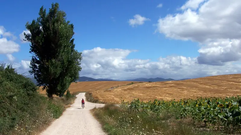
Photo: Cyrille Largillier, CC BY-SA 4.0, cropped
The Via Podiensis, or Chemin du Puy, is the most walked of the four historic pilgrim routes through France to Santiago de Compostela. Today it is waymarked as the GR 65, a Grande Randonnée footpath of the French hiking federation (FFRandonnée), with red-and-white marks and, in places, scallop shells. It runs for about 750 km from the cathedral of Le Puy-en-Velay in the Massif Central to Saint-Jean-Pied-de-Port at the foot of the Pyrenees, across the Margeride, the Aubrac plateau, the Lot valley, the limestone causses of Quercy, the hills of Gascony and the Béarn and the Basque Country. Pilgrims and hikers sleep in gîtes d'étape (walkers' hostels), pilgrim gîtes, chambres d'hôtes and small hotels in the villages along the way, and most walk it from east to west in four to five weeks.
The route
The walk begins after the pilgrims' mass in Le Puy cathedral and climbs onto the volcanic plateau of the Velay, then drops into the Allier gorge at Monistrol before Saugues. The Margeride is high, quiet farmland with granite villages and pine woods, past the lonely farm of Domaine du Sauvage. After Aumont-Aubrac comes the Aubrac, an open plateau of pastures, drystone walls and huge skies around 1,200 to 1,370 m, through Nasbinals and Aubrac village, before a long descent into the Lot valley at Saint-Chély-d'Aubrac, Saint-Côme-d'Olt, Espalion and Estaing. The path then crosses wooded hills to Conques, one of the great Romanesque abbey villages of France.
From Conques the route follows the Lot past Decazeville to Figeac, then crosses the dry causses of Quercy, with oak scrub, stone huts and long straight tracks, to Cajarc and Cahors and its fortified Pont Valentré. The Quercy Blanc leads to the hill towns of Lauzerte and Moissac, famous for its abbey cloister. After the Garonne at Auvillar come the vineyards and sunflower fields of the Gers: Lectoure, La Romieu, Condom, Montréal-du-Gers and Éauze, in Armagnac country. The last week runs through Aire-sur-l'Adour, the Béarn hills to Navarrenx, and the Basque Country past the Gibraltar stone near Ostabat, where three of the French routes meet, to Saint-Jean-Pied-de-Port.
Saint-Jean-Pied-de-Port is the start of the Camino Francés across the Pyrenees to Roncesvalles and Santiago; Outest also has a full guide to the Camino Francés. Two well-known variants are not on the map here: the Célé valley route (GR 651), about 120 km from Figeac to Cahors via Marcilhac and Saint-Cirq-Lapopie instead of about 90 km via Cajarc, and a long detour north to Rocamadour.
This guide follows the main GR 65 as mapped on OpenStreetMap and splits it into 31 stages of about 24.3 km, the stage towns most pilgrims use. The highest point is about 1,370 m on the Aubrac, the lowest about 55 m at the Garonne, and the profile adds up to about 12,000 m of climbing.
Highlights
- Le Puy-en-Velay: the cathedral, the pilgrims' blessing and the chapel on its volcanic needle
- The Aubrac: a wide, treeless plateau of cattle pastures and spring flowers
- Conques: the abbey church of Sainte-Foy and its treasury in a steep medieval village
- Figeac and Cahors: a medieval town and the Pont Valentré over the Lot
- Moissac: the Romanesque cloister and abbey portal
- The Gers: La Romieu, Lectoure and the Armagnac villages
- Saint-Jean-Pied-de-Port: the walled town and the gateway to the Pyrenees
When to walk the Via Podiensis
Most gîtes open from about April to October, and that is the walking season. May, June and September are the best and busiest months. On the Aubrac snow can fall into May and again from late October, and fog makes the plateau hard to cross. July and August are hot in Quercy and the Gers, with little shade. From November to March many villages have no open bed or café, and the hunting season (from September to the end of February) brings drives in the woods; wear something bright.
How many days do you need?
The 31 stages here take about a month, from 13 to 34 km a day; with rest days most people need 32 to 35 days. Many walk it in sections over several years: Le Puy to Conques (9 days), Conques to Cahors or Moissac, and Moissac to Saint-Jean-Pied-de-Port. The longest days are Varaire to Cahors, Auvillar to Lectoure and Aire-sur-l'Adour to Arzacq, all over 30 km.
Difficulty
The GR 65 is a long walk but not a technical one: field paths, forest tracks, old lanes and short stretches of road. The first nine stages to Conques are the hardest, with climbs of 400 to 650 m a day and steep, stony descents into the Lot valley. Quercy and the Gers are gentler but long, hot and exposed. Carry water: on the causses villages can be 10 km apart.
Credential and booking
No permit is needed. Buy a credential in Le Puy, after the pilgrims' mass in the cathedral (7:00 every day from April to October, 7:30 on weekdays in winter) or at the cathedral shop, and collect stamps in gîtes, churches and town halls.
Gîtes d'étape cost about €15 to €25 a bed. Most offer half board (demi-pension: dinner, bed and breakfast) for about €37 to €55, and many have a guest kitchen. Chambres d'hôtes cost about €70 to €100 for a double room with breakfast. Unlike in Spain, most gîtes take and expect bookings: call a day or two ahead, and earlier from April to June and in September, when the first stages from Le Puy are full. Several baggage-transfer services carry bags from gîte to gîte.
Getting there and away
Le Puy-en-Velay has trains from Saint-Étienne and Lyon, with connections from Paris; Lyon-Saint-Exupéry is the nearest major airport. Saint-Jean-Pied-de-Port has trains to Bayonne, with connections to Biarritz airport, Bordeaux and Paris. Many towns on the way, such as Figeac, Cahors, Moissac and Navarrenx, have bus or train links if you walk only part of the route.
Money and phone signal
France uses the euro. Cards work in towns, but many small gîtes and chambres d'hôtes want cash or a French cheque, so carry cash for two or three days; there are cash machines in the larger towns. Mobile signal is good in most villages and weak in places on the Aubrac and the Margeride.
What to pack
A waterproof jacket and warm layers for the Aubrac, sun hat and sun cream, comfortable walking shoes, a sleeping-bag liner (many gîtes provide blankets but not always sheets), a 2-litre water bottle, earplugs and a first-aid and blister kit.
Safety
In an emergency call 112 from any phone, 15 for a medical emergency or 18 for the fire and rescue service. Do not cross the Aubrac in thick fog or snow: wait or take the road. Check the Météo-France forecast, watch for heat in summer and for ticks in long grass, and tell your next gîte if you will not arrive.
Via Podiensis (GR 65) map
The whole Via Podiensis (GR 65) with its 31 stages, Le Puy-en-Velay to Saint-Jean-Pied-de-Port. Tap a stage on the map to open it. To follow the route with GPS and offline maps on the trail, open it in the free Outest app.
The 31 stages
Thirty-one stages on the main GR 65 from Le Puy cathedral to Saint-Jean-Pied-de-Port: over the Margeride and the Aubrac via Saugues, Domaine du Sauvage, Aumont-Aubrac and Nasbinals, down the Lot valley via Saint-Chély-d'Aubrac, Espalion and Golinhac to Conques, then Figeac, Cajarc, Cahors, Lauzerte and Moissac, the Gers via Lectoure, La Romieu, Condom and Éauze, and Aire-sur-l'Adour, Navarrenx and Ostabat in the Béarn and the Basque Country. The Célé valley variant (GR 651) and the Rocamadour detour are described in the guide. Saint-Jean-Pied-de-Port is the start of the Camino Francés. Each stage page has a map, elevation profile, gîtes and other places to sleep, and the nearest help.
Emergency, hospitals and services
In an emergency call 112 from any phone, in French or English; 15 is the SAMU for medical emergencies and 18 the fire and rescue service (pompiers), who also rescue injured walkers. 13 hospitals with a 24-hour emergency department (urgences) are within reach of the route, from Le Puy-en-Velay, Mende and Rodez to Figeac, Cahors, Moissac, Condom, Mont-de-Marsan, Pau, Orthez, Saint-Palais and Bayonne; on the Margeride and the Aubrac the nearest is 30 to 50 km away by road. Every stage page lists the nearest one, plus pharmacies, shops and bus stops on that stage.
Where to stay on the Via Podiensis (GR 65)
Gîtes d'étape, pilgrim gîtes, chambres d'hôtes, small hotels and a few campsites, grouped by stage from Le Puy-en-Velay to Saint-Jean-Pied-de-Port. Listings were checked online in October 2026. Places marked "listed, not confirmed" appear on a public pilgrim listing (Gronze.com) but could not be confirmed on their own website. A bed in a gîte costs about €15 to €25 and half board (dinner, bed and breakfast) about €37 to €55. Unlike in Spain, most places take bookings and expect them. Bivouac for one night is tolerated in many places, but not near historic monuments or in villages: ask the landowner or use a campsite.
Le Puy-en-Velay → Saint-Privat-d'Allier
6 places
- 6 with rooms
- 6 with meals
Le Puy-en-Velay · Saint-Privat-d'Allier
Saint-Privat-d'Allier → Saugues
3 places
- 3 with rooms
- 2 with meals
Saugues
Saugues → Domaine du Sauvage
1 place
- 1 with rooms
- 1 with meals
Domaine du Sauvage
Domaine du Sauvage → Aumont-Aubrac
3 places
- 3 with rooms
- 3 with meals
Aumont-Aubrac
Aumont-Aubrac → Nasbinals
3 places
- 3 with rooms
Nasbinals
Nasbinals → Saint-Chély-d'Aubrac
3 places
- 3 with rooms
- 3 with meals
Saint-Chély-d'Aubrac
Saint-Chély-d'Aubrac → Espalion
3 places
- 3 with rooms
- 3 with meals
Espalion
Espalion → Golinhac
3 places
- 3 with rooms
- 1 with meals
Golinhac
Golinhac → Conques
3 places
- 3 with rooms
- 3 with meals
Conques
Conques → Livinhac-le-Haut
3 places
- 3 with rooms
- 3 with meals
Livinhac-le-Haut
Livinhac-le-Haut → Figeac
3 places
- 3 with rooms
- 3 with meals
Figeac
Figeac → Cajarc
3 places
- 3 with rooms
- 1 camping
- 2 with meals
Cajarc
Cajarc → Varaire
3 places
- 3 with rooms
- 3 with meals
Varaire
Varaire → Cahors
3 places
- 3 with rooms
- 3 with meals
Cahors
Cahors → Lascabanes
3 places
- 3 with rooms
- 3 with meals
Lascabanes
Lascabanes → Lauzerte
3 places
- 3 with rooms
- 3 with meals
Lauzerte
Lauzerte → Moissac
3 places
- 3 with rooms
- 3 with meals
Moissac
Moissac → Auvillar
3 places
- 3 with rooms
- 2 with meals
Auvillar
Auvillar → Lectoure
3 places
- 3 with rooms
- 3 with meals
Lectoure
Lectoure → La Romieu
3 places
- 3 with rooms
- 3 with meals
La Romieu
La Romieu → Condom
3 places
- 3 with rooms
- 3 with meals
Condom
Condom → Montréal-du-Gers
3 places
- 3 with rooms
- 1 camping
- 3 with meals
Montréal-du-Gers
Montréal-du-Gers → Éauze
3 places
- 3 with rooms
- 3 with meals
Éauze
Éauze → Nogaro
3 places
- 3 with rooms
- 3 with meals
Nogaro
Nogaro → Aire-sur-l'Adour
3 places
- 3 with rooms
- 3 with meals
Aire-sur-l'Adour
Aire-sur-l'Adour → Arzacq-Arraziguet
3 places
- 3 with rooms
- 3 with meals
Arzacq-Arraziguet
Arzacq-Arraziguet → Arthez-de-Béarn
3 places
- 3 with rooms
- 1 camping
- 1 with meals
Arthez-de-Béarn
Arthez-de-Béarn → Navarrenx
3 places
- 3 with rooms
- 3 with meals
Navarrenx
Navarrenx → Aroue
3 places
- 3 with rooms
- 3 with meals
Aroue
Aroue → Ostabat
3 places
- 3 with rooms
- 2 with meals
Ostabat
Ostabat → Saint-Jean-Pied-de-Port
3 places
- 3 with rooms
- 2 with meals
Saint-Jean-Pied-de-Port
Plan your days
Pick any Via Podiensis (GR 65) stage in the free hike planner to see walking time, water to carry, calories, difficulty, the weather forecast and daylight.
More trail guides

Tour du Mont Blanc
France · Italy · Switzerland · 166 km · 11 stages

GR 20
France · Corsica · 184 km · 16 stages

Walker's Haute Route
France · Switzerland · 204 km · 12 stages
Camino Francés
France · Spain · 768 km · 33 stages

GR10
France · Pyrenees · 921 km · 55 stages

GR54 Tour des Écrins
France · Écrins · 192 km · 13 stages
GR R2 Réunion · Alta Via 1 · John Muir Trail · Laugavegur · Cotswold Way · Kerry Way · Camino Finisterre · West Highland Way · Kungsleden · Tour of Monte Rosa · Coast to Coast Walk · Pembrokeshire Coast Path · Hadrian's Wall Path · South Downs Way · Dingle Way · Wicklow Way · Fishermen's Trail · Camino Portugués · Alta Via 2 · Malerweg · Peaks of the Balkans · Overland Track · Lycian Way · St Paul Trail · Inca Trail · W Trek · Everest Base Camp Trek · Annapurna Circuit · Kumano Kodo Nakahechi · Camino del Norte · Via Francigena · Pennine Way · Carian Trail · Evliya Çelebi Way · Kaçkar Mountains Traverse · Phrygian Way · Sultans Trail · Mount Ararat Climb · Hittite Trail · Troy Culture Route · Independence Way · Mysia Ways · Rheinsteig · Westweg · Goldsteig · Via Alpina · Path of the Gods · Cinque Terre Trail · Alta Via 4 · GR221 Dry Stone Route · Stubai High Trail · Milford Track · Routeburn Track · Kepler Track · Tongariro Northern Circuit · Larapinta Trail · Great Ocean Walk · West Coast Trail · Wonderland Trail · Teton Crest Trail · Annapurna Base Camp Trek · Markha Valley Trek · Salkantay Trek · Huayhuash Circuit · Kilimanjaro Machame Route · Toubkal Circuit · Jordan Trail: Dana to Petra · Torres del Paine O Circuit · Abel Tasman Coast Track · Three Capes Track · Mestia to Ushguli Trek · Nakasendo Way · Berg Lake Trail · Skyline Trail (Jasper) · Fitz Roy & Cerro Torre Loop · Santa Cruz Trek · Otter Trail · Fish River Canyon Hiking Trail · Camino Primitivo · Camino Inglés · Eagle Walk (Adlerweg) · Berliner Höhenweg · Cape Wrath Trail · Great Glen Way · Offa's Dyke Path · Cleveland Way · Rota Vicentina Historical Way · Heaphy Track · Queen Charlotte Track · Cape to Cape Track · Rockwall Trail · Juan de Fuca Marine Trail · Quilotoa Loop · Nahuel Huapi Traverse · Ala Kul Trek · Tiger Leaping Gorge High Trail · Mount Kenya Sirimon–Chogoria Traverse · Ghorepani Poon Hill Trek · Kilimanjaro Lemosho Route · Lebanon Mountain Trail · Aladağlar Traverse · Kokoda Track · Chilkoot Trail · Lost City Trek · Choquequirao Trek · M'Goun Traverse
Hike it with the route in your pocket
Outest has the Via Podiensis (GR 65) route offline, with elevation, water and village points, and a trail guide you can ask about stages, weather and where to sleep.