
Stevenson Trail (GR 70) hiking guide: route map, stages & where to stay
France's Stevenson Trail (GR 70): 272 km from Le Puy-en-Velay over Mont Lozère and through the Cévennes to Alès, or 247 km to the classic end at Saint-Jean-du-Gard. Most walkers take 12 to 14 days, staying in gîtes d'étape and B&Bs; you can walk with a donkey.
Best time to hike the Stevenson Trail (GR 70) →

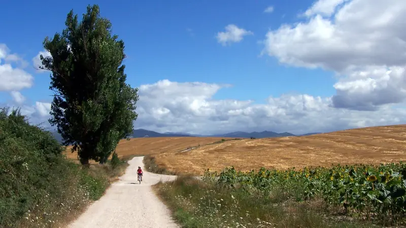
Photo: MartinD, CC BY-SA 4.0, cropped
The Stevenson Trail (Chemin de Stevenson, GR 70) follows the route that the Scottish writer Robert Louis Stevenson walked with his donkey Modestine in the autumn of 1878, and which he described in *Travels with a Donkey in the Cévennes* (1879). It crosses the Massif Central from north to south, from Le Puy-en-Velay in the Haute-Loire through the Gévaudan, over Mont Lozère and into the Cévennes, to Alès in the Gard. The official route is 272 km long and the association that looks after it suggests 12 to 14 days. Stevenson's own walk ended at Saint-Jean-du-Gard, and many walkers still finish there after about 247 km. It is waymarked red and white in both directions, and you sleep in gîtes d'étape, chambres d'hôtes, small hotels and campsites.
The route
The trail leaves Le Puy-en-Velay, with its cathedral on the volcanic hill, and crosses the high farmland of the Velay to Le Monastier-sur-Gazeille, where Stevenson bought Modestine. It drops into the Loire gorge at Goudet, climbs to the plateau around Le Bouchet-Saint-Nicolas and its crater lake, and passes Pradelles before Langogne on the Allier. The Gévaudan stages cross pine and beech forest to Cheylard-l'Évêque, the Trappist abbey of Notre-Dame-des-Neiges, where Stevenson stayed, and La Bastide-Puylaurent. After Chasseradès the trail crosses the Montagne du Goulet to Le Bleymard, then climbs Mont Lozère to the Sommet de Finiels (1,699 m), the highest point, before dropping to Le Pont-de-Montvert on the Tarn. A long day over the Bougès leads to Florac. The last part follows the old Florac - Alès railway to Cassagnas and the chestnut-covered ridges of the Cévennes, through Saint-Germain-de-Calberte and Saint-Étienne-Vallée-Française to Saint-Jean-du-Gard, and then over the hills by Mialet to Alès.
This guide follows the waymarked route as mapped on OpenStreetMap and splits it into 13 stages of about 20.8 km, at the traditional stage villages. The line measures 270 km, with about 7,300 m of ascent.
Highlights
- Le Puy-en-Velay: the cathedral and the volcanic pinnacles at the start
- Notre-Dame-des-Neiges: the Trappist abbey where Stevenson stayed, which still takes walkers
- Mont Lozère: open granite moorland and the Sommet de Finiels, the highest point of the trail
- Le Pont-de-Montvert: a stone village and bridge on the Tarn, where the Camisard revolt began in 1702
- The Cévennes ridges: chestnut woods, terraces and stone farms, part of the Causses and Cévennes World Heritage Site
When to walk the Stevenson Trail
The best period is May to October. May and June bring flowers and long days; September and October have autumn colours and fewer people. July and August are busy and can be hot in the Cévennes, with afternoon thunderstorms on the high ground; heather flowers on Mont Lozère in August. Most gîtes and B&Bs open from Easter to All Saints (1 November). In winter snow can cover the waymarks on Mont Lozère and the Goulet, and storms with blowing snow are dangerous, so winter walking is for experienced walkers only. From mid-June to mid-September the Gard has a daily forest fire-risk map: on red days the forests on the last two stages can be closed.
How many days do you need?
Plan 12 to 14 days from Le Puy-en-Velay to Alès, or 12 days to Saint-Jean-du-Gard. The 13 stages here are 13 to 29 km. Fit walkers can join La Bastide-Puylaurent to Le Bleymard (30 km) and Florac to Saint-Germain-de-Calberte (32 km) and walk to Alès in 11 days. The longest stage in this plan is Le Pont-de-Montvert to Florac (29 km), which you can shorten by about 5 km on the GR 68 or by stopping at Cocurès. Pradelles, 6 km before Langogne, is a good alternative stop. Many people walk only half, because trains reach Langogne, La Bastide-Puylaurent and Chasseradès.
Difficulty
The GR 70 is a moderate walk on tracks, forest roads, field paths and old drove roads, with no technical sections. Climbs are long but steady: the biggest are Mont Lozère (about 600 m from Le Bleymard), the Montagne du Bougès and the hills between Saint-Jean-du-Gard and Alès, a hard last stage. Mont Lozère and the Goulet are exposed to wind and fog, and the summit plateau has no shelter, so follow the granite marker stones and carry a map. Several villages have no shop or café (for example Goudet, Luc, Cheylard-l'Évêque, Les Alpiers, Finiels and Cocurès), so carry lunch and enough water.
Permits, booking and the donkey
No permit or fee is needed. Book each night directly with the gîte, B&B or hotel: the association does not take bookings. Book at least a week ahead (earlier for May, June and September) and confirm the day before. Wild camping is normally forbidden in France. In the core zone of the Parc national des Cévennes you may bivouac for one night, from 7 pm to 9 am, within 50 m of a waymarked GR, with no tent or a small one you cannot stand up in. Dogs must be on a lead in the core zone. Several companies carry bags between stops. You can hire a donkey from several donkey farms near the route; a donkey walks at about 3 km/h and carries at most about 40 kg, and you must book accommodation with a paddock.
Getting there and away
Le Puy-en-Velay has a railway station and a small airport at Loudes. Weekday buses run from Le Puy to Le Monastier (line 46), Le Bouchet-Saint-Nicolas (line 2) and Langogne (line 1). Trains on the line between Nîmes, Alès and Clermont-Ferrand stop at Langogne, and the line to Mende stops at La Bastide-Puylaurent and Chasseradès. liO bus 282 links Le Puy, Pradelles, Langogne and Mende, and liO 251 and 252 run Mende - Florac - Cassagnas - Alès. From Saint-Jean-du-Gard, AlesY buses 81 (via Mialet) and 72 (via Anduze) go to Alès, except Sundays and public holidays, and liO 112 goes to Nîmes. Alès has a railway station with trains to Nîmes. To get back to Le Puy, take the train from Alès to Langogne and the bus from there.
Money and phone signal
Carry cash: some small gîtes and tables d'hôtes do not take cards, and cash machines are mainly in the larger towns such as Le Puy, Langogne, Florac, Saint-Jean-du-Gard and Alès. Most walkers take half board, and many hosts make a picnic lunch if you ask the evening before. Mobile coverage is good in the towns but patchy in the deep Cévennes valleys and on the high moorland.
What to pack
Pack light: good walking shoes, a waterproof, a warm layer and a hat for Mont Lozère even in summer, sun protection, 1.5 to 2 litres of water, a first-aid and blister kit, a head torch and a map or the GPS track. A sleeping-bag liner and earplugs help in gîte dormitories.
Safety
In an emergency call 112 (or 15 for a medical emergency, 18 for the firefighters). Give your stage, the nearest village and your GPS position, and stay where you are. The nearest emergency departments are in Le Puy-en-Velay, Mende and Alès; Langogne's hospital is not an emergency department. Check the Météo-France forecast before crossing Mont Lozère and the Bougès, and in summer check the fire-risk map before the last stages. Do not light fires, and close gates behind you.
Stevenson Trail (GR 70) map
The whole Stevenson Trail (GR 70) with its 13 stages, Le Puy-en-Velay to Alès. Tap a stage on the map to open it. To follow the route with GPS and offline maps on the trail, open it in the free Outest app.
The 13 stages
Thirteen stages from the cathedral of Le Puy-en-Velay to Alès, via Le Monastier-sur-Gazeille, Langogne, La Bastide-Puylaurent, Le Bleymard, Mont Lozère, Le Pont-de-Montvert, Florac and Saint-Jean-du-Gard, where Stevenson's walk ended. They follow the traditional stage villages; walking times allow for the long climbs over Mont Lozère and the Bougès. Each stage page has a map, elevation profile, places to sleep and eat, and the nearest help.
| # | Stage | Distance | Level |
|---|---|---|---|
| 1 | Le Puy-en-Velay → Le Monastier-sur-Gazeille | 19.3 km | moderate |
| 2 | Le Monastier-sur-Gazeille → Le Bouchet-Saint-Nicolas | 23.7 km | hard |
| 3 | Le Bouchet-Saint-Nicolas → Langogne | 27.1 km | hard |
| 4 | Langogne → Cheylard-l'Évêque | 17.0 km | moderate |
| 5 | Cheylard-l'Évêque → La Bastide-Puylaurent | 26.9 km | hard |
| 6 | La Bastide-Puylaurent → Chasseradès | 13.3 km | moderate |
| 7 | Chasseradès → Le Bleymard | 16.8 km | moderate |
| 8 | Le Bleymard → Le Pont-de-Montvert | 19.5 km | moderate |
| 9 | Le Pont-de-Montvert → Florac | 29.4 km | hard |
| 10 | Florac → Cassagnas | 16.8 km | moderate |
| 11 | Cassagnas → Saint-Germain-de-Calberte | 15.3 km | moderate |
| 12 | Saint-Germain-de-Calberte → Saint-Jean-du-Gard | 22.3 km | hard |
| 13 | Saint-Jean-du-Gard → Alès | 23.0 km | hard |
Emergency, hospitals and services
In an emergency call 112 from any phone, or 15 (SAMU) for a medical emergency and 18 for the firefighters. 3 hospitals with a 24-hour emergency department are within reach of the trail, in Le Puy-en-Velay, Mende and Alès; the hospital in Langogne is not an emergency department. Every stage page lists the nearest one, plus pharmacies, shops and bus stops on that stage.
Where to stay on the Stevenson Trail (GR 70)
Gîtes d'étape, chambres d'hôtes, small hotels and campsites, grouped by stage from Le Puy-en-Velay to Alès. Listings were checked online in October 2026. Places marked "listed, not confirmed" appear on a public listing (the GR 70 association or Tourisme Occitanie) but could not be confirmed on their own website. Wild camping is normally forbidden in France; in the core zone of the Cévennes National Park you may bivouac for one night, from 7 pm to 9 am, within 50 m of the GR. Book each night directly with your host: the trail association does not take bookings.
Le Puy-en-Velay (trailhead)
3 places
- 3 with rooms
- 1 with meals
Le Puy-en-Velay
Le Puy-en-Velay → Le Monastier-sur-Gazeille
5 places
- 5 with rooms
- 1 camping
- 4 with meals
Le Monastier-sur-Gazeille
Le Monastier-sur-Gazeille → Le Bouchet-Saint-Nicolas
4 places
- 4 with rooms
- 3 with meals
Le Bouchet-Saint-Nicolas
Le Bouchet-Saint-Nicolas → Langogne
6 places
- 6 with rooms
- 1 camping
- 5 with meals
Langogne · Pradelles
Langogne → Cheylard-l'Évêque
4 places
- 4 with rooms
- 1 camping
- 4 with meals
Cheylard-l'Évêque · L'Herm (Saint-Flour-de-Mercoire) · Meyssouzac (Chaudeyrac)
Cheylard-l'Évêque → La Bastide-Puylaurent
4 places
- 4 with rooms
- 4 with meals
La Bastide-Puylaurent · Notre-Dame-des-Neiges
La Bastide-Puylaurent → Chasseradès
4 places
- 4 with rooms
- 1 camping
- 4 with meals
Chasseradès · Prat Claux (Chasseradès)
Chasseradès → Le Bleymard
4 places
- 4 with rooms
- 2 with meals
Le Bleymard · Le Bleymard (Goulet road) · Saint-Jean-du-Bleymard
Le Bleymard → Le Pont-de-Montvert
4 places
- 3 with rooms
- 1 camping
- 2 with meals
Finiels · Le Pont-de-Montvert
Le Pont-de-Montvert → Florac
5 places
- 5 with rooms
- 4 with meals
Cocurès · Florac
Florac → Cassagnas
3 places
- 3 with rooms
- 2 camping
- 3 with meals
Barre-des-Cévennes · Cassagnas · Saint-Julien-d'Arpaon
Cassagnas → Saint-Germain-de-Calberte
5 places
- 4 with rooms
- 1 camping
- 3 with meals
Le Serre de la Can · Saint-Germain-de-Calberte
Saint-Germain-de-Calberte → Saint-Jean-du-Gard
7 places
- 7 with rooms
- 1 camping
- 4 with meals
Le Pont de Burgen · Saint-Étienne-Vallée-Française · Saint-Germain-de-Calberte (Le Mas Cévenol) · Saint-Jean-du-Gard
Saint-Jean-du-Gard → Alès
2 places
- 2 with rooms
- 2 with meals
Alès
Plan your days
Pick any Stevenson Trail (GR 70) stage in the free hike planner to see walking time, water to carry, calories, difficulty, the weather forecast and daylight.
More trail guides

Tour du Mont Blanc
France · Italy · Switzerland · 166 km · 11 stages

GR 20
France · Corsica · 184 km · 16 stages

Walker's Haute Route
France · Switzerland · 204 km · 12 stages
Camino Francés
France · Spain · 768 km · 33 stages

GR10
France · Pyrenees · 921 km · 55 stages

GR54 Tour des Écrins
France · Écrins · 192 km · 13 stages
Via Podiensis (GR 65) · GR R2 Réunion · Tour de la Vanoise · Alta Via 1 · John Muir Trail · Laugavegur · Cotswold Way · Kerry Way · Camino Finisterre · West Highland Way · Kungsleden · Tour of Monte Rosa · Coast to Coast Walk · Pembrokeshire Coast Path · Hadrian's Wall Path · South Downs Way · Dingle Way · Wicklow Way · Fishermen's Trail · Camino Portugués · Alta Via 2 · Malerweg · Peaks of the Balkans · Overland Track · Lycian Way · St Paul Trail · Inca Trail · W Trek · Everest Base Camp Trek · Annapurna Circuit · Kumano Kodo Nakahechi · Camino del Norte · Via Francigena · Pennine Way · Carian Trail · Evliya Çelebi Way · Kaçkar Mountains Traverse · Phrygian Way · Sultans Trail · Mount Ararat Climb · Hittite Trail · Troy Culture Route · Independence Way · Mysia Ways · Rheinsteig · Westweg · Goldsteig · Via Alpina · Path of the Gods · Cinque Terre Trail · Alta Via 4 · GR221 Dry Stone Route · Stubai High Trail · Milford Track · Routeburn Track · Kepler Track · Tongariro Northern Circuit · Larapinta Trail · Great Ocean Walk · West Coast Trail · Wonderland Trail · Teton Crest Trail · Annapurna Base Camp Trek · Markha Valley Trek · Salkantay Trek · Huayhuash Circuit · Kilimanjaro Machame Route · Toubkal Circuit · Jordan Trail: Dana to Petra · Torres del Paine O Circuit · Abel Tasman Coast Track · Three Capes Track · Mestia to Ushguli Trek · Nakasendo Way · Berg Lake Trail · Skyline Trail (Jasper) · Fitz Roy & Cerro Torre Loop · Santa Cruz Trek · Otter Trail · Fish River Canyon Hiking Trail · Camino Primitivo · Camino Inglés · Eagle Walk (Adlerweg) · Berliner Höhenweg · Cape Wrath Trail · Great Glen Way · Offa's Dyke Path · Cleveland Way · Rota Vicentina Historical Way · Heaphy Track · Queen Charlotte Track · Cape to Cape Track · Rockwall Trail · Juan de Fuca Marine Trail · Quilotoa Loop · Nahuel Huapi Traverse · Ala Kul Trek · Tiger Leaping Gorge High Trail · Mount Kenya Sirimon–Chogoria Traverse · Ghorepani Poon Hill Trek · Kilimanjaro Lemosho Route · Lebanon Mountain Trail · Aladağlar Traverse · Kokoda Track · Chilkoot Trail · Lost City Trek · Choquequirao Trek · M'Goun Traverse · Royal National Park Coast Track · Grand Cliff Top Walk · Snowies Alpine Walk · Rwenzori Central Circuit · Whale Trail · Ausangate Circuit · Thorsborne Trail · Paparoa Track · Mount Assiniboine Traverse · Sunshine Coast Trail · Sinai Trail · Rakiura Track · Grand Canyon Rim to Rim · Via degli Dei · Juliana Trail · Camí de Cavalls · Karhunkierros Trail · Lost Coast Trail · East Coast Trail · Kalalau Trail · Mount Rinjani Trek · MacLehose Trail · Lake Waikaremoana Great Walk · Hump Ridge Track · Jatbula Trail · Druk Path Trek · Mardi Himal Trek · Mount Kinabalu Climb · Kilimanjaro Marangu Route · Amatola Trail · Mount Olympus Traverse · Dales Way · Lechweg · High Coast Trail · Rennsteig · Old Ghost Road · Gokyo Lakes Trek · Corfu Trail · Leleg Way · Anillo de Picos · Fundy Footpath
Hike it with the route in your pocket
Outest has the Stevenson Trail (GR 70) route offline, with elevation, water and village points, and a trail guide you can ask about stages, weather and where to sleep.