
Best time to hike the MacLehose Trail
Best: November–March. Also good: October.
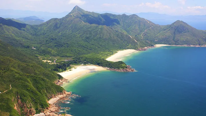
The MacLehose Trail is 99 km long, in 10 stages. Below is the average weather for every month at about 241 m, the middle height of the trail (2–910 m), from 10 years of daily data (2015–2024).
Weather month by month
| Month | High °C | Low °C | Rain mm | Rain days | Daylight h |
|---|---|---|---|---|---|
| January | 19° | 12° | 52 | 6 | 10.9 |
| February | 20° | 13° | 53 | 7 | 11.4 |
| March | 23° | 17° | 107 | 12 | 12.0 |
| April | 25° | 20° | 131 | 14 | 12.6 |
| May | 28° | 23° | 276 | 21 | 13.2 |
| June | 29° | 26° | 294 | 25 | 13.5 |
| July | 30° | 26° | 203 | 22 | 13.4 |
| August | 29° | 26° | 300 | 26 | 12.9 |
| September | 29° | 25° | 203 | 20 | 12.2 |
| October | 27° | 22° | 93 | 10 | 11.6 |
| November | 24° | 18° | 59 | 6 | 11.0 |
| December | 20° | 13° | 26 | 3 | 10.8 |
Higher up it is colder: about 6 °C less for every 1,000 m of height. The highest point of the trail is 910 m.
Season notes from our guide
The best time is from October to March, when the air is drier and cooler (around 15–25 °C) and the views are clearer. November is the busiest month on the trail because of the Oxfam Trailwalker, a 100 km team event along the whole route (20–22 November in 2026). From April to September it is hot and humid, often above 30 °C, with heavy thunderstorms, and typhoons are possible from June to October. Do not set out when tropical cyclone signal No. 3 or higher, or a Red or Black Rainstorm signal, is in force, and take the Very Hot Weather Warning seriously. Weekends and holidays are crowded, especially on the Sai Kung beaches.
Stages, map, elevation profile, places to stay and emergency help, free.
Read the full MacLehose Trail guideHike it with Outest
Offline maps, stages and places to stay on your phone.
Best time for other trails
- Tour du Mont Blanc
- Alta Via 1
- GR 20
- John Muir Trail
- Laugavegur
- Cotswold Way
- Kerry Way
- Camino Finisterre
- West Highland Way
- Walker's Haute Route
- Kungsleden
- Tour of Monte Rosa
- Coast to Coast Walk
- Pembrokeshire Coast Path
- Hadrian's Wall Path
- South Downs Way
- Dingle Way
- Wicklow Way
- Fishermen's Trail
- Camino Portugués
- Alta Via 2
- Malerweg
- Peaks of the Balkans
- Overland Track
- Lycian Way
- St Paul Trail
- Camino Francés
- Inca Trail
- W Trek
- Everest Base Camp Trek
- Annapurna Circuit
- Kumano Kodo Nakahechi
- Camino del Norte
- Via Francigena
- GR10
- Pennine Way
- Carian Trail
- Evliya Çelebi Way
- Kaçkar Mountains Traverse
- Phrygian Way
- Sultans Trail
- Mount Ararat Climb
- Hittite Trail
- Troy Culture Route
- Independence Way
- Mysia Ways
- Rheinsteig
- Westweg
- Goldsteig
- GR54 Tour des Écrins
- Via Alpina
- Path of the Gods
- Cinque Terre Trail
- Alta Via 4
- GR221 Dry Stone Route
- Stubai High Trail
- Milford Track
- Routeburn Track
- Kepler Track
- Tongariro Northern Circuit
- Larapinta Trail
- Great Ocean Walk
- West Coast Trail
- Wonderland Trail
- Teton Crest Trail
- Annapurna Base Camp Trek
- Markha Valley Trek
- Salkantay Trek
- Huayhuash Circuit
- Kilimanjaro Machame Route
- Toubkal Circuit
- Jordan Trail: Dana to Petra
- Torres del Paine O Circuit
- Abel Tasman Coast Track
- Three Capes Track
- Mestia to Ushguli Trek
- Nakasendo Way
- Berg Lake Trail
- Skyline Trail (Jasper)
- Fitz Roy & Cerro Torre Loop
- Santa Cruz Trek
- Otter Trail
- Fish River Canyon Hiking Trail
- Camino Primitivo
- Camino Inglés
- Eagle Walk (Adlerweg)
- Berliner Höhenweg
- Cape Wrath Trail
- Great Glen Way
- Offa's Dyke Path
- Cleveland Way
- Rota Vicentina Historical Way
- Via Podiensis (GR 65)
- Heaphy Track
- Queen Charlotte Track
- Cape to Cape Track
- Rockwall Trail
- Juan de Fuca Marine Trail
- Quilotoa Loop
- Nahuel Huapi Traverse
- Ala Kul Trek
- Tiger Leaping Gorge High Trail
- Mount Kenya Sirimon–Chogoria Traverse
- Ghorepani Poon Hill Trek
- Kilimanjaro Lemosho Route
- Lebanon Mountain Trail
- Aladağlar Traverse
- Kokoda Track
- Chilkoot Trail
- Lost City Trek
- Choquequirao Trek
- GR R2 Réunion
- M'Goun Traverse
- Royal National Park Coast Track
- Grand Cliff Top Walk
- Snowies Alpine Walk
- Rwenzori Central Circuit
- Whale Trail
- Ausangate Circuit
- Thorsborne Trail
- Paparoa Track
- Mount Assiniboine Traverse
- Sunshine Coast Trail
- Sinai Trail
- Rakiura Track
- Grand Canyon Rim to Rim
- Via degli Dei
- Stevenson Trail (GR 70)
- Juliana Trail
- Camí de Cavalls
- Karhunkierros Trail
- Lost Coast Trail
- East Coast Trail
- Kalalau Trail
- Mount Rinjani Trek
- Lake Waikaremoana Great Walk
- Hump Ridge Track
- Jatbula Trail
- Druk Path Trek
- Mardi Himal Trek
- Mount Kinabalu Climb
- Kilimanjaro Marangu Route
- Amatola Trail
- Mount Olympus Traverse
- Dales Way
- Tour de la Vanoise
- Lechweg
- High Coast Trail
- Rennsteig
- Old Ghost Road
- Gokyo Lakes Trek
- Corfu Trail
- Leleg Way
- Anillo de Picos
- Fundy Footpath
Weather: NASA POWER (MERRA-2 reanalysis), daily values 2015–2024 near 22.35, 114.20, adjusted to 241 m. Rain days: days with at least 1 mm. Daylight: sunrise to sunset on the 15th of the month.